This Scenic Canyon in Texas Is Made for Rafting and Rapids
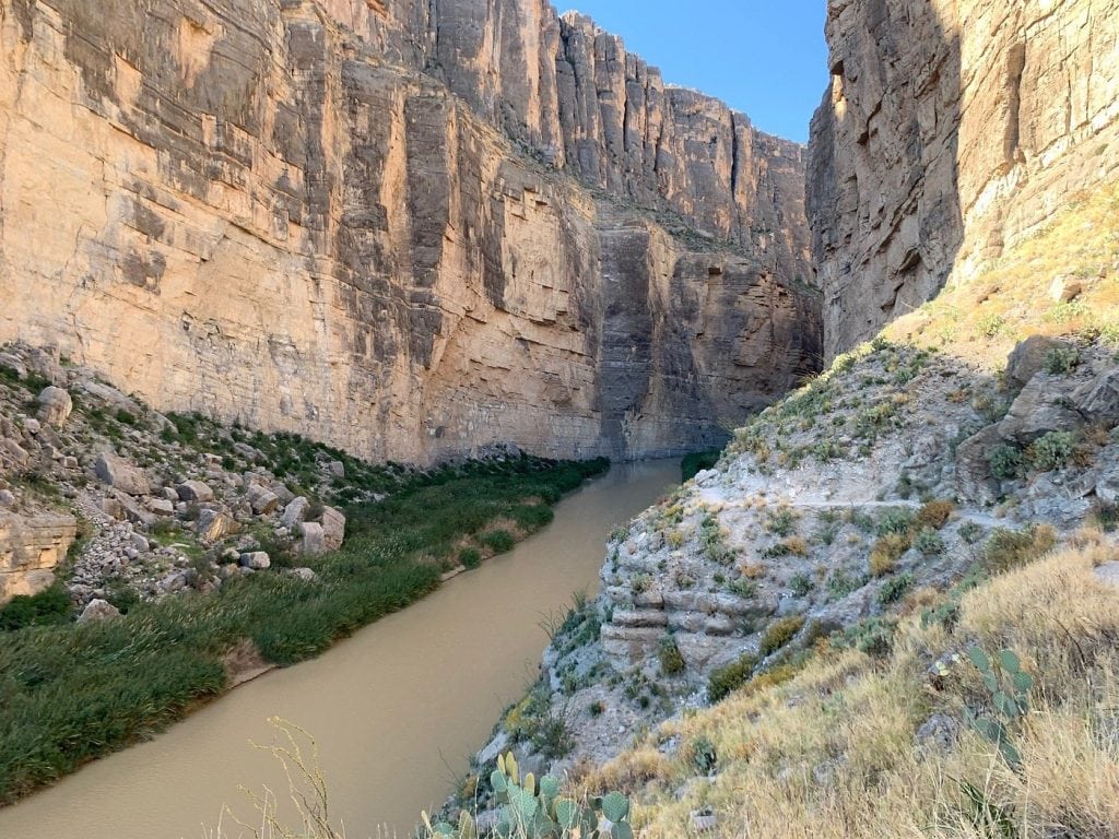
Canyon walls layered in different colors. Stunning views for miles.
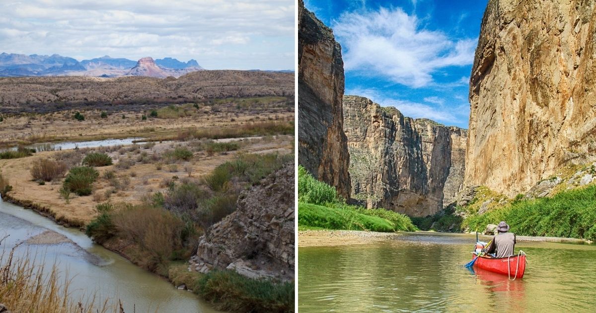
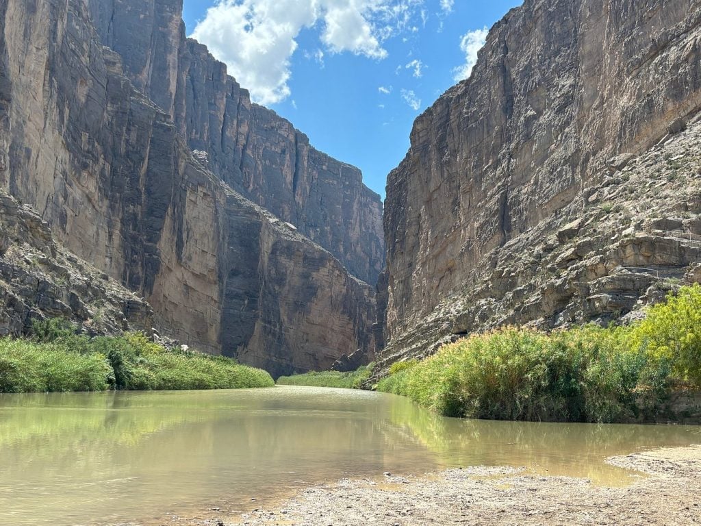
Welcome to Santa Elena Canyon in the Lone Star State’s Big Bend National Park.
This summer, Santa Elena Canyon is waiting to show you some of the most breathtaking scenery in the Southwest.
Cliffs to rival The Princess Bride. Rapids rushing by.
Adventure beckons in Santa Elena Canyon.
Downstream
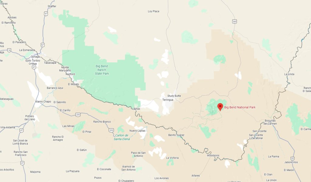
The National Park Service manages Santa Elena Canyon, part of the larger Big Bend National Park system.
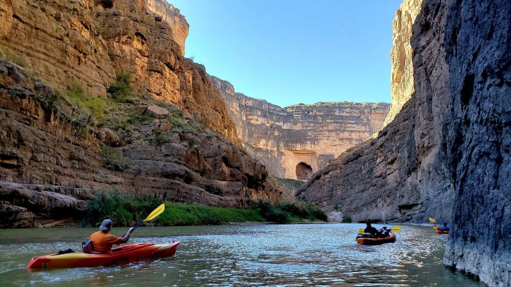
Paddling downstream through this canyon is one of the park’s most popular overnight or multi-day trips.
Part of this is because of the put-in and take-out, easily accessible by car.
Another part is that this canyon is thought of as one of the most beautiful sites to visit.
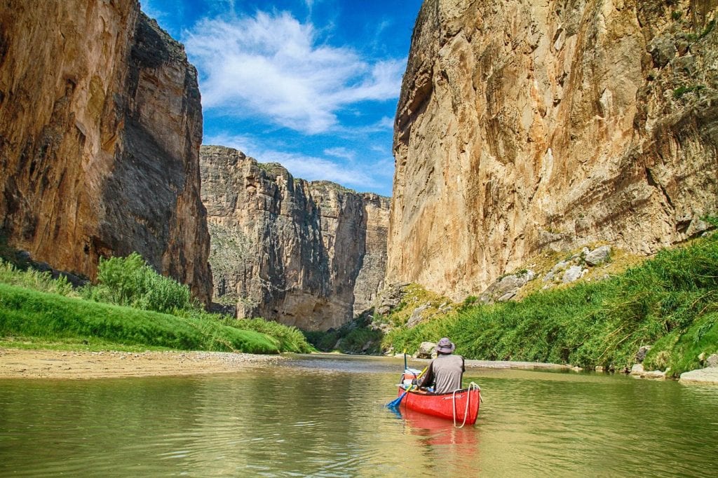
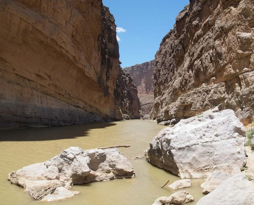
I think what I like most are the towering cliffs in Santa Elena. These cliffs, forming the canyon’s walls, rise up to 1,500 feet high!
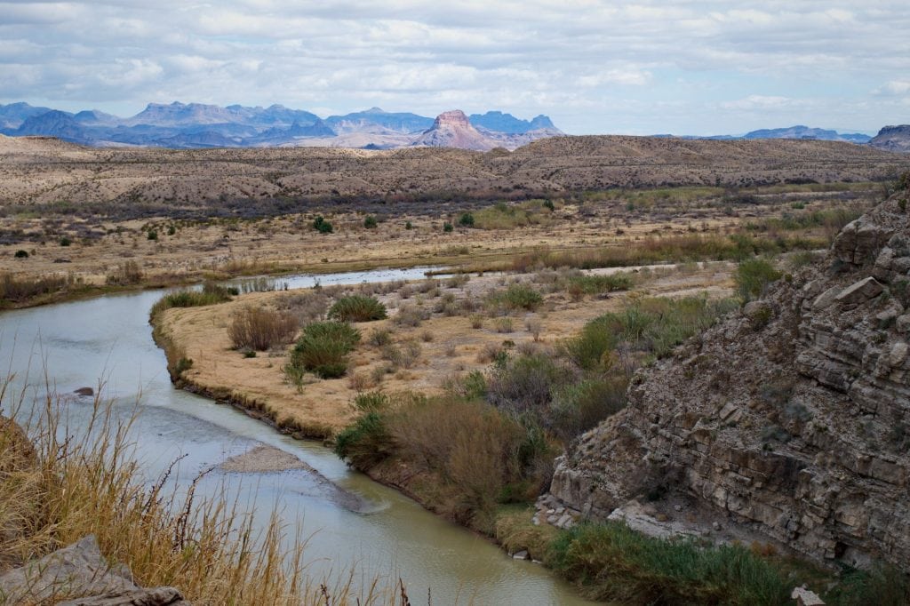
The first 13 miles from the put-in at Lajitas treat you to unique views of the riparian and desert ecosystem, contrasting one another.
Those first miles aren’t too rigorous. They meander. It’s more of a relaxing ride.
The next 7 miles get technical once you enter the canyon proper. Be prepared to use those skills you’ve worked hard to get.
Two miles into the canyon, you’ll encounter the largest rapids at Santa Elena. They’re called the Rock Slide — and the name says it all. You’ve been warned.
The Rock Slide is classified as Class IV rapids at some water levels. Know what to expect before you launch.
If the water levels are 300 to 600 CFS, that’s perfectly fine for open boats. Anything above 600 CFS is only okay for rafts. Beginners shouldn’t go out when the rapids are above 600 CFS. Take care of yourself and others.
Note that a backcountry permit is required for all overnight river trips. Be prepared!
The National Park Service offers a handy resource on their website: a River Guide to the Rio Grande covering the Colorado and Santa Elena Canyons.
It’s available through the National Park Service’s online store.
It’s a full-color, laminated trip log of sorts that you can use as you plan a trip this summer.
Inside you’ll find detailed maps of the route, along with historical context and natural history notes.
For anyone who likes to have a map handy, as well as fun facts about what you’ll find or experience, grab a copy of this river guide.
It covers everything from the Tapado Canyon to the Santa Elena Canyon take-out, and it includes specific notes about the Colorado Canyon and the Santa Elena Canyon.
You can buy it through the Big Bend Natural History Association online store.
There are quite a few river guides in the Big Bend Natural History Association’s online store, so look for the one that says “Santa Elena Canyon.” That’s the one!
It costs $17.95 (listing price). They have a lot of these river guides in stock, more than 1,000 copies, so you should be able to get a copy, no problem.
The guide is designed for anyone who’d like to plan a multi-day float trip through a canyon like the Santa Elena Canyon.
You’ll find information about launching near Lajitas and other put-ins and how to navigate your way through dramatic 1,500-feet-deep cliffs.
There’s a mix of calm paddling and technical rapids information, including the Class IV Rock Slide.
The guide also includes insights into the historical context, geology, and navigation of the canyon, which makes it challenging but also rewarding as you traverse this canyon along the U.S.-Mexico border.
Keep in mind that permits are required for the trip. And always be aware of ideal water flow rates between 300-600 CFS for a great summer trip.
The guide gives you not only detailed maps, but also campsite information and critical safety tips you’ll need as you’re planning ahead.
What’s cool is that the river guide also features moments in history of the first river trip to survey the Rio Grande in 1852. If you’re a history buff, check out these historical snippets in the river guide.
Upstream
It’s fun to explore Santa Elena going upstream, too.
You can have a lovely day trip by paddling upstream, from the Santa Elena Canyon Trailhead. This trailhead is a few miles inside the canyon.
You’d return back downstream (known as a boomerang trip).
This trip should only be taken when flow rates are under 200 CFS. Really, 100 CFS is more ideal. Be careful, and don’t take any unnecessary risks to yourself or others.
If it’s below 100 CFS, the water may be too shallow to paddle and you may end up dragging your boat through sections of the river.
You can check the current CFS rates on the National Park Service’s website. Know before you go!
A lower water level means a gentler current, making the upstream paddle more manageable and relaxing.
If you’d rather skip the shuttle fee, this is a great trip to plan with just one vehicle — no return logistics needed.
Note that you’ll need a backcountry permit for any river trips you take.
Day-use trips are free, which makes it a nice, free activity to do this summer.
Planning Tips
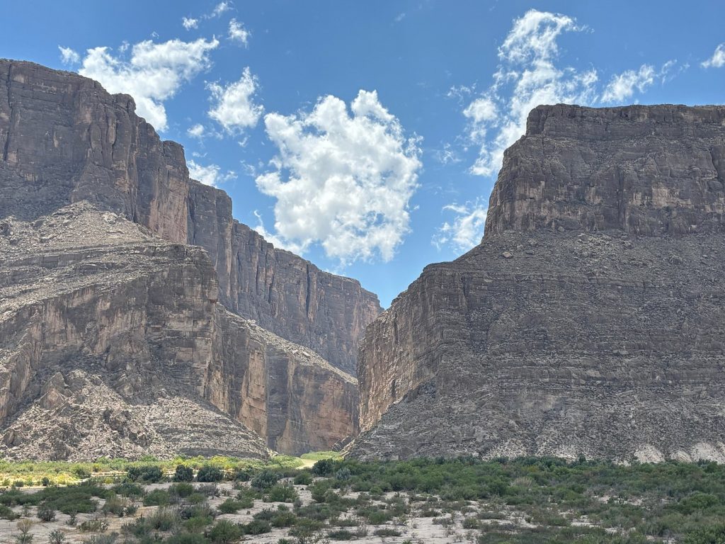
One of the most amazing sights to experience at this canyon is the Santa Elena Canyon Overlook.
It’s a great spot to pause and enjoy the landscape around you.
Santa Elena Canyon is 8 miles long and 1,500 feet deep. In some spots, the canyon’s walls are only 30 feet wide.
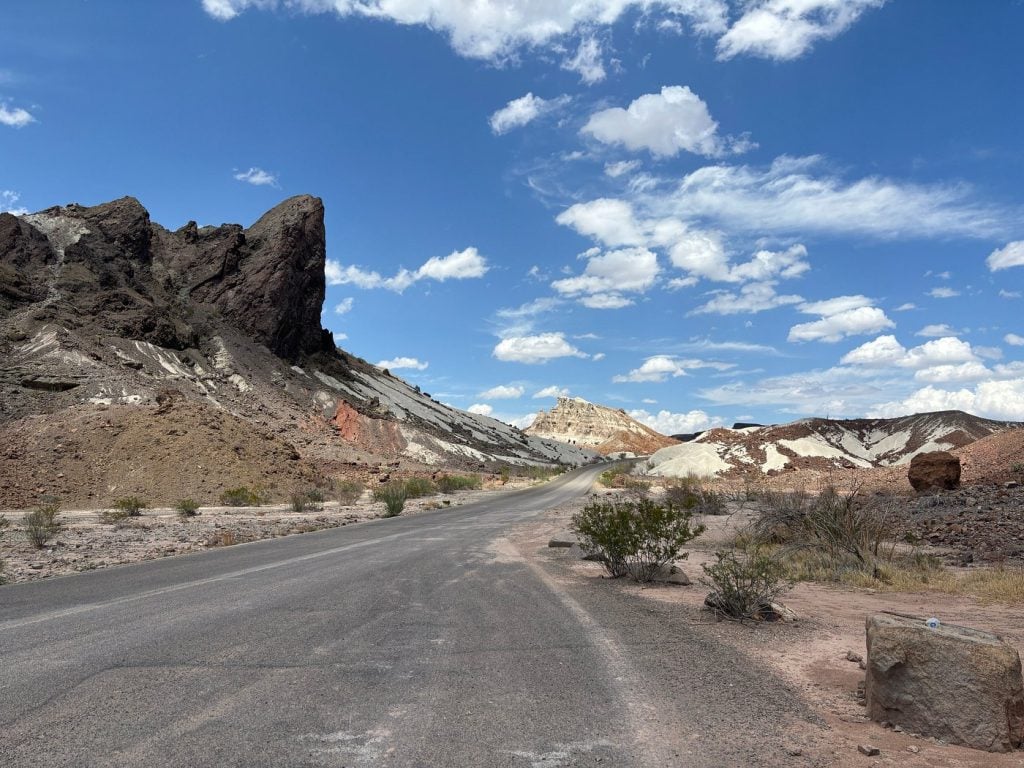
Many people like to go on two- or three-day river rafting trips through Santa Elena, starting out in the town of Lajitas. Note that this town is actually outside of Big Bend National Park.
Last summer, part of the route at Santa Elena was closed due to flooding. Always check the proper channels and websites to make sure the route is fully operational and accessible.
Big Bend National Park has some fees it charges, so be aware of any extra fees you’ll need to pay.
Hikers like to go on the Santa Elena Canyon Trail. It’s 1.7 miles long, and it’ll take you about half an hour to an hour to hike.
It’s an out-and-back trail, meaning you return the same way you came. The elevation gain is 232 feet, so keep that in mind as you plan your hike.
This trail starts at the end of the Ross Maxwell Scenic Drive. This is a paved parking area.
Though this trail is not very long, it’s one of the most scenic hikes.
After crossing Terlingua Creek, the trail climbs through several short switchbacks before gradually descending along the banks of the Rio Grande.
I can’t pass up a view of the river as I’m hiking. There’s something so peaceful about its sound.
You’ll be surrounded by riparian vegetation and deep cliffs of solid limestone.
The trail will drop you off where the canyon walls meet the river. Stop there for lunch, and look around at the views.
Be aware that Terlingua Creek can be impassable after heavy rains, flash floods, or any high water. The trail is closed during those times to keep everyone safe and well.
For many travelers, the Santa Elena Canyon is a popular natural feature to go explore in Big Bend National Park.
Its short nature trail winds into shady depths beneath towering cliff shadows, with the sound of the rushing river below.

It’s 8 miles west of Castolon, and it’s accessible by either Ross Maxwell Scenic Drive or Old Maverick Road.
Note that the trail climbs up several flights of ramps and stairs, so make sure you’re prepared for that type of hike.
Many people love to see the canyon not through hiking, but by raft or canoe. Local outfitters even offer trip packages anywhere from 1 to 3 days when conditions are good.
Some river runners who have intermediate or advanced skills go on their own, through the canyon’s waters.
You’ll have opportunities to spot wildlife, hike in shady side canyons (a fun discovery!), and camp on spacious sandbars.
There are a couple of rapids, including the Rock Slide, so watch out for those. Even if you have intermediate or advanced skills, be careful on the rapids.
Check current conditions, talk to a local outfitter, and consider buying a guidebook before you head out.
Heading off into the wilderness this summer is exciting. But you also need a good plan to make the most out of your trip.
The Santa Elena Canyon borders the western edge of Big Bend National Park. There’s plenty to explore and discover about Big Bend, while you’re also contemplating a trip to Santa Elena.
Don’t forget to check out all the different types of adventures West Texas holds in store for you this summer.
Where: Big Bend National Park
Find them online at nps.gov/bibe and pull up directions on Google Maps before you head out — because canyon walls 1,500 feet deep and Class IV rapids deserve a well-planned summer adventure.

Shelby Brooks
Travel Writer
Shelby Brooks was born and raised in the North Dallas area. For her studies in creative writing, and later for work as a writer and editor, Brooks lived in Sherman, Fort Worth, Denton, and for many years, Aggieland (College Station). Brooks travels within Texas, to theme parks in Orlando, up to the Big Apple in NYC, and to beaches across the U.S.
More Stories


Tags