14 Virginia Natural Wonders That Look Too Wild to Be Real
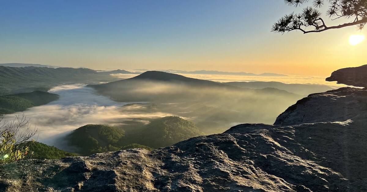
I keep a running list of places that look faked, the kind of photo a friend swears is edited until you check the map and realize it is real. Most of mine, oddly, sit in one state.
Virginia hides an absurd amount of it. Waterfalls that look staged, wild ponies on grassy peaks, a stone arch older than the dinosaurs. It has a kind of quiet drama you underestimate until you actually stop and look.
Below are fourteen Virginia natural wonders worth building a whole trip around, from the far southwest mountains to a barrier beach you can only reach on foot. Here is where to find every one.
1. Skyline Drive, Shenandoah National Park, Virginia
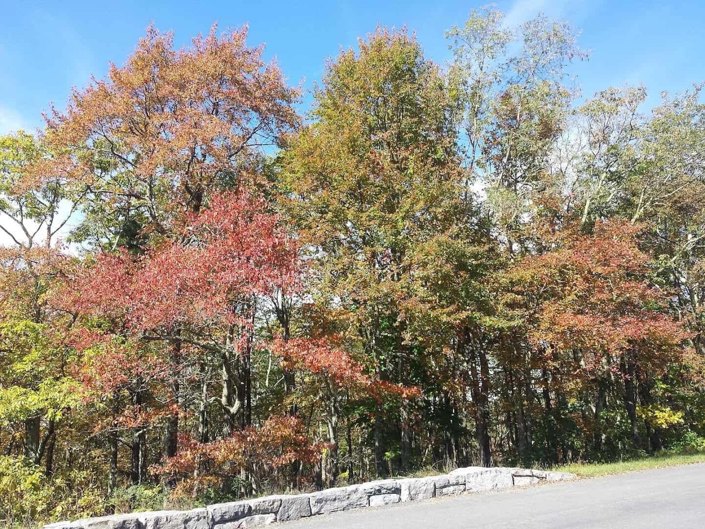
Some wonders you drive. Skyline Drive runs 105 miles down the spine of Shenandoah National Park, with 75 overlooks spaced roughly every mile and a half. The speed limit is a lazy 35, which is exactly the point.
Completed in 1939, it is the park’s only public road, and every pull-off frames a different fold of the Blue Ridge. Come in October and the whole valley turns gold and rust.
Black bears, wild turkeys and more than 200 bird species live in the park, so keep your camera handy. The mile markers count down heading south, an easy way to track stops like Big Meadows and Hawksbill.
Where: Skyline Drive, Shenandoah National Park. The northern entrance is at Front Royal (Mile 0), with a southern entrance near Waynesboro. Give yourself a full day.
2. Devils Bathtub, Virginia
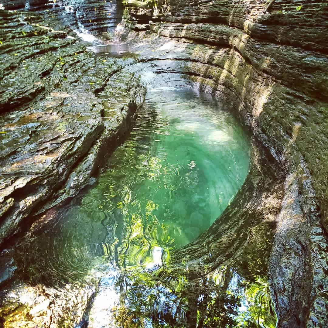
Deep in the far southwest, the Devil’s Fork carved something unreal. The Devils Bathtub is a slot of emerald water spun into stone, so clear and so green it looks color-corrected before you ever raise a phone.
The churning creek scooped a chute about 20 feet long and 12 feet deep in solid rock. The hike runs roughly four miles round trip with more than ten creek crossings, so wear shoes you can soak.
Where: Devil’s Fork Trailhead, off Route 619 near Fort Blackmore, Virginia, inside the Jefferson National Forest. The lot is small, so arrive early on summer weekends.
3. Great Falls Park, Virginia

Fifteen miles from the nation’s capital, the Potomac loses its manners. At Great Falls the river drops 76 feet in under a mile, then slams through Mather Gorge, where the banks pinch from 1,000 feet down to barely 60.
Three overlooks put you right over the roar, inside an 800-acre park most Washingtonians forget is there. Kayakers actually run these rapids, which you will not quite believe until you watch one drop in.
A network of trails traces the cliff edge, popular with rock climbers below. Come after heavy rain and the river turns brown and thunderous; come in fall and the rock walls blaze above the water.
Where: Great Falls Park, 9200 Old Dominion Drive, McLean, Virginia, on the Potomac’s Virginia bank. It is a short drive from the Beltway.
4. Grayson Highlands Wild Ponies, Virginia

This wonder comes with a mane and hooves. Up in Grayson Highlands, more than 100 wild ponies roam grassy alpine balds above 5,000 feet, right beside Mount Rogers, the highest point in the state at 5,729 feet.
The herd was brought in around 1974 to keep the balds open, and they wander the same ridge trails you hike. Keep your distance and let them be. They are genuinely wild and photograph better from a few feet back anyway.
The landscape up here feels more like Scotland than the South, all open grass, rocky outcrops and wind, with the Appalachian Trail threading right through the middle of it.
Where: Grayson Highlands State Park, 829 Grayson Highland Lane, Mouth of Wilson, Virginia. The Wilburn Ridge and Rhododendron trails give you the best pony odds.
5. Luray Caverns, Virginia

Now go underground. Discovered in 1878, Luray Caverns unspool across 64 acres of chambers up to ten stories tall, dripping with stalactites the color of caramel and cream and lit so every formation glows.
The showpiece is the Great Stalacpipe Organ, built over three years by Leland Sprinkle, which taps 37 stalactites with rubber mallets to play real music. Nearby, Dream Lake mirrors the ceiling so perfectly you lose which way is up.
Wide paved walkways loop the whole route, so even small kids handle it easily. The temperature underground hovers near 54 degrees year-round, which makes it a perfect stop on a blazing summer afternoon.
Where: Luray Caverns, 101 Cave Hill Road, Luray, Virginia, in the Shenandoah Valley. Tours run year-round, rain or shine.
6. Crabtree Falls, Virginia
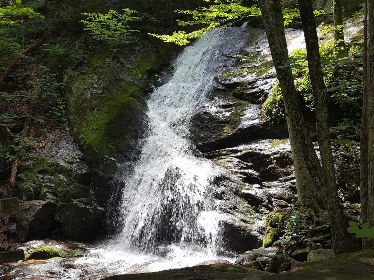
Not to be confused with its North Carolina namesake, Virginia’s Crabtree Falls tumbles down five major cascades that stack up to roughly 1,200 feet, often called the tallest cascading waterfall east of the Mississippi.
A paved lower trail reaches the first overlook fast, then the path climbs past cascade after cascade toward the top. The single biggest drop falls about 400 feet in one long ribbon of white water.
Where: Crabtree Falls Trailhead on VA-56 near Montebello, Virginia, in the George Washington National Forest. From the Blue Ridge Parkway at milepost 27, take VA-56 east about 6.5 miles.
7. Chincoteague Ponies, Virginia

Out on the Eastern Shore, the ponies swim. A wild herd has lived on Assateague Island for an estimated 300 to 400 years. Legend blames a wrecked Spanish galleon, though nobody has ever proven it, which only makes the story better.
Every July the Chincoteague Volunteer Fire Company swims the herd across the channel at slack tide, a tradition formalized back in 1925. The rest of the year you can spot them from the refuge trails, small and shaggy against the marsh grass.
Marguerite Henry’s 1947 novel Misty of Chincoteague turned the herd into national celebrities. The ponies stay small and round because the salty marsh grass makes them drink far more water than a horse.
Where: Chincoteague National Wildlife Refuge, 8231 Beach Road, Chincoteague Island, Virginia. The wildlife loop and marsh trails give you the best pony views, so pack binoculars.
8. McAfee Knob, Virginia
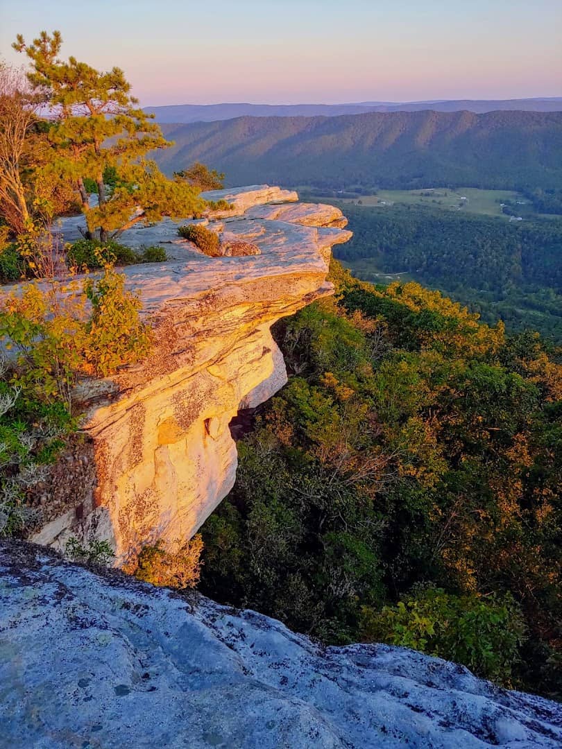
If Virginia has one signature view, this is it. McAfee Knob juts over the Catawba Valley some 3,197 feet up, a flat lip of rock that has become the most photographed spot on the entire Appalachian Trail.
The round trip runs about 8.8 miles and climbs 1,700 feet, and the reward is a panorama that falls away far below your dangling boots. Go at sunrise if you can manage it, because the overlook fills fast on clear weekends.
The knob anchors Virginia’s Triple Crown of viewpoints, alongside Tinker Cliffs and Dragon’s Tooth, all within a short drive of each other. A shuttle runs on busy weekends and spares you the roadside parking scramble.
Where: McAfee Knob Trailhead, 4004 Catawba Valley Drive (VA-311), Catawba, Virginia, northwest of Roanoke. Start early to beat the parking crunch.
9. Natural Bridge, Virginia
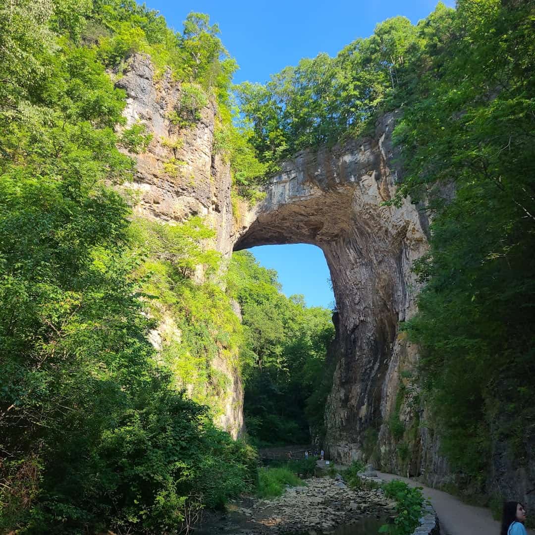
Some arches you look up at. This one you can drive across without knowing. Natural Bridge stands 215 feet tall with a 90-foot span, the tallest natural arch in the southeastern United States, carved by little Cedar Creek over roughly 470 million years.
Thomas Jefferson bought it from King George III in 1774 and called it the most sublime of nature’s works. George Washington is said to have surveyed it and carved his initials into the rock wall. Route 11 still runs right across the top.
The Monacan Indian Nation knew it long before the colonists, calling it the Bridge of God. Today the state park pairs the arch with more than ten miles of trails, a cave and a cascade.
Where: Natural Bridge State Park, 6477 South Lee Highway, Natural Bridge, Virginia, between Lexington and Roanoke. The gorge trail leads on to Lace Falls.
10. Dragon’s Tooth, Virginia
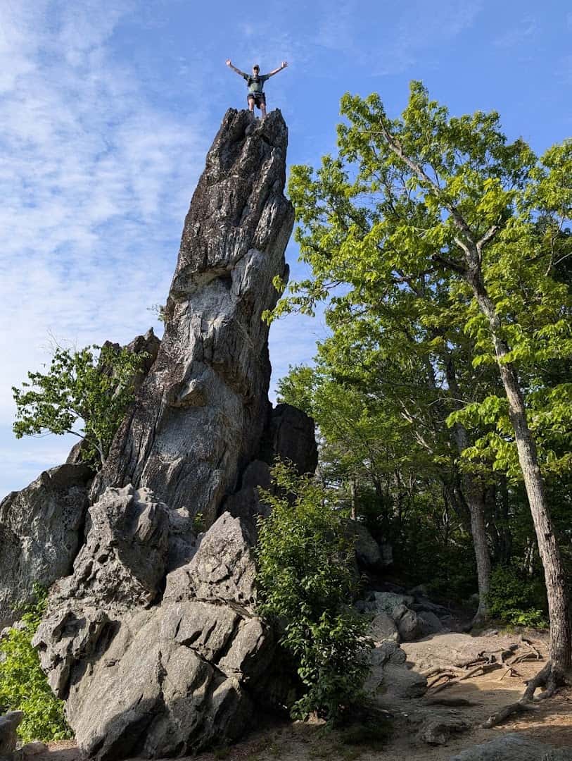
The second jewel in the Triple Crown bites back. Dragon’s Tooth is a cluster of prehistoric Tuscarora quartzite spires that erupt about 35 feet off the spine of Cove Mountain, jagged enough to earn the name.
The 4.6-mile round trip climbs roughly 1,150 feet, and the final stretch has you hauling up rock steps and iron rungs bolted into the cliff. Scramble to the top of the spire for a long view over the valley.
Where: Dragon’s Tooth Trailhead on VA-311 in Catawba, Virginia, near the McAfee Knob lot. Wear grippy shoes for the rock scramble at the summit.
11. Assateague Island Beach, Virginia
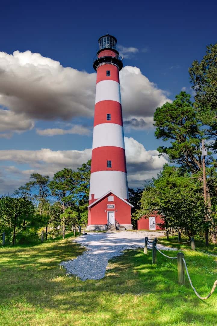
Share the same barrier island as the ponies, then keep driving to the sand. The Virginia end of Assateague Island hides Toms Cove, a wide wild beach where you can swim, comb for shells and watch shorebirds work the tide line.
Above it all stands the candy-striped Assateague Lighthouse, lit on October 1, 1867, and still climbing 142 feet over the pines. Sunset from the beach, with the tower glowing behind you, is reason enough to linger past dinner.
Where: Toms Cove and the Assateague Lighthouse, reached through Chincoteague National Wildlife Refuge on Beach Road, Chincoteague Island, Virginia. The beach parking sits at the end of the road.
12. Cascade Falls, Virginia
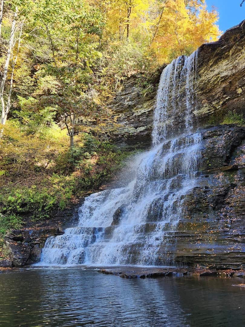
Southwest Virginia guards a genuine showstopper. Cascade Falls drops 66 feet in one clean sheet into a green plunge pool, the sort of waterfall that looks staged for a calendar cover rather than tucked into a quiet mountain hollow.
The four-mile loop follows Little Stony Creek past footbridges, stone steps and smaller cascades before the big reveal. Take the lower trail out for the creek views and the wider upper trail back. On a hot day, half the crowd wades right in.
Spring runoff makes the main drop thunder; late summer softens it into a gentler curtain you can stand beside. Come on a weekday morning when the light angles into the hollow and the crowds have not found the lot yet.
Where: Cascade Falls Trailhead, off Cascade Drive (VA-623) near Pembroke, Virginia, about 3.3 miles from US-460. A small day-use fee covers parking.
13. Breaks Interstate Park, Virginia
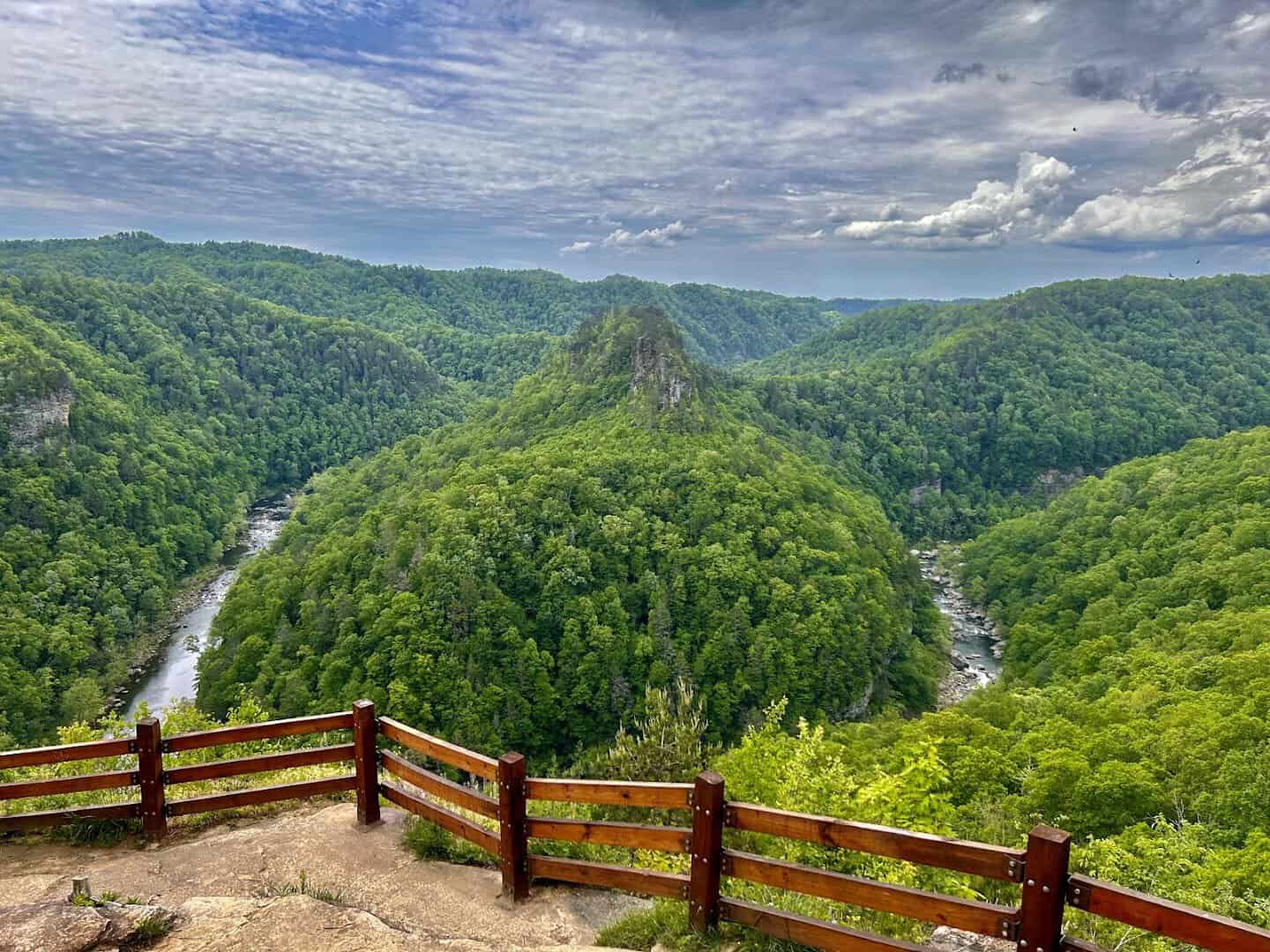
They call it the Grand Canyon of the South, and for once the nickname holds up. At Breaks Interstate Park the Russell Fork River has cut a gorge some 1,650 feet deep, the deepest canyon east of the Mississippi.
Overlooks along the rim stare straight down into five miles of forested chasm where the river breaks clean through Pine Mountain. Come in October for whitewater season, when releases turn the Russell Fork into a magnet for expert paddlers.
Where: Breaks Interstate Park, 627 Commission Circle, Breaks, Virginia, on the Kentucky line in Dickenson County. The rim overlooks are a short walk from the visitor center.
14. False Cape State Park, Virginia

End where the roads run out. False Cape is a mile-wide ribbon of wild coast between Back Bay and the Atlantic, one of the last undeveloped shorelines on the East Coast, and no car can reach it at all.
You get there on foot, by bike, or by tram through Back Bay National Wildlife Refuge, and the payoff is six miles of empty beach and loblolly forest. Deer, otters and wild pigs outnumber the people most days.
A ghost settlement called Wash Woods, all that remains of an old fishing community, still stands quietly in the forest for hikers who go looking. Pack water and food, because there is no store once you pass the refuge gate.
Where: False Cape State Park, reached through Back Bay National Wildlife Refuge, 4005 Sandpiper Road, Virginia Beach, Virginia. No vehicle access, so plan the tram or a long walk in.
Start Mapping Your Virginia Run
Here is the thing about this list. You could knock out three of these in a single long weekend and still have a dozen good reasons to come back.
The southwest mountains alone, from Cascade Falls to the Grayson ponies to the Breaks canyon, make a trip worth taking on their own, and that is before you ever reach the coast.
So pick a corner and go. Chase a waterfall, drive the ridge at golden hour, or stand on that knob and let the whole valley drop away beneath your feet. Virginia has been hiding these in plain sight, and every one is waiting for you.
Featured image: Anthony Simpkins via McAfee Knob

Stella Raines
Editor-in-Chief
Stella brings over a decade of storytelling experience to TX Headlines. With roots in West Texas and a love for road trips, she leads the editorial team with an eye for the hidden stories that make Texas unforgettable.