13 Southwest Parks and Landmarks Made for One Great Desert Road Trip
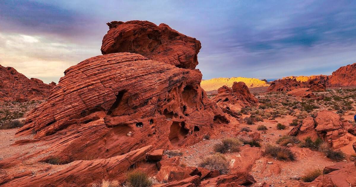
Some road trips are a straight line to one big thing. The best one I keep sketching on napkins is a wide, looping circle.
You fly into Las Vegas, point the car toward the desert, and let the pavement stitch a whole galaxy of canyons together. Two weeks later it hands you back, dusty and grinning.
This loop runs through red-rock country, the sweep of Utah, Arizona, Nevada, and New Mexico where the ground has been carved into hoodoos, arches, buttes, and mile-deep gorges. Thirteen stops turn one big vacation into the best drive in the West.
Below, I’ve put them in a rough loop order, so the miles between them flow instead of doubling back. Each one earns its parking spot, and the driving in between is half the reward.
You will cross four states, gain and lose thousands of feet, and watch the same desert reinvent itself again and again. Here is where to point the wheel.
1. Zion National Park, Utah
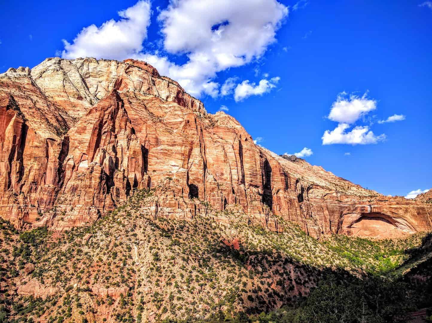
Zion is the handshake at the start of the trip, and it does not let go. The Virgin River threads a slot so tight that hikers wade straight up it, water at their knees and 2,000 feet of Navajo sandstone leaning in overhead.
That hike is The Narrows, and there is nothing else quite like it. You are walking in the river, not beside it, with the walls closing to a few arm-spans wide in places.
This was Utah’s first national park, protected in 1919. From spring through fall a free shuttle carries you up the canyon, so you can crane your neck instead of watching the road. Angels Landing, the knife-edge climb with chains bolted into the rock, now needs a permit won by lottery.
Come early, before the walls turn white in the midday glare, and the cliffs run gold and rust. The Emerald Pools trail is the gentle counterpoint if The Narrows sounds too wet.
Where: Zion National Park, main entrance on State Route 9, Springdale, Utah.
2. Bryce Canyon National Park, Utah

An hour and a half east, the land does something it does nowhere else on Earth. Bryce holds the largest gathering of hoodoos anywhere, thousands of stone spires standing in amphitheaters like a crowd that turned to rock mid-cheer.
Sunrise Point and Sunset Point are the easy wins, but drop below the rim on the Navajo Loop past Thor’s Hammer and you walk among the spires themselves. Link it with the Queen’s Garden trail for the gentlest way back up.
The park sits above 8,000 feet, so the air is thin and the nights stay cold even in July. Pack a jacket you would not think to bring to the desert.
That altitude buys you something rare: some of the darkest skies in the country, and rangers run astronomy programs when the Milky Way comes out. Pioneer Ebenezer Bryce, who gave the place his name in the 1870s, reportedly called it a tough spot to lose a cow.
Where: Bryce Canyon National Park, off Highway 63, Bryce Canyon City, Utah.
3. Capitol Reef National Park, Utah

Capitol Reef is the one most travelers skip, which is exactly why you should not. Its spine is the Waterpocket Fold, a hundred-mile wrinkle in the planet’s crust that looks like the earth got shoved and never smoothed back out.
In the old settlement of Fruita, Mormon pioneers planted orchards in the 1880s that the park still tends today. In season you can pick your own apples, pears, and cherries right off the branch.
Then carry a warm fruit pie out of the tiny Gifford House, once a working farmhouse. Pro tip: the pies sell out by midday, so make it your first stop, not your last.
White sandstone domes overhead gave the park the “Capitol” half of its name. Older still are the petroglyphs left by the Fremont people, pecked into the rock along Highway 24 where anyone can pull over and look up.
Where: Capitol Reef National Park, along Highway 24, Torrey, Utah.
4. Arches National Park, Utah
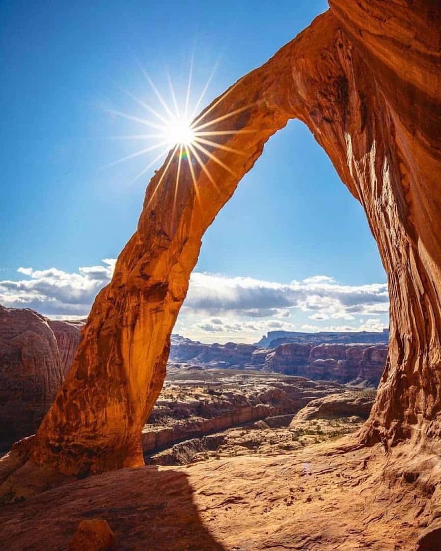
Near the desert town of Moab, the rock stops being walls and starts being windows. Arches protects more than 2,000 natural stone openings, more than anywhere else on the planet, and no two frame the sky the same way.
Delicate Arch is the famous one, the free-standing curve on Utah’s license plate, worth the three-mile round-trip hike at dusk when it glows like an ember. Landscape Arch, out along the Devils Garden trail, stretches longer than a football field on a span that looks impossibly thin.
Do not rush past Balanced Rock or the Windows Section on the way in; they are the easy stops that reward a five-minute stroll. In peak season the park uses timed-entry tickets, so book your window before you roll up to the gate.
Where: Arches National Park, off US-191, Moab, Utah.
5. Canyonlands National Park, Utah

Arches and Canyonlands share a hometown but not a temperament. Canyonlands is Utah’s biggest national park, a vast tabletop of mesas split apart by the Green and Colorado rivers into a maze you feel more than you cross.
Most first-timers head to the Island in the Sky district, where Grand View Point drops away for what feels like forever. The Needles district to the south trades the big overlooks for trails right down among the spires.
Get there before dawn for Mesa Arch, when the rising sun lights the underside of the rock and the whole opening burns orange for a few short minutes. Photographers line up for it, so claim your spot early.
If you have four-wheel drive and nerve, the White Rim Road loops for a hundred miles below the mesa top. Most of us are happy with the overlooks and the silence.
Where: Canyonlands National Park, Island in the Sky district, Moab, Utah.
6. Monument Valley, Arizona

Cross the state line and the West gets its most famous silhouette. Monument Valley is not a national park but a Navajo tribal park, and its sandstone buttes have starred in so many Westerns that you will feel like you have been here before.
The Mittens and Merrick Butte rise straight off the desert floor with nothing around them for scale. A 17-mile dirt drive loops past the icons, and John Ford’s Point looks out over the view that made the movies.
Sunrise over the buttes is the shot people cross the country for, when the light turns the towers copper and the shadows stretch for miles. It is worth setting an alarm you will hate.
This is Navajo land, so go with respect. A guided tour with a Navajo host reaches the corners visitors cannot drive alone, and the stories that come with them are worth every dollar.
Where: Monument Valley Navajo Tribal Park, off US-163, Oljato-Monument Valley, Arizona.
7. Horseshoe Bend, Arizona

Just outside the town of Page, the Colorado River shows off. At Horseshoe Bend the water swings a full 270 degrees around a towering fin of rock, a near-perfect U you take in from a cliff a thousand feet above.
It is a short walk, about a mile and a half round trip, from the parking lot to the overlook, which makes this the easiest jaw-drop of the whole loop. There is no railing along much of the rim, so keep kids close and your phone in a firm grip.
Bring water, because there is no shade out there, and time it for late afternoon when the light turns the river a deep, unreal green. The city of Page runs the lot and charges a small parking fee.
Get there before the crowds and you might have a stretch of rim to yourself, just you and a thousand-foot drop. Sunset turns the sandstone walls to embers while the river holds onto the last of the daylight.
Where: Horseshoe Bend, off US-89 just south of Page, Arizona.
8. Grand Canyon National Park, Arizona

You think you know how big it is. You do not. The Grand Canyon runs 277 river miles long, opens up to 18 miles across, and falls a full mile from rim to river, and the first look still resets the scale of everything.
The South Rim stays open all year and holds the classic views, from Mather Point to the stone Desert View Watchtower that architect Mary Colter designed in 1932. A free shuttle runs the western overlooks along Hermit Road, so you can catch sunset at Hopi Point without fighting for parking.
Walk a little way down the Bright Angel Trail to feel the canyon from the inside, then turn around and climb back up before the light goes. It became a national park in 1919, the same year as Zion, and it never stops earning the name.
Sunrise and sunset are when the canyon truly performs, the layered walls shifting from rust to rose to violet as the light moves. Bring a jacket for the rim, because even in summer the mornings up here start cold.
Where: Grand Canyon National Park, South Rim, Grand Canyon Village, Arizona.
9. Sedona, Arizona

Not every stop on this loop is a park gate. Sedona is a whole town built into the red rock, where the buttes glow crimson at sunset and the main drag hums with galleries, patios, and trailheads.
The formations are the draw. Cathedral Rock and Bell Rock look sculpted on purpose, and the little Chapel of the Holy Cross seems to grow straight out of the stone.
Drive Oak Creek Canyon north of town for cool water and shade, or ride the switchbacks up to Airport Mesa for the sunset view everyone talks about. This is red rock you can sleep beside.
Where: Sedona sits on State Route 89A, about two hours north of Phoenix and 30 minutes south of Flagstaff. Worth a stop:
- Cathedral Rock, Back O’ Beyond Road, the postcard red-rock spire above Oak Creek
- Chapel of the Holy Cross, 780 Chapel Road, a modern chapel built into the rock
- Bell Rock, off State Route 179 in the Village of Oak Creek, an easy walk to big views
- Airport Mesa Overlook, Airport Road, the town’s favorite sunset perch
- Slide Rock State Park, Oak Creek Canyon on 89A, a natural sandstone water chute
10. Petrified Forest National Park, Arizona
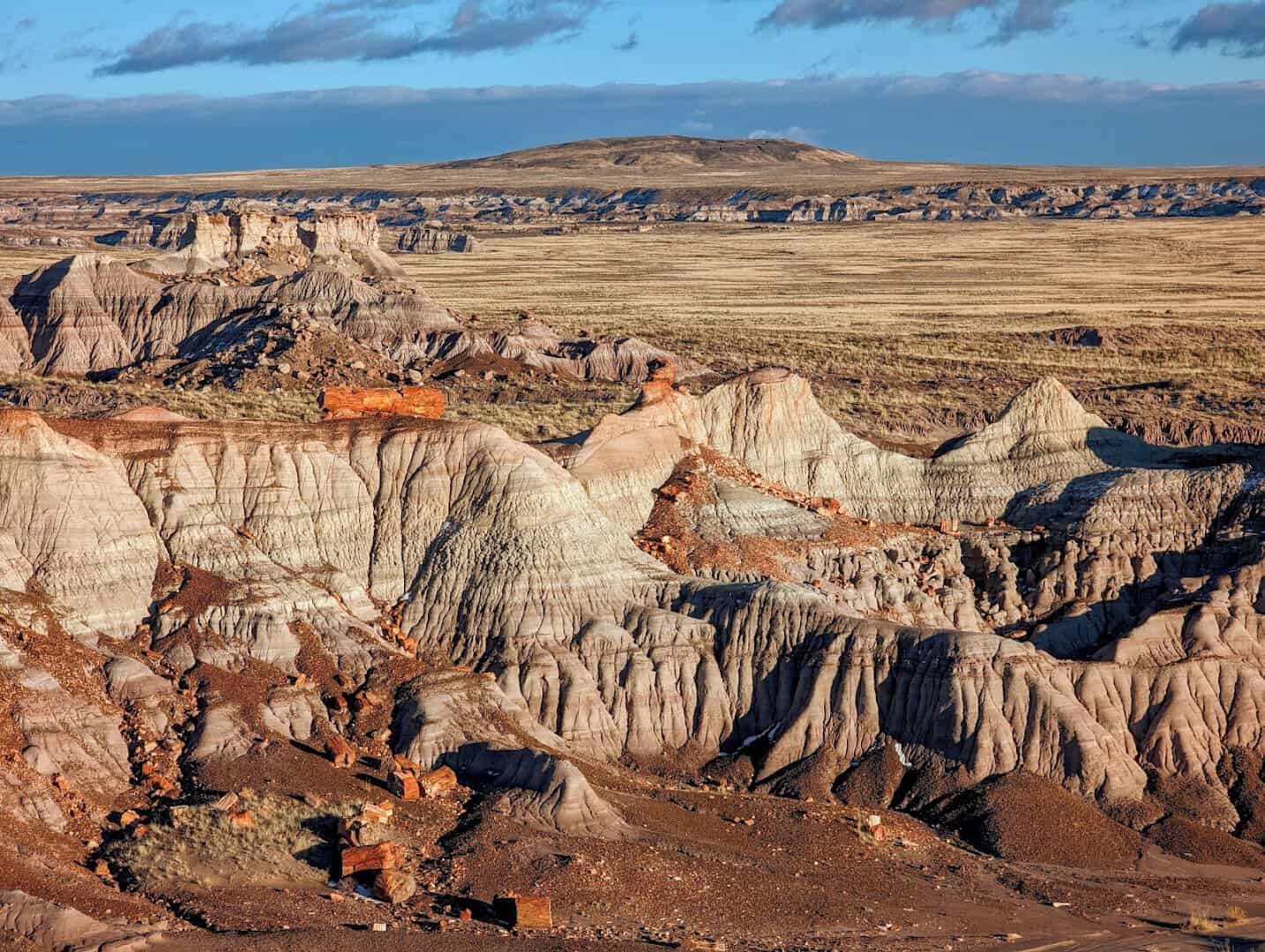
Head east on old Route 66 and time cracks wide open. Petrified Forest protects a landscape littered with logs turned to solid quartz, trees that fell over 200 million years ago and slowly became stone rainbows.
Pick up a chunk with your eyes only, because the colors are wild, deep reds, purples, and golds locked in the grain. The Painted Desert stretches across the north of the park in bands of rose and lavender.
The drive through is only 28 miles, so it slots neatly into a travel day. Stop at the Rainbow Forest Museum and the Blue Mesa loop, and never pocket a souvenir, it is federal law and bad luck besides.
Where: Petrified Forest National Park, off Interstate 40 at exit 311, near Holbrook, Arizona.
11. Saguaro National Park, Arizona
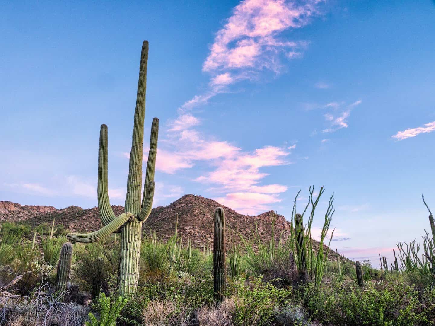
The loop’s southern swing trades red rock for green giants. Saguaro guards forests of the tall, many-armed cactus that only grows in this corner of the country, some of them older than the state itself.
The park splits in two around the city of Tucson. The west side, the Tucson Mountain District, is dense with cactus and sunsets, while the east side climbs higher into the Rincon Mountains.
A saguaro can live 150 years and does not sprout its first arm until it is around 70. Come for sunrise, when the desert is cool and the cactus throw long shadows across the gravel.
Where: Saguaro National Park, two districts flanking Tucson, Arizona, off Kinney Road (west) and Old Spanish Trail (east).
12. White Sands National Park, New Mexico
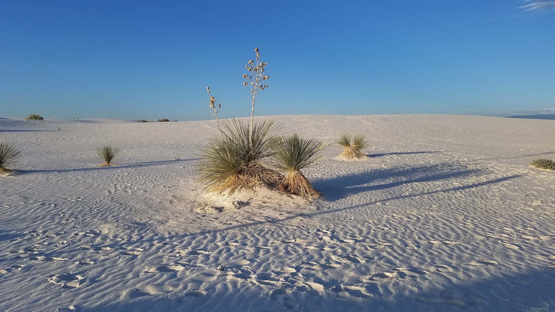
The strangest stop of all is the one that looks like snow. White Sands is a sea of gypsum dunes, brilliant white and cool underfoot, rolling to the horizon across the Tularosa Basin.
It became the country’s newest national park in 2019, though the dunes have been drifting here for thousands of years. Rent a plastic sled at the entrance and ride the powdery slopes like a kid.
Sunset is the moment, when the white turns rose and gold and the mountains behind it go purple. Bring water and mark your car, because out on the dunes every direction looks the same.
Where: White Sands National Park, off US-70 between Las Cruces and Alamogordo, New Mexico.
13. Valley of Fire State Park, Nevada

The loop closes with a bang, an hour short of Las Vegas. Valley of Fire is Nevada’s oldest state park, opened in 1935, and its Aztec sandstone burns such a bright red at sunset that the whole basin looks lit from within.
The Fire Wave ripples like frozen candy stripes at the end of a short desert trail. Elephant Rock arches its stone trunk over the path near the east gate, an easy walk from the road.
Ancient petroglyphs are pecked into the rock at Atlatl Rock and along the Mouse’s Tank trail, left by people who crossed this valley long before any of us. It is a lot of wonder for one last stop.
Sitting right off Interstate 15, it is the perfect final act before you hand the car back. Summers here are brutally hot, so an early start or a cooler-month visit pays off.
Where: Valley of Fire State Park, off Interstate 15 near Overton, Nevada.
Start Planning Your Southwest Loop
Give yourself two weeks if you can, more if you are lucky, and pack more water than you think you need. Book Arches, Monument Valley, and any Navajo tours ahead, and chase the good light at dawn and dusk.
Let the miles between stops be part of the show, because the empty highways out here are their own kind of beautiful. Fuel up, cue the playlist, and go watch the desert catch fire.
Featured image: Wanderful mapleleaf via Valley of Fire State Park

Stella Raines
Editor-in-Chief
Stella brings over a decade of storytelling experience to TX Headlines. With roots in West Texas and a love for road trips, she leads the editorial team with an eye for the hidden stories that make Texas unforgettable.