12 Sedona to Grand Canyon Stops That Hide a Volcano and Ancient Ruins
I have a rule about road trips: the moment you treat the drive as dead time between two places, you have already lost. My best travel memories tend to happen at the unplanned stops nobody circled on a map.
Few drives reward that rule like the run from Sedona to the Grand Canyon. You could cover it in about two and a half hours flat, and rushing it would be the real mistake.
This is red-rock country giving way to pine forest, then to a mile-deep hole in the earth, all on one tank of gas. Below, twelve stops that turn a quick hop north into the best day of the whole trip.
Go slow, and pack a cooler. The canyon will still be there when you finally arrive, and every mile between here and there is trying to hand you a reason to pull over.
1. Bell Rock, Arizona
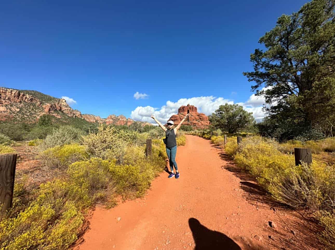
Roll up into the Village of Oak Creek and Bell Rock greets you first, a round-shouldered butte the color of a struck match. It sits right beside Highway 179, so you get the postcard before you even park.
A wide, easy path loops the base, and bolder hikers scramble partway up the slickrock for a higher view. Like Cathedral Rock, it is tagged as one of Sedona’s energy vortexes, so expect a calm, humming crowd near sunset.
Where: Bell Rock, Highway 179, Village of Oak Creek, Arizona 86351, about 15 minutes south of uptown Sedona.
2. Cathedral Rock, Arizona
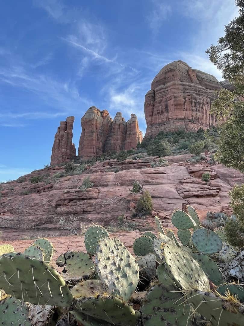
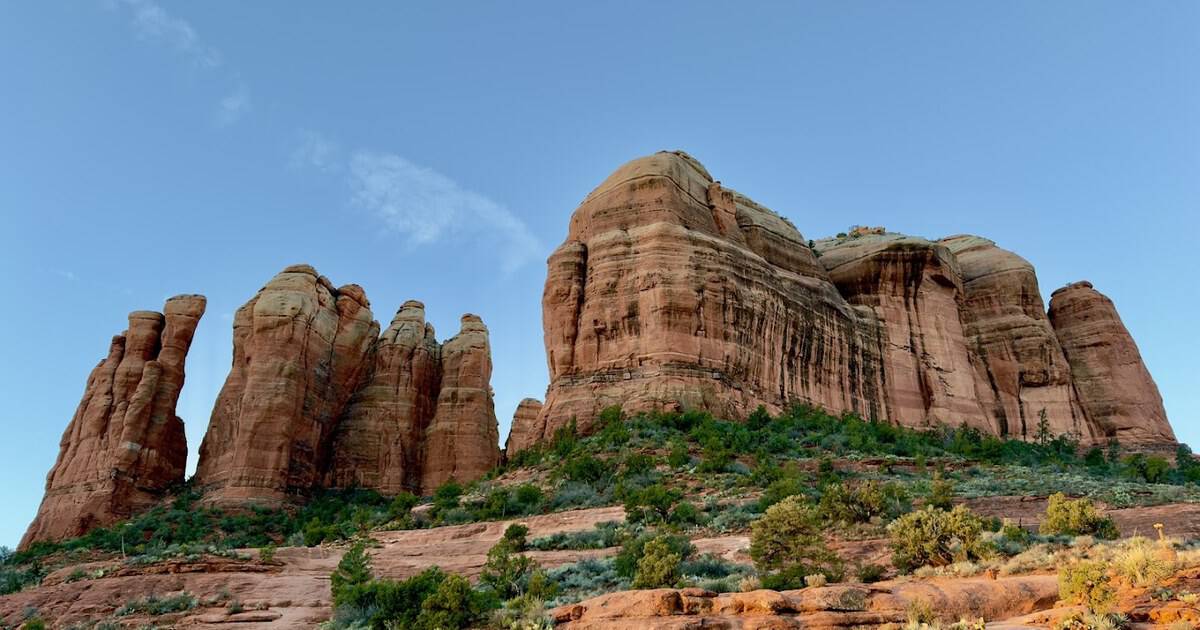
Start where every Sedona postcard is born. Cathedral Rock rises straight out of the desert floor like a set of stone fingers, and it glows a deep orange the second sunrise hits it. Come at first light and you get the color without the crowd.
The trail to the saddle is short but genuinely steep, a scramble more than a stroll, and the payoff view makes the climb feel like a steal. Even from the parking area, the formation stops you cold.
It stands close to 4,900 feet, and one of Sedona’s famous energy vortexes is said to swirl right at its base. Down below, Oak Creek loops past on the Templeton Trail, so you can pair the climb with a shady creekside walk.
Pro tip: the trailhead lot is tiny and fills before eight in the morning, so an early start is less about beating the heat than beating the parking. Sunrise on this rock is worth the alarm anyway.
Where: Cathedral Rock Trailhead, 550 Back O’ Beyond Road, Sedona, Arizona 86336.
3. Slide Rock State Park, Arizona
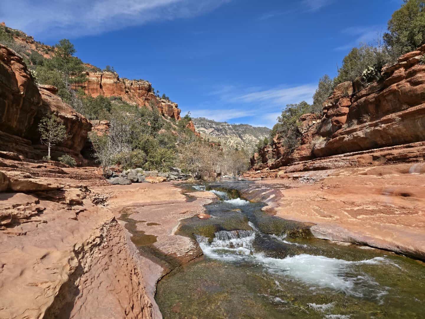
Halfway up Oak Creek Canyon on Highway 89A sits the stop that turns grown adults back into eight-year-olds. Slide Rock is a natural water chute, a run of slick sandstone the creek has buffed smooth over centuries, and yes, you sit down and slide.
The land began as the Pendley homestead in 1912, and the old apple orchard still stands, so you can grab fresh cider on your way through in autumn. Anglers wade the same creek downstream for trout.
The chute runs about 80 feet, the water stays snowmelt cold, and the rocks are algae slick, which is why kids shriek and grownups pretend they were not about to. Arrive early, because the gate closes when the park hits capacity.
Where: Slide Rock State Park, 6871 North Highway 89A, Sedona, Arizona 86336.
4. Flagstaff, Arizona
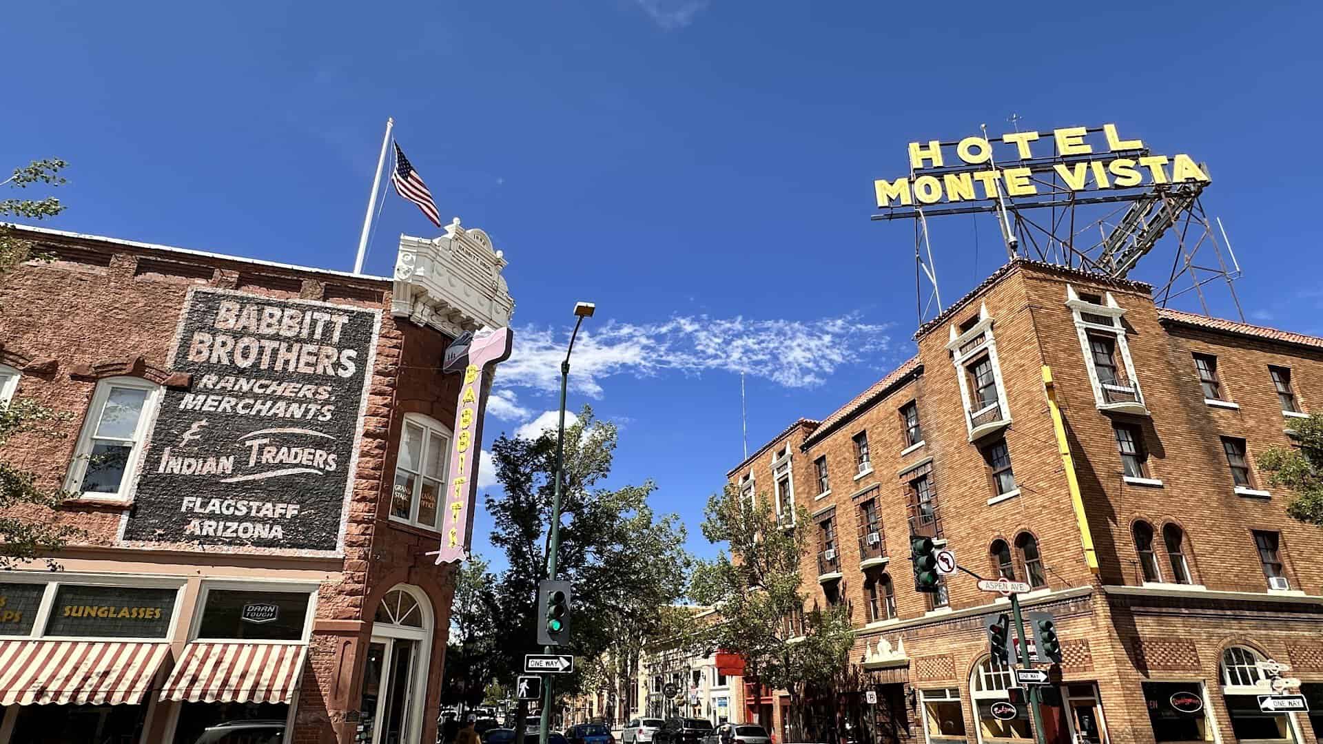
The pines thicken, the air cools by a solid twenty degrees, and suddenly you are in a mountain town sitting at 7,000 feet. Flagstaff is the trip’s natural refuel, and its historic downtown rewards a wander.
It is a walkable grid of brick storefronts, old Route 66 signs, and coffee that tastes better than it should at altitude. This is a college town with a railroad heart, and freight trains still rumble straight through the middle of it.
Up the hill sits Lowell Observatory, where Pluto was discovered in 1930, and the dark mountain skies make Flagstaff a certified International Dark Sky City. If you can spare an evening, a stargazing session through those telescopes is a genuine bucket-list treat.
Where: Flagstaff sits at the crossroads of I-17 and I-40, about 45 minutes north of Sedona at 7,000 feet. Worth a stop:
- Historic downtown, around Route 66 and San Francisco Street, for brick storefronts, cafes, and old neon
- Lowell Observatory, 1400 West Mars Hill Road, where Pluto was found in 1930
- Riordan Mansion State Historic Park, 409 West Riordan Road, a 1904 log-and-stone Arts and Crafts home
5. Williams, Arizona
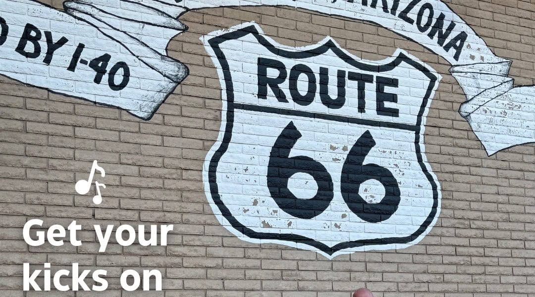
Thirty-five minutes west of Flagstaff on old Route 66 sits Williams, a small railroad town that calls itself the Gateway to the Grand Canyon. It was the last stretch of the Mother Road to be bypassed by the interstate, back in 1984.
The main drag still leans into that history, all neon motels, diners, and a working steam railway that runs excursions up to the South Rim. Give it an hour to wander, or a full afternoon if the train tempts you.
Where: Williams lies right off I-40, about 35 minutes west of Flagstaff and an hour south of the Grand Canyon’s south entrance. Worth a stop:
- Historic downtown Route 66, along Railroad Avenue and Bill Williams Avenue
- Grand Canyon Railway Depot, 233 North Grand Canyon Boulevard, for the daily train to the South Rim
- Pete’s Route 66 Gas Station Museum, 101 East Route 66, a free stop full of roadside Americana
6. Bearizona Wildlife Park, Arizona
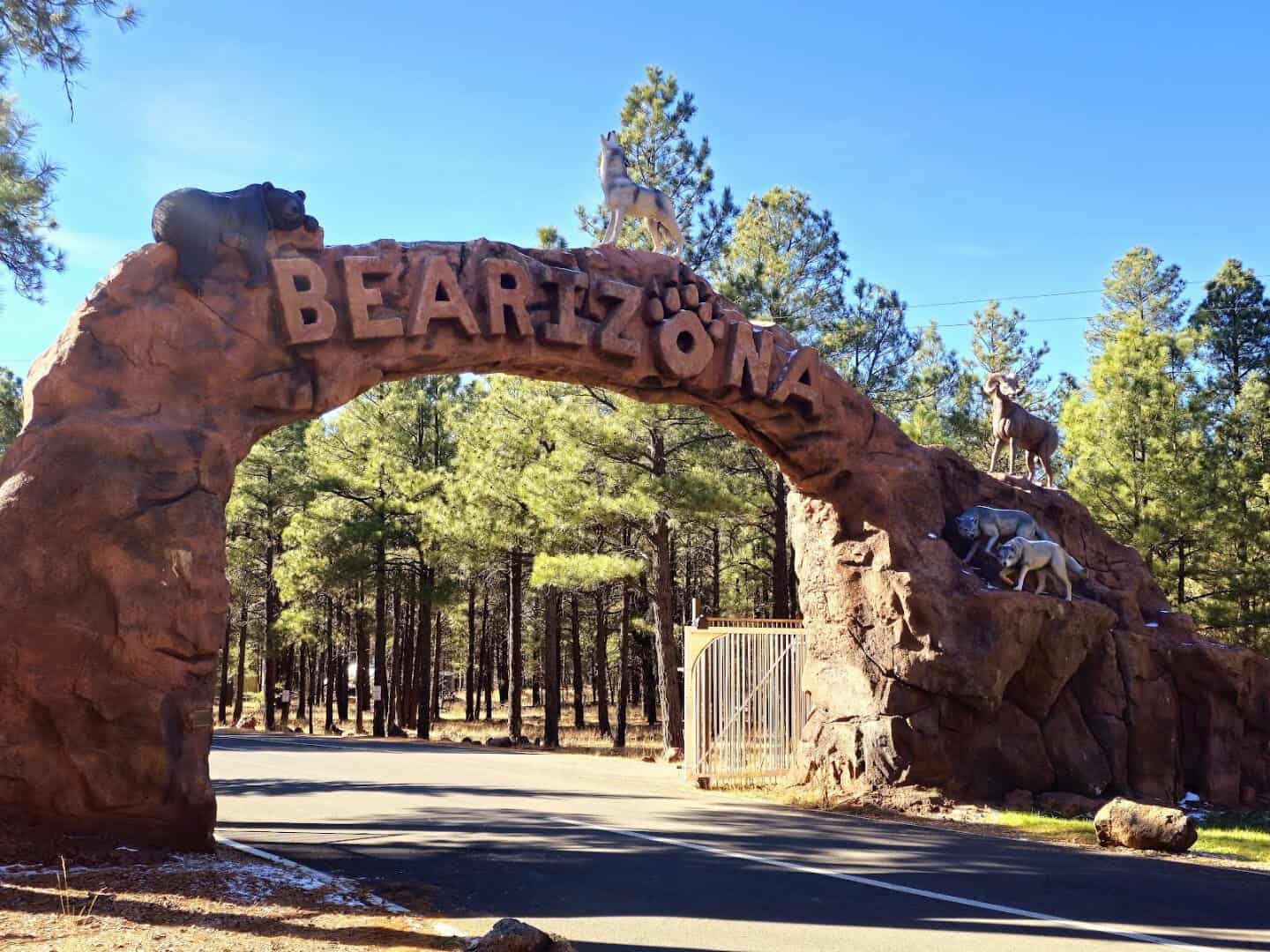
Just east of Williams, Bearizona lets you drive your own car through three miles of ponderosa forest while bison, wolves, and black bears roam right outside the window. It is a proper wildlife park, not a roadside zoo.
Park up at the far end and Fort Bearizona adds a walking loop with bear cubs, otters, and a daily birds-of-prey show. Kids lose their minds here, and honestly so do most of the adults.
Where: Bearizona Wildlife Park, 1500 East Route 66, Williams, Arizona 86046, just off I-40 exit 165.
7. Walnut Canyon National Monument, Arizona
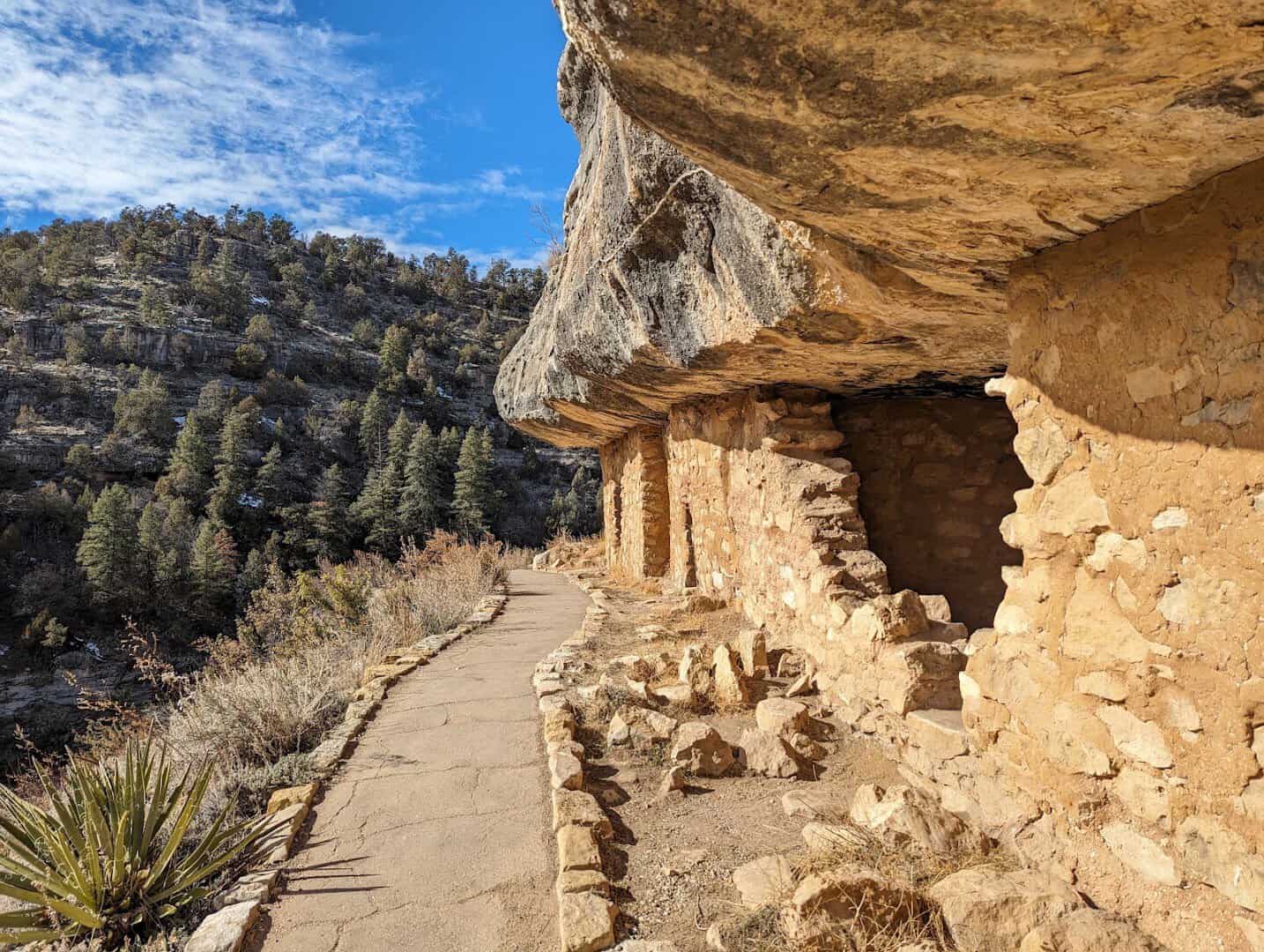
Just southeast of Flagstaff, the ground splits open into a wooded gorge lined with cliff dwellings. The Sinagua people carved homes into these limestone ledges around 800 years ago, tucked under the natural overhangs like a stone apartment complex.
The Island Trail drops roughly 240 steps into the canyon and loops past 25 dwelling rooms up close, close enough to see the smoke-blackened ceilings where families once cooked. Bring water and take the descent slowly.
Stand in one of those doorways and the whole gorge falls away in front of you, ringed with piñon and juniper. It is easy to see why people chose to live here, with water in the creek below and shelter built right into the rock.
It is a real climb back up at this altitude, and worth every stair. The site became a national monument in 1915, and the Sinagua moved on by about 1250, leaving these rooms remarkably intact. If your legs are done, the level rim trail up top is the easy alternative.
Where: Walnut Canyon National Monument, 3 Walnut Canyon Road, Flagstaff, Arizona 86004.
8. Sunset Crater Volcano National Monument, Arizona
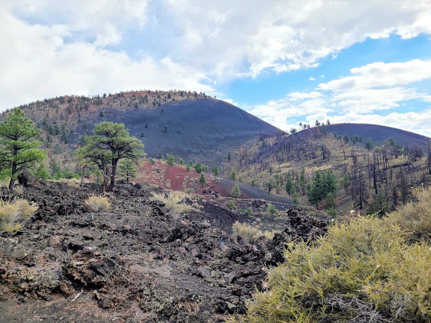
Head north on Highway 89 and the forest floor abruptly turns black. This is where a volcano erupted around the year 1085, and the cinder cone it built still rises more than a thousand feet above the plain.
Its rim is streaked rust and red, like a permanent sunset frozen into the rock, and that coloring is how the crater earned its name. Naturalist John Wesley Powell christened it in 1885, and the description has stuck ever since.
You cannot climb the cone itself, but the Lava Flow Trail winds right through the hardened Bonito flow, past cracked black rock and collapsed lava tubes. It is the youngest volcano in a whole field of them, and standing on ground that was once molten rearranges your sense of time.
Loop back through the same monument road and the transformation runs in reverse, from raw black cinder to recovering pine. Bring water; the shade is thin out here.
Where: Sunset Crater Volcano National Monument, 6082 Sunset Crater Road, Flagstaff, Arizona 86004.
9. Wupatki National Monument, Arizona
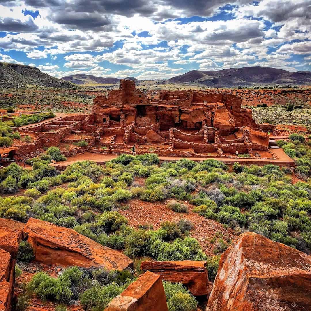
The same loop road that leaves Sunset Crater carries you into open red desert and the ruins of Wupatki. Nearly a thousand years ago this was a busy pueblo, its farmland enriched by ash from that very eruption.
The main house still stands multiple stories tall, with more than 100 rooms built from red sandstone that seems to grow out of the ground itself. Look for two things the guidebooks undersell.
There is a round ballcourt, the northernmost one ever found, and a natural blowhole that literally breathes cool air out of the earth. I could stand at that blowhole for an hour. Smaller sites like Lomaki and the Citadel dot the same loop, so give yourself time.
At its peak this was the tallest building for miles, home to people who farmed corn and beans in ground most of us would call impossible. The whole loop road, from black cinder to open red desert, is one of the strangest, most beautiful drives in Arizona.
Where: Wupatki National Monument, 25137 North Wupatki Loop Road, Flagstaff, Arizona 86004.
10. Cameron Trading Post, Arizona
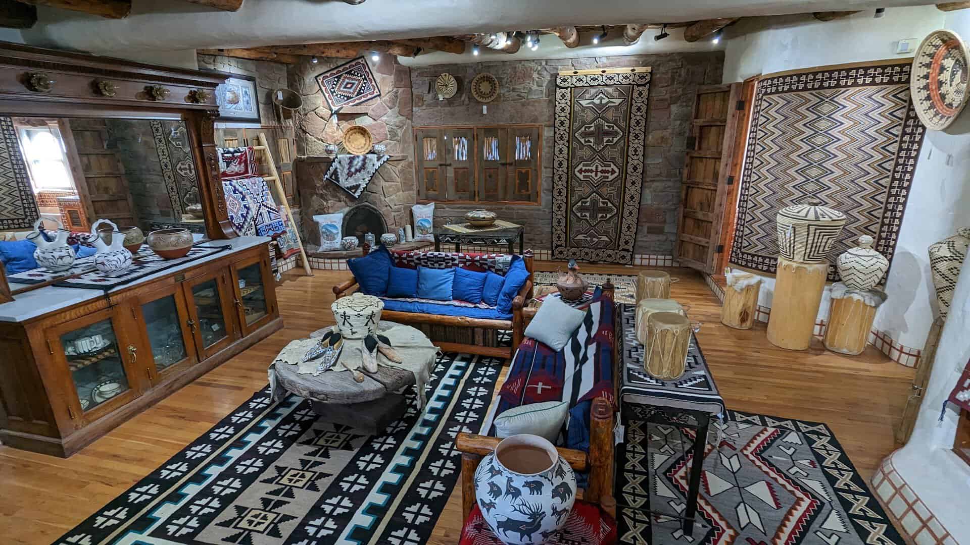
Back on Highway 89 heading north, the land flattens into wide Navajo Nation country, and just past a steel bridge over the Little Colorado River gorge sits a working piece of history.
Cameron Trading Post opened in 1916, when a suspension bridge first let wagons cross the canyon here, and it has been feeding and outfitting travelers ever since.
It is still a trading post in the real sense, a place to buy genuine Navajo rugs, silver, and turquoise, with a gallery of museum-grade pieces in back. The stone rooms are worth a slow browse even if you buy nothing at all.
The stone dining room is famous for one thing above all. Order the Navajo taco, fry bread the size of a hubcap piled with beans and chile, and give yourself a few minutes in the terraced sunken garden out back before you drive on.
Where: Cameron Trading Post, 466 US Highway 89, Cameron, Arizona 86020.
11. Desert View Watchtower, Arizona
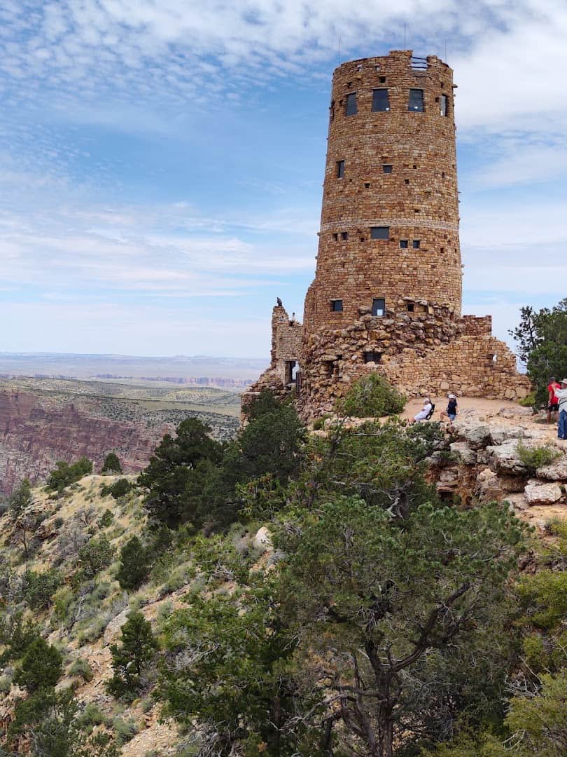
Turn west at Cameron and you enter the Grand Canyon through its quiet eastern door, where the crowds have not gathered yet. The first jaw-drop is the Desert View Watchtower, a 70-foot stone tower perched right on the rim.
Architect Mary Colter designed it to echo the ancestral Puebloan towers of the region, and it opened in 1932 as the easternmost overlook on the South Rim.
Climb the inside staircase past murals by Hopi artist Fred Kabotie and step onto the top for a view that runs from the canyon to the Painted Desert to the San Francisco Peaks. As a first proper look at the canyon, it is hard to beat.
Where: Desert View Watchtower, Desert View Drive, east entrance, Grand Canyon Village, Arizona 86023.
12. Grand Canyon South Rim, Arizona
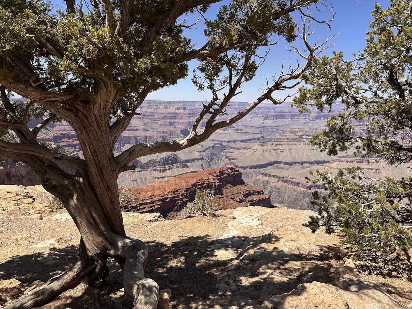
And then you arrive at the reason for the whole drive. The South Rim is where the earth simply ends, dropping a full mile to the Colorado River below.
The canyon runs 277 river miles long and stretches up to 18 miles wide. No photo has ever gotten it right, and yours will not either. Unlike the North Rim, this side stays open year round, so the view is here whenever you make it.
Elk graze the rim lawns as if they own the place, and the layered walls turn every shade of red as the sun drops. You earned this view stop by stop, and it still manages to feel impossible.
Where: Grand Canyon South Rim, Grand Canyon Village, Arizona 86023. Park at the visitor center and ride the free shuttles. Worth a stop:
- Mather Point, steps from the main visitor center, for the classic first look
- Rim Trail, a mostly flat path linking the overlooks along the edge
- Hopi Point, a Hermit Road shuttle stop famous for sunset color
- El Tovar Hotel, on the rim in the village, a grand 1905 log-and-stone lodge
Make the Drive the Destination
Point the car north with a full tank and a loose schedule, because the miles between Sedona and the Grand Canyon are not a gap to close. They are the trip.
Slide down a rock, stand on a lava flow, breathe with a thousand-year-old blowhole, then let the canyon knock the wind clean out of you at the end. Take the whole day, and pack more snacks than you think. You will still wish you had two.
Featured image: Landon Wisser via Cathedral Rock

Stella Raines
Editor-in-Chief
Stella brings over a decade of storytelling experience to TX Headlines. With roots in West Texas and a love for road trips, she leads the editorial team with an eye for the hidden stories that make Texas unforgettable.