15 Midwest Road Trip Stops That Prove the Region Is Wildly Underrated
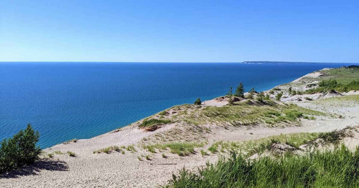
Nobody warned me that some of the best road trips in the country hide right in the middle of it. We talk up the coasts, the desert Southwest, the mountains out west. Meanwhile the heartland quietly keeps its shorelines, its badlands, and its storybook towns to itself.
I have logged enough long, flat highway miles to trust the payoff. Point the car anywhere across these ten states and you drive straight into wide-open wonder, one lake or canyon or lighthouse at a time. The Midwest rewards a patient driver.
Below, fifteen road-trip stops worth the gas, spread from the Great Lakes shore to the North Dakota badlands. Each one names its state and tells you how to get there. Grab a cooler, pick your favorites, and go.
1. Mackinac Island, Michigan

Start where the cars stop. Mackinac Island bans automobiles, so the soundtrack is hooves on pavement and ferry horns across the Straits of Mackinac. Bikes and horse-drawn carriages carry everyone, and the flat eight-mile shoreline loop suits any rider.
The Grand Hotel has watched the bluff since 1887, its front porch stretching about 660 feet, said to be among the longest in the world. Fudge shops perfume Main Street with butter and brown sugar, and yes, you should buy a thick slab for the ferry home.
I love a place that forces you to slow down, and an island with no engines does exactly that. Ride the loop past Arch Rock, tour Fort Mackinac above the harbor, then watch the sun drop behind the water. Come in June and the whole island smells of lilacs.
Where: Mackinac Island sits in the Straits of Mackinac; catch a passenger ferry from Mackinaw City or St. Ignace, since private cars are not allowed. Worth finding:
- The Grand Hotel, 286 Grand Ave, whose porch runs about 660 feet along the bluff
- Fort Mackinac, 7127 Huron Rd, the 1780s fort on the hill above the harbor
- Arch Rock, on the island’s east shore, a limestone arch 146 feet above the water
- Main Street, where the fudge shops perfume the whole block
2. Indiana Dunes National Park, Indiana

Trade the island for a beach you would never expect in Indiana. Indiana Dunes National Park runs along fifteen miles of Lake Michigan shoreline, where mountains of sand climb behind the surf and the Chicago skyline shimmers across the water on a clear day.
Congress elevated it to national park status in 2019, though the dunes drew swimmers and botanists for more than a century before that. Climb Mount Baldy, a living dune that creeps a few feet inland every year, then turn around for the view back over the lake.
More than 350 bird species pass through, so tuck binoculars in the bag. Fifty miles of trail wind through marsh, bog, and oak forest. When the heat builds, kick off your shoes and let the cool freshwater waves do their work.
Pro tip: the three-loop Dune Succession Trail packs the biggest views into the shortest walk, boardwalk stairs and all.
Where: Indiana Dunes Visitor Center, 1215 N State Road 49, Porter, IN 46304, near Chesterton on Lake Michigan.
3. Starved Rock State Park, Illinois

Illinois surprises people, and Starved Rock is exhibit A. Carved by ancient glacial meltwater, the park stacks eighteen canyons of golden sandstone along the Illinois River, each one hiding a waterfall that roars in spring and freezes into blue columns come January.
The name traces to a Native legend from the 1760s, when the Illiniwek reportedly took refuge on the butte above the river. Today thirteen miles of trail thread the canyons, and the lodge, built by the Civilian Conservation Corps in the 1930s, still warms hikers by a giant stone fireplace.
I would drive out for the frozen falls alone. St. Louis Canyon and Wildcat Canyon are the showstoppers, so save your camera battery for them. Weekdays are quieter, and the light in the canyons is best in the late afternoon.
Where: Starved Rock State Park, 2668 E 875th Rd, Oglesby, IL 61348.
4. Badlands National Park, South Dakota

Then the land cracks wide open. Badlands National Park spreads 244,000 acres of striped spires and clay canyons across South Dakota, a landscape that glows pink and gold at dawn. The Badlands Loop Road strings the overlooks together in a single easy morning.
Bison, bighorn sheep, and prairie dogs still roam the mixed-grass prairie, and one of the richest fossil beds on earth sits underfoot; saber-toothed cats once hunted this ground, and fossil hunters have worked the beds since the 1840s.
Drive it slow, stop at every pullout, and stay past dark. Far from any city, the star-filled sky here is honestly absurd, and rangers run night programs all summer to point out what you are seeing. Fill the tank first, since services out here are thin.
Save time for the Notch Trail, a short scramble up a log ladder to a canyon-rim view of the White River Valley. It is the most fun half mile in the whole park.
Where: Ben Reifel Visitor Center, 25216 Ben Reifel Rd, Interior, SD 57750.
5. Door County, Wisconsin
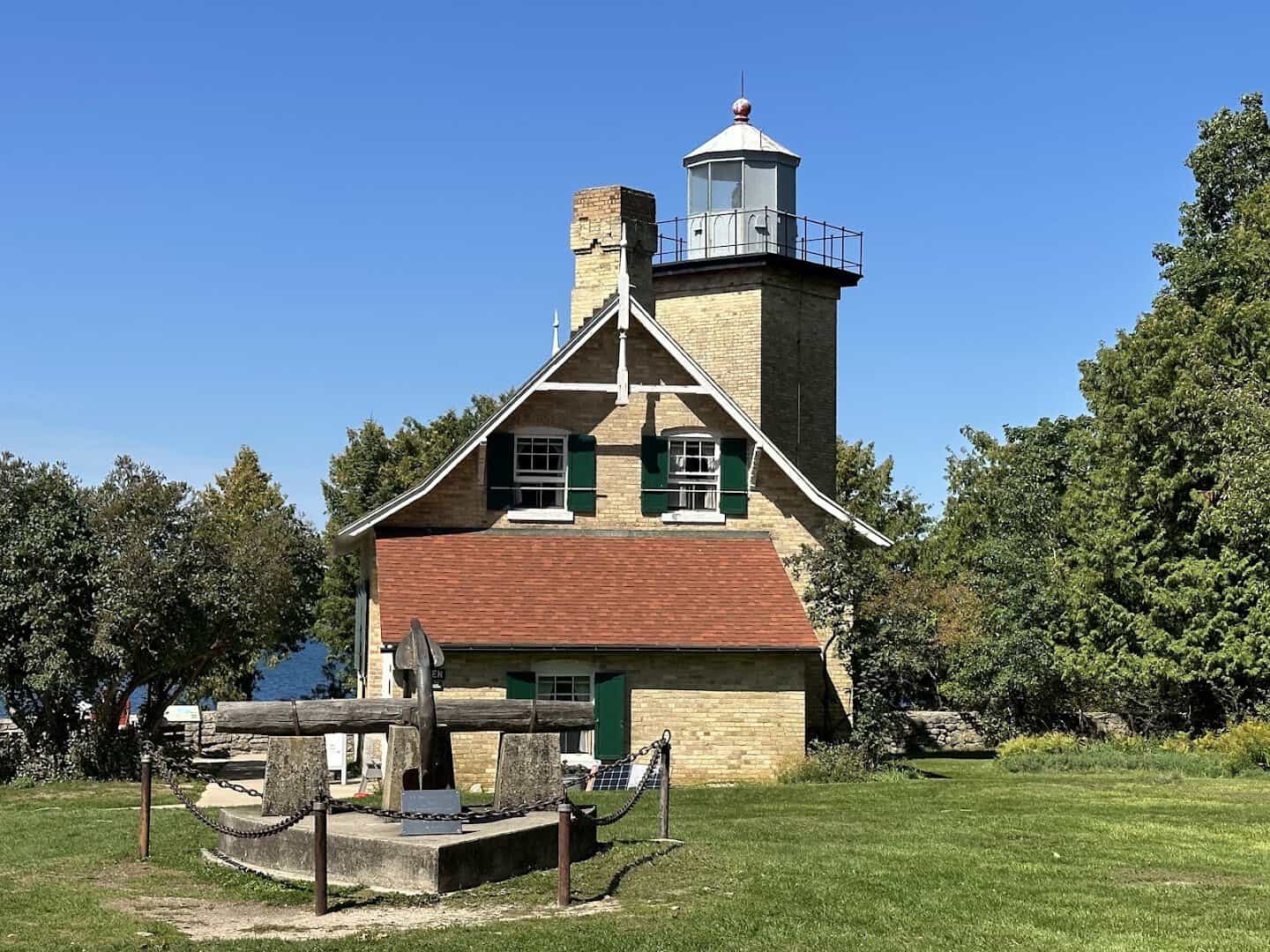
Wisconsin’s thumb points into Lake Michigan, and travelers call it the Cape Cod of the Midwest. Door County folds 300 miles of shoreline, eleven lighthouses, five state parks, and cherry orchards that blush pink every May into a single slender peninsula.
Peninsula State Park alone hands you a 75-foot observation tower, limestone bluffs, and Nicolet Beach. Cap the evening at a fish boil, a Scandinavian tradition where whitefish and potatoes cook over an open flame until the pot dramatically boils over in a wall of fire.
Give me a shoreline that shifts character every few miles and I am sold. Watch the sunset from Cave Point, where the waves hammer hollow limestone caves, and you will understand the fuss. Stop at a roadside stand for a jar of tart cherry jam on the way out.
Where: Door County is the peninsula north of Green Bay, reached on Highway 42 or 57 about an hour past the city. Worth a stop:
- Peninsula State Park, 9462 Shore Rd, Fish Creek, with its Eagle Tower and Eagle Bluff Lighthouse
- Cave Point County Park, 5360 Schauer Rd, Sturgeon Bay, where waves hammer hollow limestone
- Fish Creek, a harbor village known for its evening fish boils
- Cana Island Lighthouse, 8800 E Cana Island Rd, Baileys Harbor
6. Effigy Mounds National Monument, Iowa
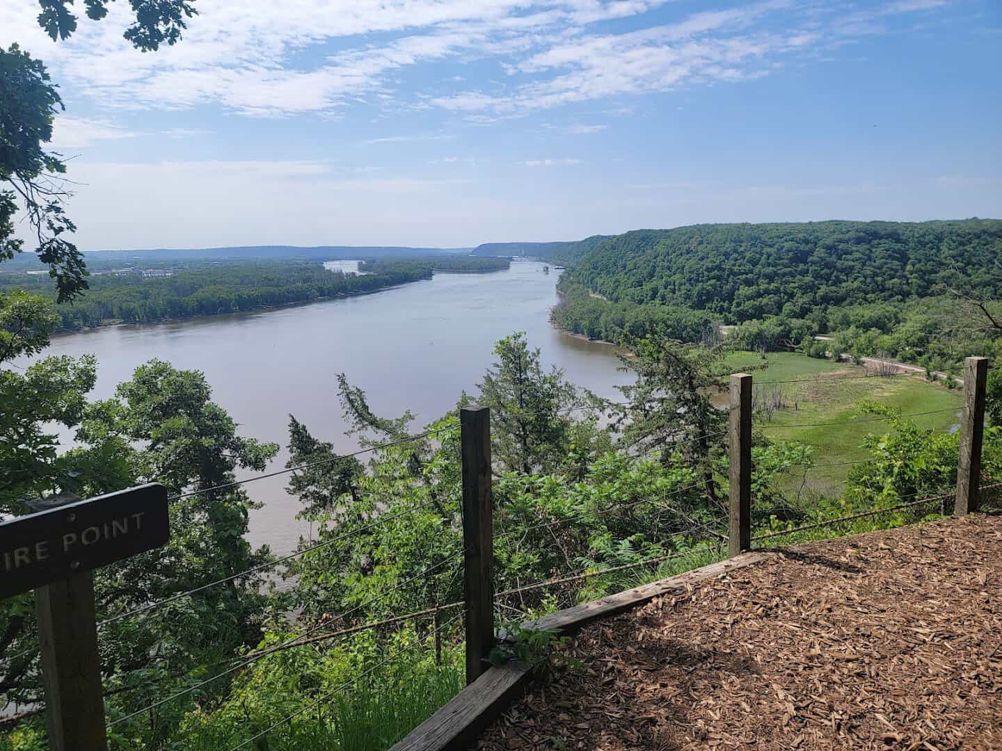
Iowa guards something ancient above the Mississippi. Effigy Mounds National Monument protects more than 200 prehistoric mounds, dozens shaped like bears and birds, raised by Native peoples along the towering bluffs of the Upper Mississippi River.
The Marching Bears, ten bear-shaped mounds walking in a single line, reward the climb to Fire Point, where the river valley falls away some 300 feet below your boots. Eleven miles of trail wind through oak savanna and restored prairie above the water.
This is quiet, sacred ground, and the effort of the climb is the whole point. I save places like this for autumn, when the bluffs turn gold and the Mississippi runs slow and silver beneath them. Start early and pack water, because shade thins out up top.
Where: 151 Iowa Highway 76, Harpers Ferry, IA 52146.
7. Lake of the Ozarks, Missouri
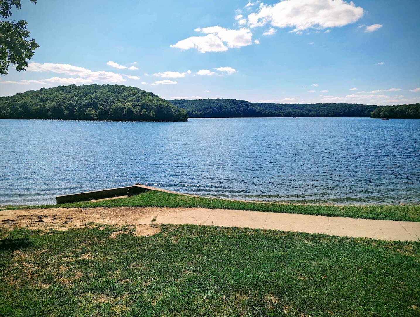
Missouri built itself a coastline in the middle of the country. Lake of the Ozarks unspools more than 1,100 miles of shoreline, longer than California’s entire coast, across a reservoir born in 1931 when Bagnell Dam plugged the Osage River.
Rent a boat, find a quiet cove, and tie up at a waterfront grill you can only reach by water. Underground, Bridal Cave draws couples who marry among the stalactites; more than 4,000 weddings have taken place inside it.
Lake of the Ozarks State Park, the largest in Missouri, throws in trails, swimming beaches, and its own show cave. Summer here is a full-contact sport, and I mean that as the highest praise. Come midweek if you would rather trade the boat traffic for a quiet dock.
Where: Lake of the Ozarks spreads across central Missouri, about a three-hour drive from either St. Louis or Kansas City. Worth finding:
- Lake of the Ozarks State Park, 403 Highway 134, Kaiser, the largest state park in Missouri
- Bridal Cave, 526 Bridal Cave Rd, Camdenton, a show cave that has hosted thousands of weddings
- Bagnell Dam, at Lake Ozark, the 1931 dam that created the whole lake
- Ha Ha Tonka State Park, 1491 State Rd D, Camdenton, with castle ruins above a spring
8. Split Rock Lighthouse, Minnesota
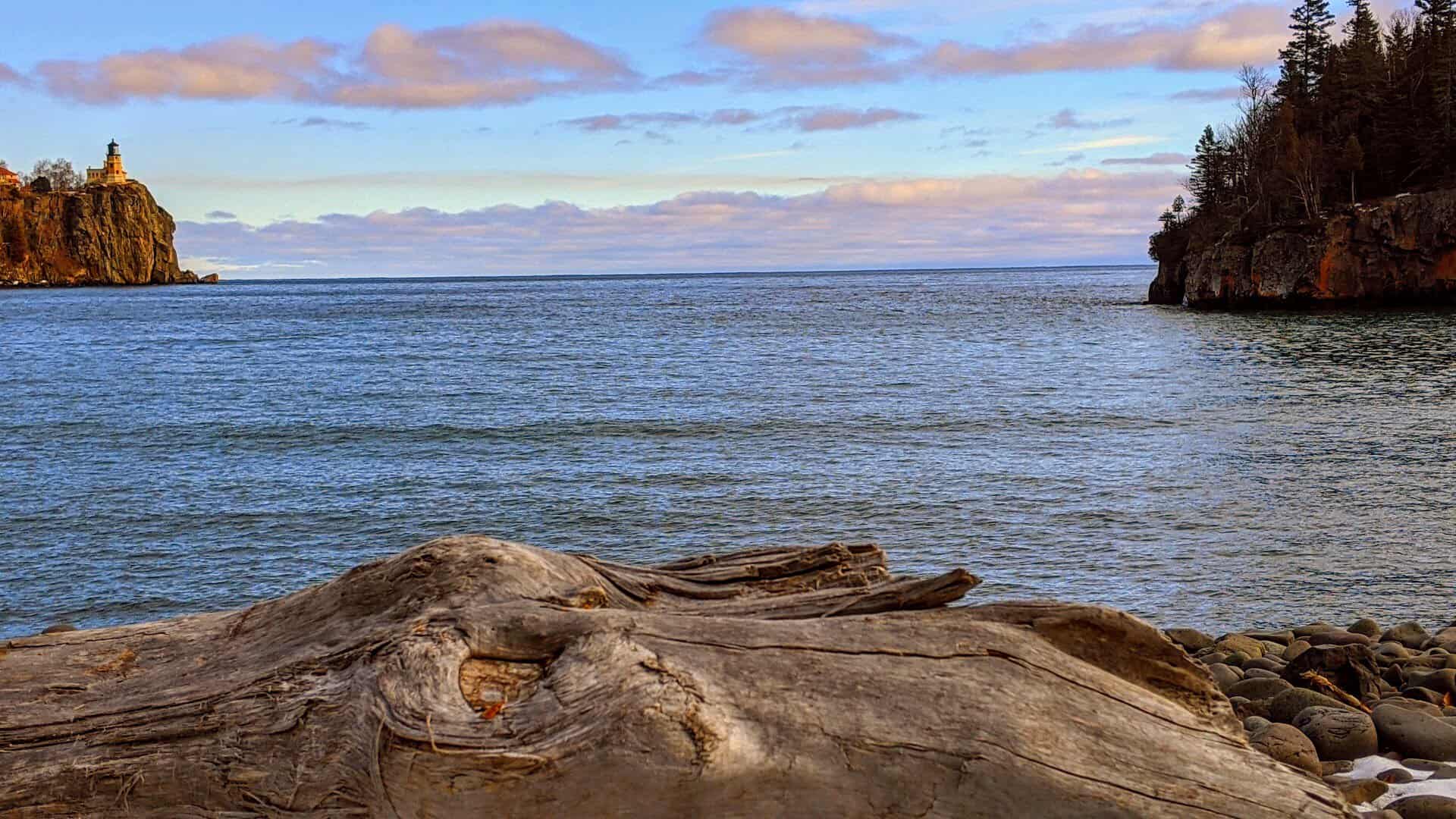
Drive Minnesota’s North Shore and one image stops you cold. Split Rock Lighthouse stands on a 130-foot cliff above Lake Superior, built in 1910 after a savage 1905 November storm wrecked or damaged dozens of ships along this coast. It may be the most photographed lighthouse in America.
The restored keeper’s house and tower are open for tours, and every November 10 the beacon is lit to honor the crew of the Edmund Fitzgerald. The Gitchi-Gami State Trail glides right past for anyone on two wheels.
I chase views that feel earned, and this cliff serves up a stunner for the price of a short walk. Come at sunrise, before the tour buses, and you will have the light to yourself. The overlook down the shore gives you the classic postcard angle.
Where: 3755 Split Rock Lighthouse Rd, Two Harbors, MN 55616.
9. Chicago, Illinois
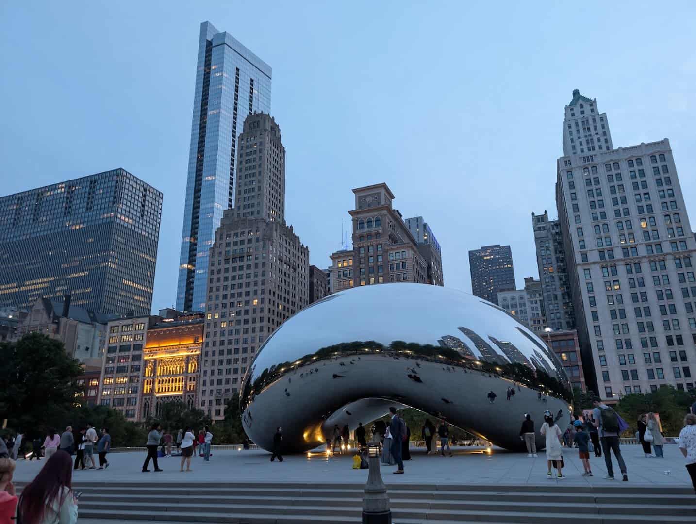
Every great Midwest road trip deserves one big city, and Chicago wins my vote. Millennium Park anchors the downtown lakefront, where Cloud Gate, the mirrored sculpture everyone calls the Bean, throws the skyline back at you in a silver curve. Anish Kapoor unveiled it in 2006.
Walk the lakefront path, spin the Ferris wheel at Navy Pier, and eat a deep-dish pie thick enough to demand a fork. The Art Institute guards Grant Wood and Edward Hopper a short stroll away.
Route 66 famously begins here, which makes the city the natural launch pad for a whole heartland journey. Give it a full day before you point the car back toward open country. Then stand under the Bean once more and find yourself in the crowd of reflections.
Where: Chicago anchors the southwest shore of Lake Michigan, where Route 66 begins. Worth a full day:
- Millennium Park, 201 E Randolph St, home to Cloud Gate, the mirrored sculpture everyone calls the Bean
- Navy Pier, 600 E Grand Ave, with its lakefront Ferris wheel
- The Art Institute of Chicago, 111 S Michigan Ave, guarding Grant Wood and Edward Hopper
- Maggie Daley Park, 337 E Randolph St, with a climbing wall and a winding ribbon rink
10. Hocking Hills State Park, Ohio

Ohio hides a green jungle in its hills. Hocking Hills carves recess caves, gorges, and waterfalls out of blackhand sandstone, and Old Man’s Cave is the crown, a mossy chasm where a hermit named Richard Rowe reportedly lived in the early 1800s.
Six connected trail areas link Ash Cave, the largest recess cave in the state at some 700 feet wide, with Cedar Falls and the sheer walls of Conkle’s Hollow. Hemlocks keep the gorges cool and shaded even in the thick of July.
If you only have time for one walk, take the trail from Old Man’s Cave to Cedar Falls; it is the finest mile in the park. Go on a weekday morning to beat the crowds, then let the highway carry you deeper into the trip.
Where: Hocking Hills sits in the hills of southeast Ohio, about an hour southeast of Columbus. The trails to link:
- Old Man’s Cave, 19852 State Route 664 S, Logan, the mossy chasm at the park’s heart
- Ash Cave, the largest recess cave in Ohio at some 700 feet wide
- Cedar Falls, the park’s most powerful waterfall, a short drive from Old Man’s Cave
- Conkle’s Hollow, a sheer-walled gorge on the park’s north side
11. Sleeping Bear Dunes National Lakeshore, Michigan

Michigan hides a desert on a freshwater coast. Sleeping Bear Dunes piles sand bluffs 450 feet above Lake Michigan, and a national morning show once voted it the most beautiful place in America. The water below glows an unreal turquoise on a bright day.
An Ojibwe legend gives the place its name: a mother bear who swam the lake and still waits on the shore for her cubs, now the two Manitou Islands offshore. The park protects 35 miles of that coast, its dunes, forest, and clear inland lakes.
Run down the Dune Climb, then drive the scenic loop for the overlook that does the bragging. I love a view that makes you gasp before you have caught your breath from the walk up.
Where: Sleeping Bear Dunes runs along Lake Michigan near Empire, about 30 minutes west of Traverse City. Worth finding:
- The Dune Climb, off M-109, a 110-foot wall of sand you race up and roll down
- Pierce Stocking Scenic Drive, a 7.4-mile loop to the 450-foot Lake Michigan Overlook
- Glen Haven, a restored 1920s lumber village on Sleeping Bear Bay
- Empire Bluff Trail, an easy 1.5-mile walk to a cliff-edge view of the dunes
12. Apostle Islands National Lakeshore, Wisconsin
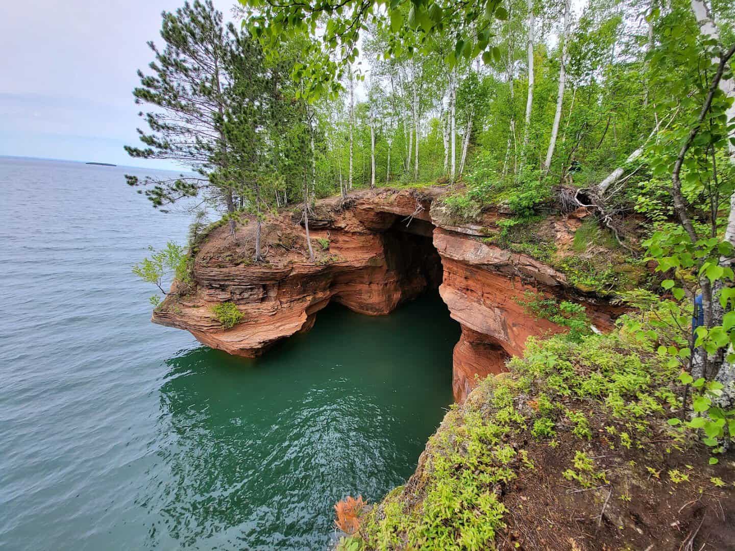
Wisconsin keeps its wildest coast up north. The Apostle Islands scatter 21 green humps across Lake Superior, ringed by red cliffs the lake has carved into caves and arches. Paddle a kayak into the mainland sea caves and hear the water echo under stone.
In a hard winter the spray freezes the cliffs into blue ice caves, though the lake decides whether they are safe to reach. The park guards more historic lighthouses than any other unit, nine light stations spread across the water.
Catch the ferry to Madeline Island, browse Bayfield’s harbor, and watch the sun sink into the biggest freshwater lake on earth. Bring a jacket, because Superior makes its own weather.
Where: The Apostle Islands scatter across Lake Superior off Bayfield, in the far north of Wisconsin. Worth finding:
- The mainland sea caves at Meyers Beach, off Highway 13, best seen by kayak in summer
- Bayfield, the harbor town where the ferries and boat tours leave
- Madeline Island, a 20-minute ferry from Bayfield and the only island with a village
- Raspberry Island Lighthouse, one of nine historic light stations in the park
13. Mount Rushmore, South Dakota

Some stops earn the cliche, and this is one. Mount Rushmore carves four presidents 60 feet tall into a Black Hills granite face, and the scale only lands when you stand under it. Washington, Jefferson, Roosevelt, and Lincoln gaze out over the pines.
The sculptor Gutzon Borglum began blasting the mountain in 1927, and he and roughly 400 workers finished in 1941, his son Lincoln seeing it through. Walk the Presidential Trail for the close-up angles most photos miss.
Come back after dark in summer for the evening lighting ceremony, when the faces glow against the night. Pair it with Custer State Park’s bison herd down the road and you have a full Black Hills day.
Where: Mount Rushmore National Memorial, 13000 SD-244, Keystone, SD 57751, in the Black Hills about 30 minutes southwest of Rapid City.
14. Theodore Roosevelt National Park, North Dakota

North Dakota saves its drama for the far west. Theodore Roosevelt National Park spreads badlands, bison, and wild horses across the Little Missouri River country, striped hills glowing copper at sunset. It is the only national park named for a single person.
A grieving young Roosevelt came here to ranch in the 1880s, and the raw land helped shape the conservationist president he became. Prairie dogs bark from their towns, and the 36-mile scenic loop in the South Unit strings the overlooks together.
Stop at Painted Canyon right off the interstate for the view that will make you exit, then drive into Medora, the little Old West town at the gate. Fill the tank first, because the plains run long out here.
Where: Painted Canyon Visitor Center, off Interstate 94 exit 32 near Medora, ND 58645, the easiest gateway to the park’s South Unit.
15. Brown County, Indiana
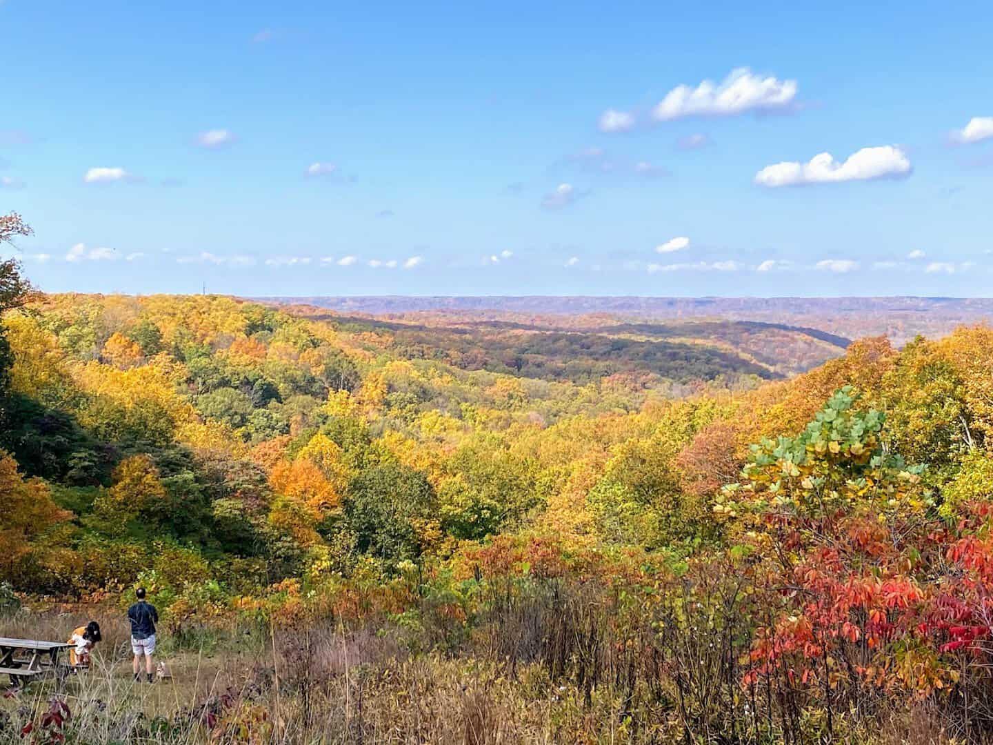
Indiana turns to gold every October, and Brown County is where the color pools deepest. Rolling wooded hills earn the nickname the Little Smokies, and the state’s largest park crowns them with a fire tower built for exactly this view.
At the foot of the hills sits Nashville, an artist colony since painters chased the light here a century ago. Its walkable village packs galleries, candy shops, and front porches into a few square blocks.
Time it for peak leaf color, roughly mid-October, and drive the ridgelines with the windows down. There is nothing like a town that smells like fudge and fallen leaves at once.
Where: Brown County sits in the wooded hills of south-central Indiana, about an hour south of Indianapolis. Worth a stop:
- Brown County State Park, 1801 State Road 46 E, Nashville, the state’s largest park, with a fire tower over the fall color
- The village of Nashville, a walkable artist colony full of galleries and shops
- T.C. Steele State Historic Site, 4220 T.C. Steele Rd, the Impressionist painter’s hilltop home and studio
- Bean Blossom Covered Bridge, a restored 1880 bridge north of town
Point the Car Toward the Middle
The Midwest does not shout for your attention, which is precisely why so much of it is still yours to discover. String a few of these stops into a long weekend, or link the whole set into the road trip of a lifetime.
So fill the tank, load the playlist, and let that flat horizon fool you one more time. The best surprises on the map are hiding right in the middle of it, and the drive between them is half the fun. Go find them, and save room for the fudge.
Featured image: Sheri via Sleeping Bear Dunes National Lakeshore

Stella Raines
Editor-in-Chief
Stella brings over a decade of storytelling experience to TX Headlines. With roots in West Texas and a love for road trips, she leads the editorial team with an eye for the hidden stories that make Texas unforgettable.