15 Beautiful Places in Washington That Look Unreal in Person
Every so often a photo lands in my feed that I’m sure has been faked. The water is too blue, the peak too sharp, the forest too green to be a real place a person can actually drive to. Then I read the caption, and it’s Washington. Again.
The Pacific Northwest keeps handing us beauty that overwhelms, and Washington State is where it stacks up highest: glaciered volcanoes, turquoise lakes, moss-hung rainforests, and sea stacks against the Pacific. Below, I’ve pulled together fifteen places that look photoshopped and aren’t, with a note on how to reach each one.
Some are a short drive from Seattle. Others ask for a ferry or a long haul east. All of them are worth the gas.
1. Mount Rainier, Washington
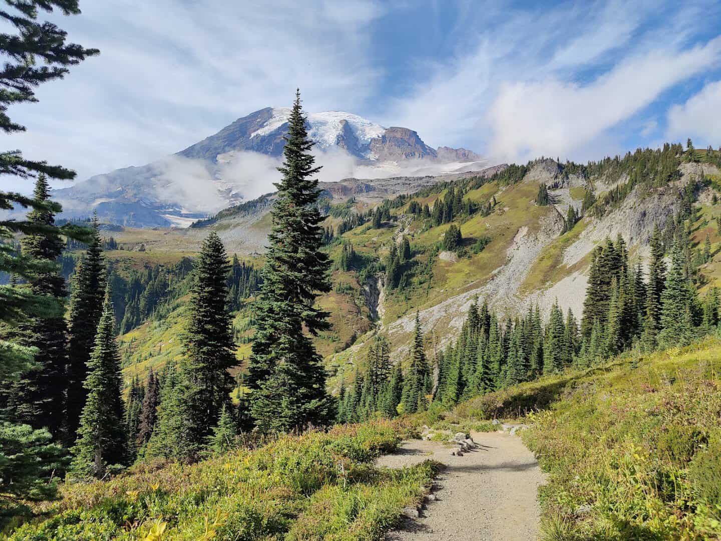
Nothing prepares you for the scale of it. Rainier rises 14,411 feet, an active volcano wearing 25 named glaciers, and on a clear day you can see it from Seattle like a cardboard cutout pasted on the horizon.
Come to the aptly named Paradise in July and the meadows go electric with lupine and paintbrush, the white dome hanging right above you. Reflection Lakes mirrors the whole thing on a still morning. It is the classic Washington photo, and it earns it.
The park spreads across nearly 370 square miles, so give it a full day. Wander the Skyline Trail, poke into the historic Paradise Inn, or drive up to Sunrise, the highest point you can reach by car, for a different angle on the peak.
Pro tip: arrive early. Paradise parking fills by mid-morning on summer weekends, and the light is best before the afternoon clouds roll up the valley.
Where: Mount Rainier National Park, Paradise area, Ashford, WA. Enter via the Nisqually Entrance off State Route 706.
2. Diablo Lake, Washington
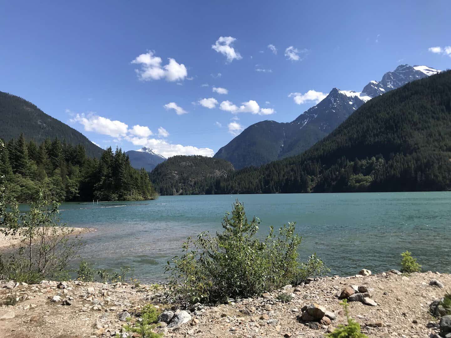
The first time you crest the overlook on the North Cascades Highway, the color stops the conversation in the car. Diablo Lake is an unreal milky turquoise, and no filter is involved.
The shade comes from glacial flour, rock ground to fine powder by surrounding glaciers and carried down into the reservoir, where it catches the light. Ring it with jagged, forested peaks and you have one of the most photographed views in the North Cascades.
Pull over at the Diablo Lake Overlook and just look. The color is strongest in mid to late summer, once the glaciers upstream are melting hardest and feeding the lake its powder.
The whole North Cascades Highway is a stunner, so build in time to stop. If you want to get out on that unreal water, guided boat tours run on the lake through the warmer months.
Where: Diablo Lake Overlook, State Route 20, near Newhalem, WA, inside Ross Lake National Recreation Area.
3. Hoh Rain Forest, Washington
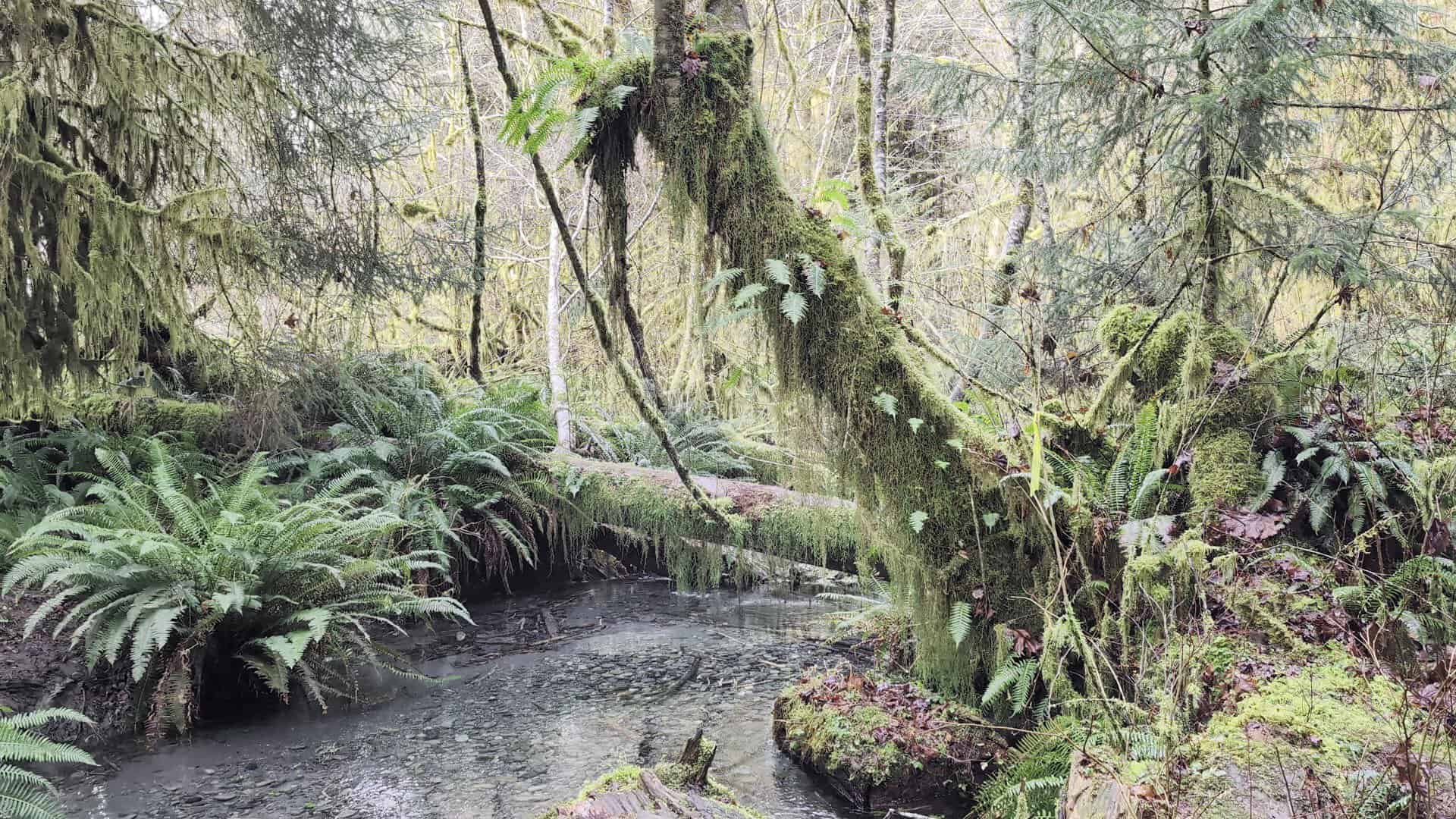
I have a real soft spot for a forest that feels prehistoric, and the Hoh is the greenest place I know of in the Lower 48. This is a genuine temperate rainforest, soaking up as much as twelve to fourteen feet of rain a year.
Walk the Hall of Mosses and the bigleaf maples wear sleeves of club moss, spike moss drips from every branch, and the light goes soft and underwater-green. Even the sound is muffled. You start whispering without deciding to.
The main loops are short and mostly flat, so this one works for almost anybody. Bring a rain shell no matter the forecast; the whole point of the place is that it is wet.
Where: Hoh Rain Forest Visitor Center, Olympic National Park, Upper Hoh Road, near Forks, WA.
4. Palouse Falls, Washington
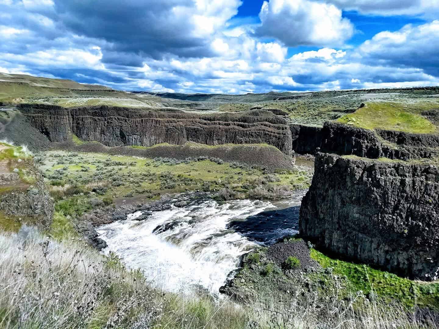
Out in the dry, rolling wheat country of eastern Washington, the last place you’d expect a waterfall, the ground simply splits open. Palouse Falls drops around 198 feet into a wide amphitheater of layered basalt.
It is the official state waterfall, and it was carved by the Ice Age Missoula floods that reshaped this whole region thousands of years ago. Spring runoff is the showstopper, when the Palouse River is high and the canyon glows gold at sunset around the churning plunge pool.
The overlook sits just steps from the parking area, so even a quick stop rewards you with the full drop. Stay for golden hour and watch the light crawl across those stacked basalt walls.
It sits far from anything, so fuel up and pack water before you go. That remoteness is also why the night skies out here are so dark and full of stars.
Where: Palouse Falls State Park, 4915 Palouse Falls Road, LaCrosse, WA. A Discover Pass is required.
5. Leavenworth, Washington
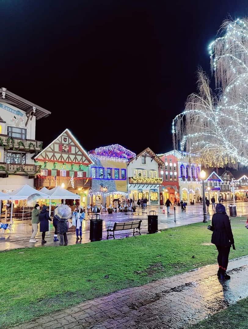
Here is the plot twist on this list: a Bavarian village in the Cascade foothills. In the 1960s a struggling timber town reinvented itself as an Alpine hamlet, and the whole downtown now looks straight out of the German Alps.
Wooden balconies, painted murals, flower boxes, and a wall of real mountains behind it all. Come in December, when hundreds of thousands of lights turn the village into a snow globe, or in fall when the larches and vineyards turn gold.
It should feel like a gimmick. It works instead. Book your room well ahead for the lighting-festival weekends; this little town fills up fast once the lights come on.
Where: Downtown Leavenworth sits about 2.5 hours east of Seattle on US Highway 2. Worth a stroll:
- Front Street, the Bavarian main drag, lined with painted facades, flower boxes, and beer gardens
- Leavenworth Nutcracker Museum, 735 Front Street, home to thousands of nutcrackers from around the world
- Waterfront Park, a leafy riverside loop on the Wenatchee just off Commercial Street
- Icicle Road, the quick route out to river beaches, trailheads, and the Enchantments
- Ski Hill, just north of town, for larch-gold autumn views and winter tubing
6. Deception Pass, Washington
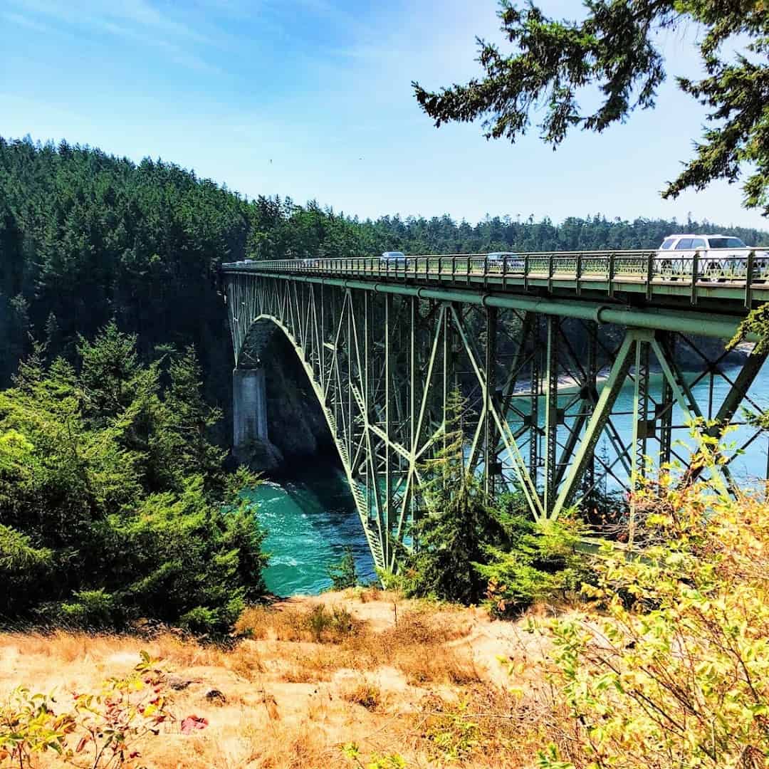
Some views make your stomach drop in the best way, and standing on the Deception Pass Bridge is one of them. The steel span, finished in 1935, links Whidbey and Fidalgo islands about 180 feet above a narrow channel.
Below you, the tide rips through the gap so fast it swirls into visible whirlpools, framed by evergreen bluffs and clear green water. Hike down to Rosario Beach or paddle the pass and you get the drama from below too.
It is one of the most visited state parks in Washington for good reason. Time your walk for a strong outgoing tide if you want to watch the water really churn.
There is more here than the bridge, too. The park wraps around forested trails, quiet coves, and a small freshwater lake, so it easily fills a half day of wandering before you point the car back toward Whidbey.
Where: Deception Pass State Park, 41229 State Route 20, Oak Harbor, WA.
7. Mount St. Helens, Washington
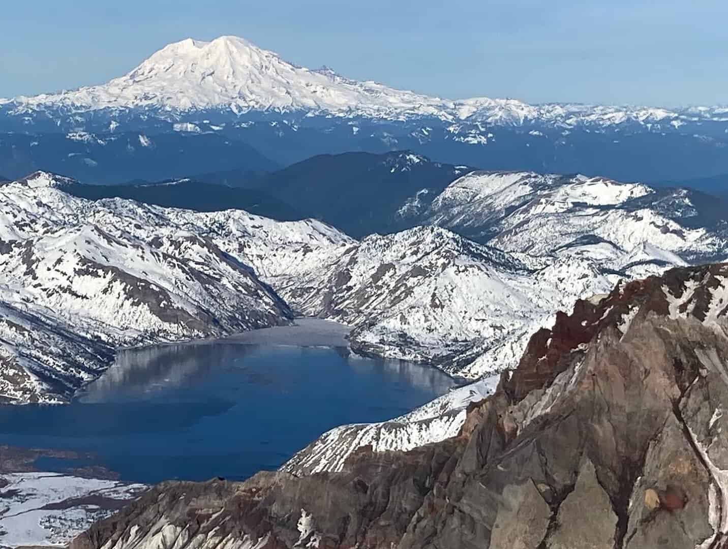
On May 18, 1980, this mountain blew its own top off, and the reshaped landscape it left behind is genuinely awe-inspiring. The eruption dropped the summit by more than a thousand feet and opened a mile-wide crater you can still peer into.
From Johnston Ridge you look straight into that crater, across the blast zone where forests are growing back, toward the steaming lava dome. Nature rebuilding itself in real time is a rare thing to witness, and few places show it so plainly.
The drive up State Route 504 is part of the payoff, climbing through ridgelines toward the mountain with pullouts the whole way. Summer is the safe bet, when the road and the ridge facilities are fully open.
Did you know wildflowers and elk returned to the blast zone within just a few years? The visitor centers along the way tell that recovery story better than any textbook.
Where: Mount St. Helens National Volcanic Monument, near Toutle, WA. Reach Johnston Ridge via State Route 504 east of Interstate 5.
8. San Juan Islands, Washington
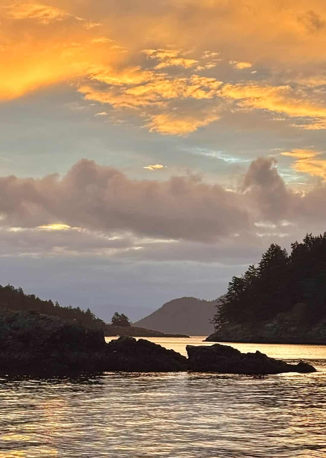
I could happily spend a week just riding the ferries out here. The San Juans are an archipelago of more than 170 islands scattered across the water north of Puget Sound, reached by ferry from Anacortes.
You get quiet harbor towns, lavender farms, driftwood coves, and orcas surfacing offshore in summer. Watch the sun go down over the water from a lighthouse headland and you understand why people never quite leave.
San Juan, Orcas, and Lopez are the three main islands the ferry serves, and each has its own personality. Orcas has the high viewpoint at Mount Constitution; Lopez is the flat, friendly one that cyclists adore.
Reserve a vehicle spot on the ferry ahead of a summer trip, or leave the car behind and rent a bike once you land. The islands are made for slow days.
Where: Board the Washington State Ferry at Anacortes, about 90 minutes north of Seattle, for the islands. Don’t miss:
- Friday Harbor, San Juan Island, the walkable ferry-landing town of shops and seafood
- Lime Kiln Point State Park, 1567 Westside Road, a lighthouse headland famed for whale watching from shore
- Mount Constitution in Moran State Park, Orcas Island, the archipelago’s highest viewpoint
- Lopez Island, the flat, friendly one cyclists loop in a single day
- Roche Harbor, the historic resort village at the north end of San Juan Island
9. Snoqualmie Falls, Washington
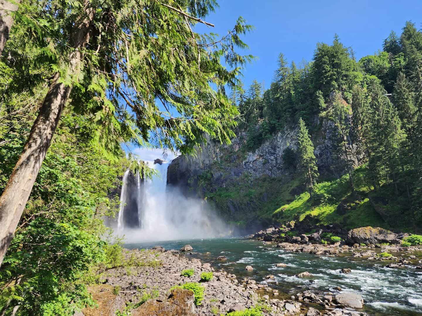
Just half an hour from Seattle, the ground gives way and the Snoqualmie River plunges 268 feet, taller than Niagara. That easy access is the magic here: this is a genuine roaring waterfall you can reach on a lunch break.
An observation deck puts you right at the lip, mist rising off the gorge, the Salish Lodge perched at the edge. Fans of the show Twin Peaks will recognize it instantly. A short trail winds down to the base if you want to feel the spray.
Go after a heavy rain and the falls thunder at full force. The upper viewpoint is free and takes only minutes from the parking lot, which makes this the easiest jaw-dropper on the whole list to fit into a busy day.
Where: Snoqualmie Falls, 6501 Railroad Avenue SE, Snoqualmie, WA.
10. Ruby Beach, Washington
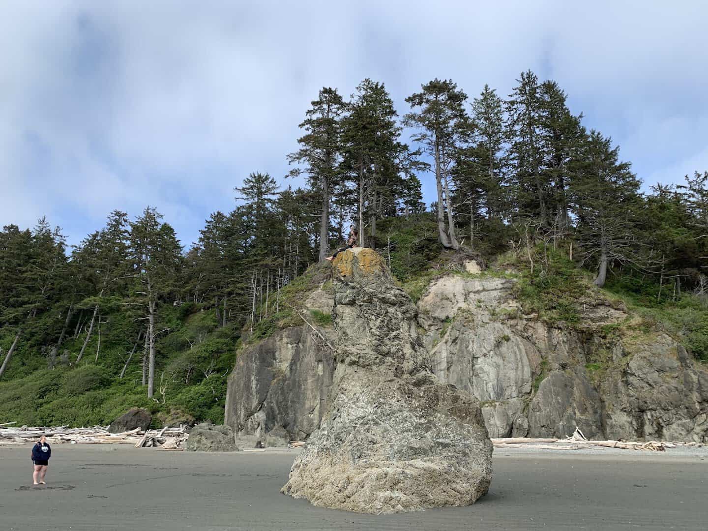
The Washington coast does not do gentle, and Ruby Beach is where that pays off. Massive sea stacks stand offshore in the surf, giant sun-bleached driftwood logs pile along the tide line, and the sand carries a faint reddish tint that gave the beach its name.
At low tide you can wander out among the rocks and hunt for tide pools; at sunset the stacks turn to black silhouettes against a burning sky. It is wild, moody, and endlessly photogenic, the fitting edge of the continent to close on.
Check a tide chart before you drive out. Low tide opens up the pools and the walking room, and the short path down from the lot is quick and family-friendly.
Where: Ruby Beach, Olympic National Park, off US Highway 101, south of Forks, WA.
11. Cape Flattery, Washington
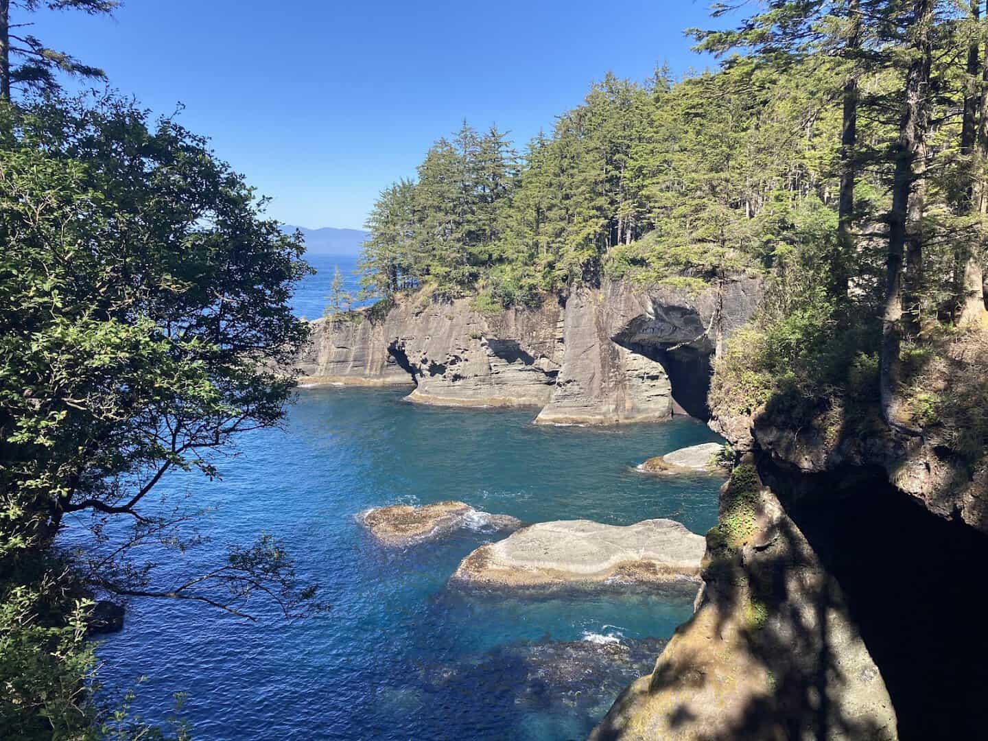
The most northwesterly point in the Lower 48 sits at the tip of the Makah Reservation, and the payoff is a short cedar boardwalk trail through coastal forest to the very edge of the continent.
At the end, viewing platforms look down on sea caves, arches, and Tatoosh Island with its lighthouse offshore. Bald eagles ride the wind, sea otters bob in the swell, and the water glows an impossible green on a calm day.
Pick up a Makah Recreation Pass in Neah Bay before you hike; it is required, and it helps fund the trail. Save this one for a clear, settled day when the color really turns on.
Where: Cape Flattery Trail, Cape Loop Road, near Neah Bay, WA, at the far tip of the Olympic Peninsula. A Makah Recreation Pass is required.
12. Lake Chelan, Washington
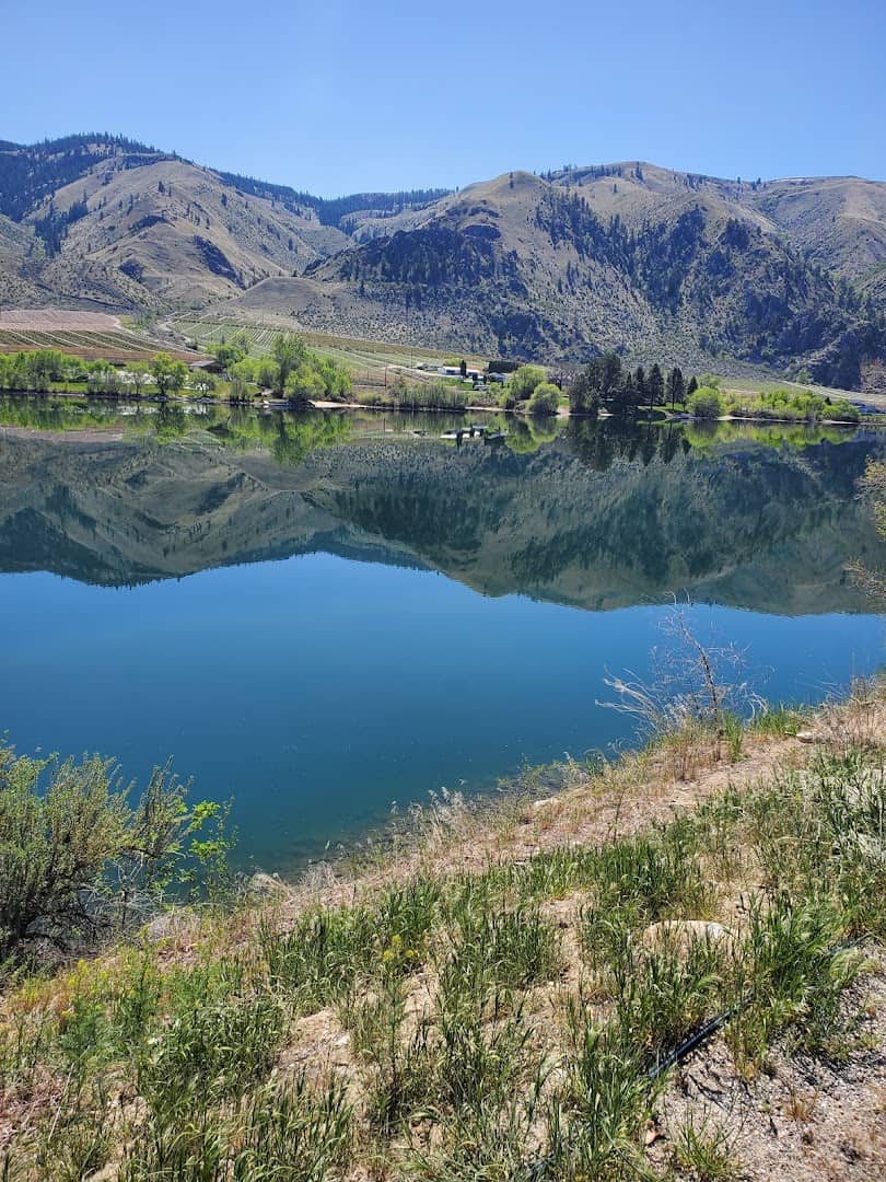
Picture a 55-mile lake so deep it ranks among the deepest in the country, threading between dry hills at one end and glaciered peaks at the other. That is Lake Chelan, and the water runs a clean, swimmable blue all summer.
The town of Chelan anchors the sunny south shore with wineries, beaches, and a lakeside state park. Point a boat north and the shores climb into the Cascades toward Stehekin, a village with no road in at all.
Rent a paddleboard, taste a local Riesling, or ride the passenger ferry up-lake for the day. The far end feels like the edge of the wilderness because it genuinely is.
Where: Lake Chelan, town of Chelan, WA, roughly 3.5 hours east of Seattle. Stehekin, at the roadless north end, is reached by the Lady of the Lake passenger ferry.
13. Mount Baker, Washington
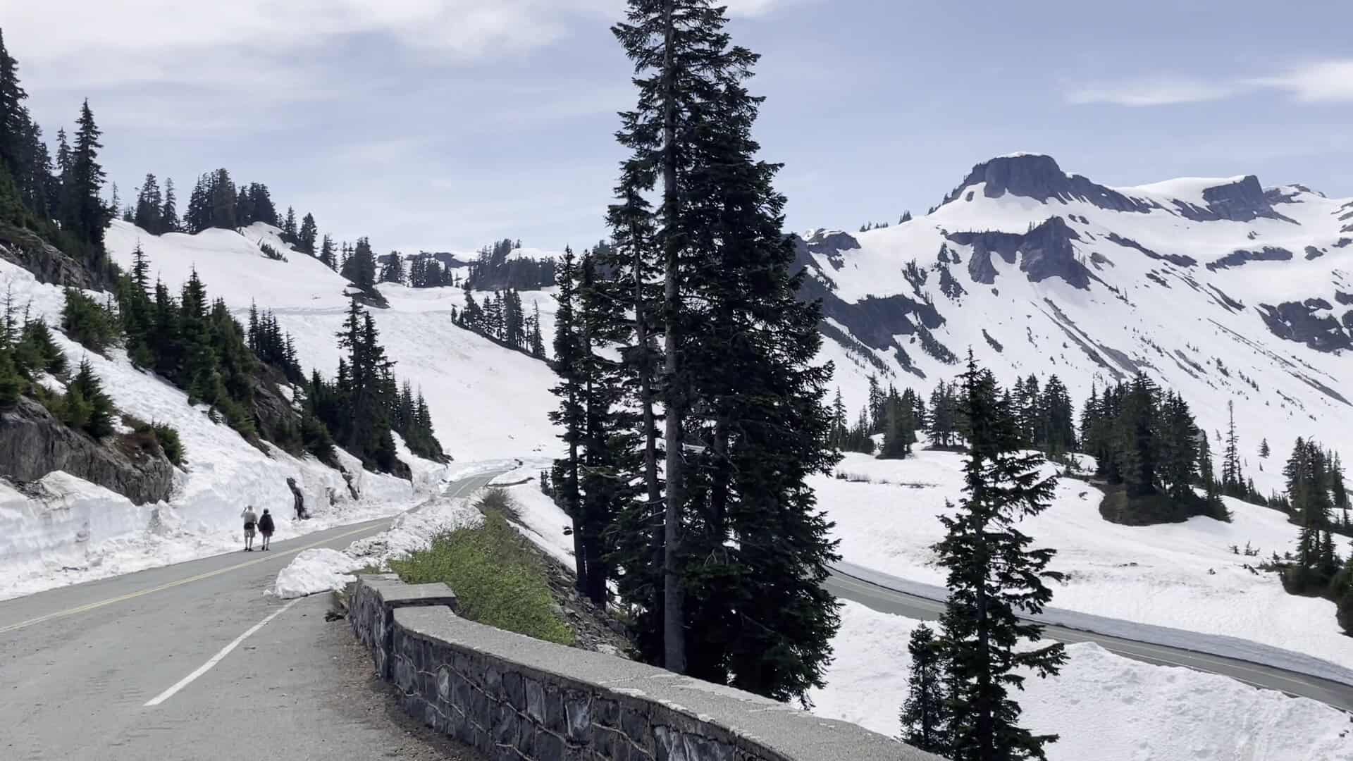
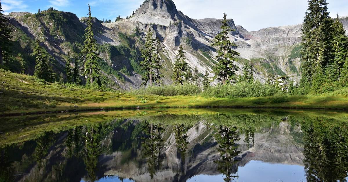
Way up in the northwest corner of the state, Mount Baker piles up some of the heaviest snowfall on earth, and the drive to Artist Point delivers you right into the postcard.
At the road’s end, jagged Mount Shuksan reflects in Picture Lake, wildflower meadows roll toward Baker’s white cone, and in late summer the whole basin glows. It is one of the most photographed views in Washington, and it earns it.
The upper road opens only for the short summer season once the plows catch up, so aim for August or September. Come early for a parking spot and the clearest light on the peaks.
Where: Artist Point, end of State Route 542 (the Mount Baker Highway), above Glacier, WA. Picture Lake sits just below, on the loop near the ski area.
14. Spokane Falls, Washington
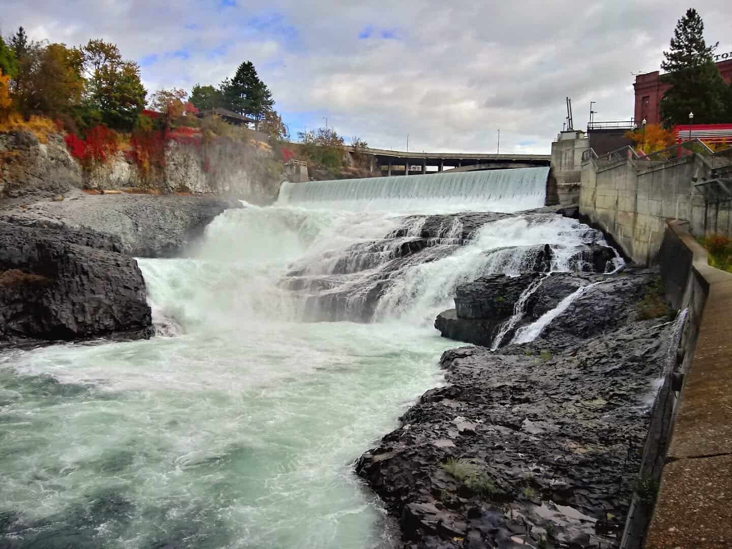
Most cities hide their rivers. Spokane put a thundering waterfall right in the middle of downtown, and you can ride a gondola straight out over the churning drop.
The Spokane River tumbles through Riverfront Park in a run of falls that roar loudest in spring runoff. The SkyRide cable cars float above the lower falls, and footbridges put you close enough to feel the mist off the black basalt.
Riverfront Park, left over from the 1974 World’s Fair, wraps the falls with paths, a giant red wagon, and a restored 1909 carousel. It is a genuine waterfall you can reach on foot from a coffee shop.
Where: Spokane Falls, Riverfront Park, 507 N Howard Street, Spokane, WA. The SkyRide launches from the park’s south side.
15. Colchuck Lake, Washington
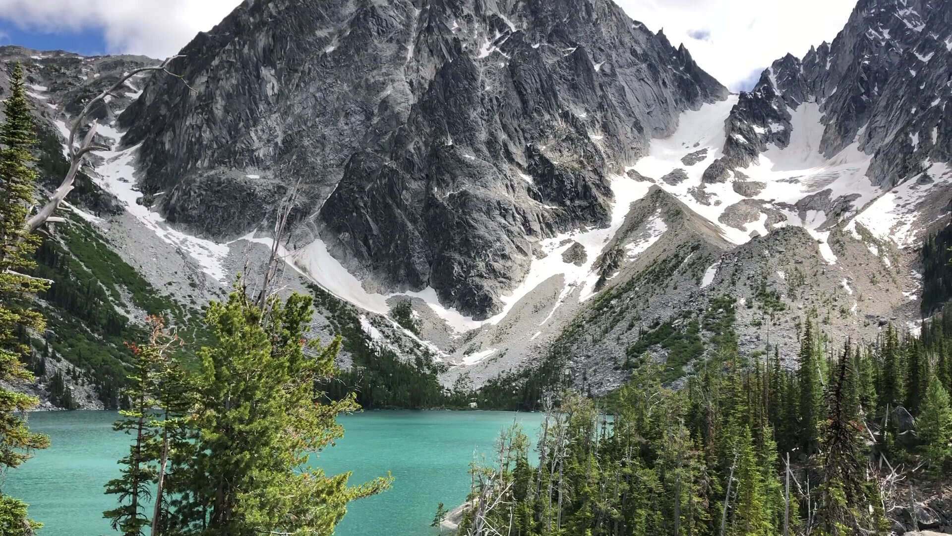
Some places make you work for them, and Colchuck Lake is the finest kind of reward. The trail climbs hard out of the Icicle Creek drainage near Leavenworth, gaining serious elevation over about four miles.
Then the forest opens and there it is: a lake the color of raw turquoise, cradled beneath the granite spires of Dragontail and Colchuck peaks, with the notorious Aasgard Pass rising at the far shore. This is the gateway to the Enchantments.
It is a strenuous day hike, so bring real boots, plenty of water, and an early start. The color peaks in summer, and the larches turn gold in late September.
Where: Colchuck Lake via the Stuart Lake Trailhead, end of Eightmile Road off Icicle Road, near Leavenworth, WA. A Northwest Forest Pass is required to park.
Start Planning Your Washington Road Trip
What gets me about Washington is the range. In one state you can stand under a glaciered volcano, whisper through a rainforest, and watch orcas roll past an island lighthouse, all in the same week.
A good first loop pairs the Olympic Peninsula, the Hoh, Ruby Beach, and Cape Flattery, with a couple of days near the Cascades. Save the eastern spots like Palouse Falls and Spokane for a trip built around the drive, and let the ferry islands be their own slow weekend.
So pick a few of these, string them into a route, and go see for yourself that the photos were real all along. Just don’t blame me when your own feed starts looking a little too good to be true.
Featured image: John Song via Artist Point

Stella Raines
Editor-in-Chief
Stella brings over a decade of storytelling experience to TX Headlines. With roots in West Texas and a love for road trips, she leads the editorial team with an eye for the hidden stories that make Texas unforgettable.