This Soaring West Texas Bridge Is the State’s Highest Highway Bridge, and the Canyon Views Are Jaw-Dropping
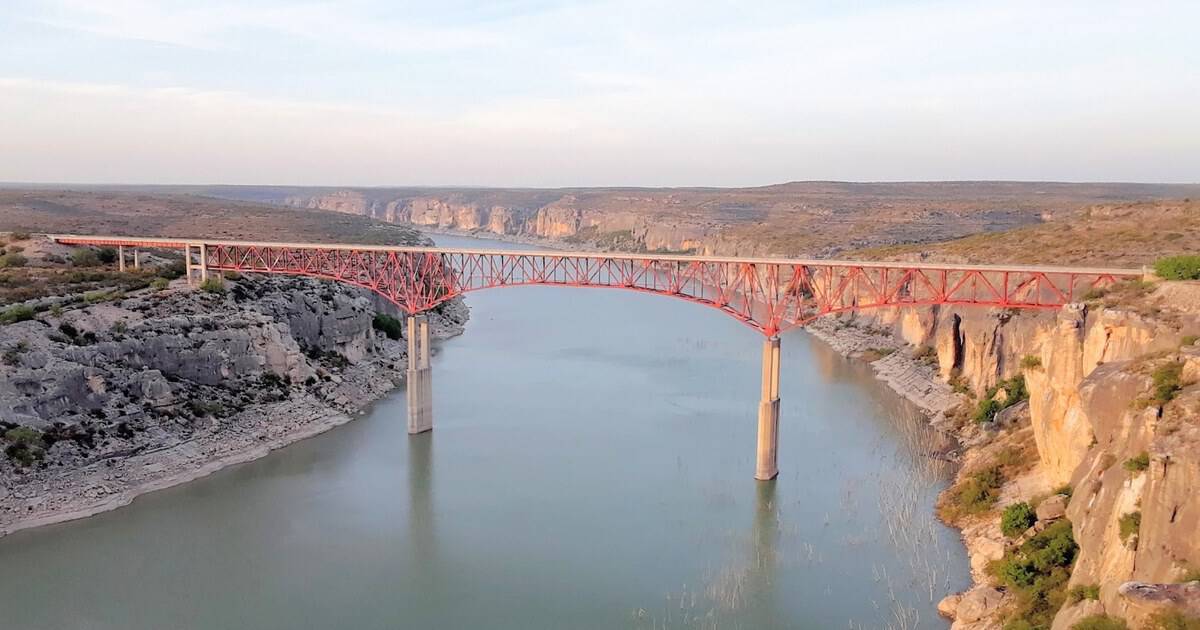
I have a rule for long West Texas drives: if the road suddenly lifts off the ground, you stop the car. Most of US 90 between Del Rio and Langtry is flat scrub and big sky. Then the land splits open and the highway walks across the gap on stilts.
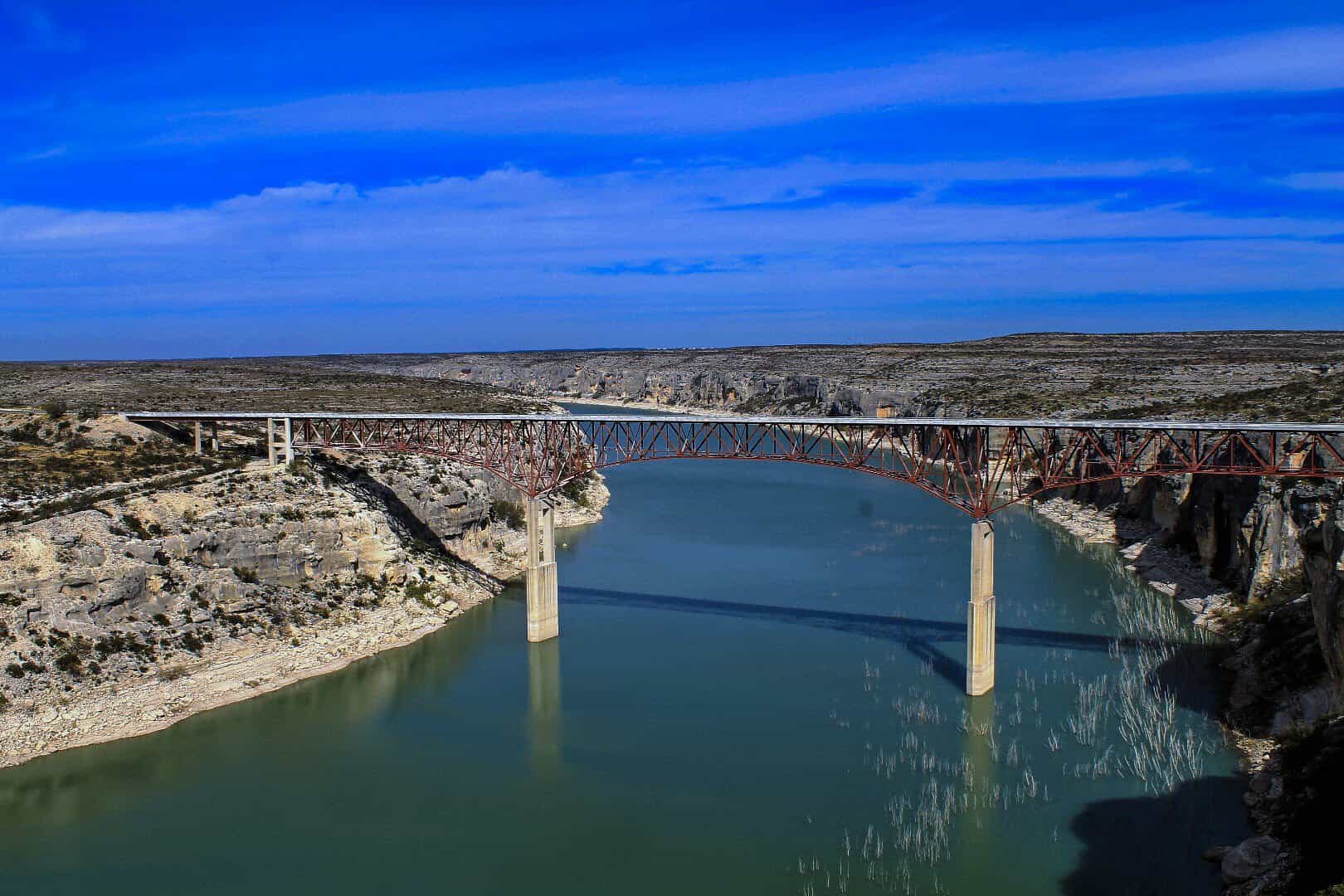
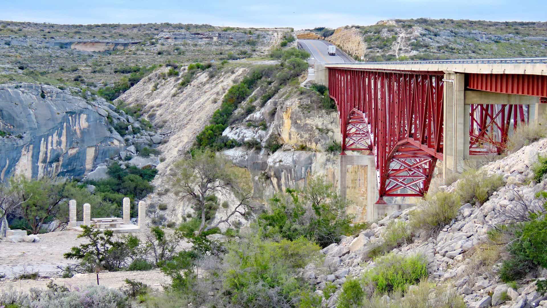
That gap is the Pecos River canyon, and the road across it is the Pecos River High Bridge. It is the highest highway bridge in Texas, a dizzying limestone drop of 273 feet from deck to water, and the views make people miss their turn on purpose.
Below, I will walk you through what the crossing feels like, the numbers behind it, the free overlook that most people fly right past, the flood that forced Texas to build it this high, and the older, even taller bridge hiding just upstream.
The Moment the Ground Drops Away
Picture it from the driver’s seat. You are heading west out of Comstock on a two-lane highway that has not changed much in decades. Mesquite, cactus, the occasional ranch gate. Nothing in the landscape hints at a canyon.
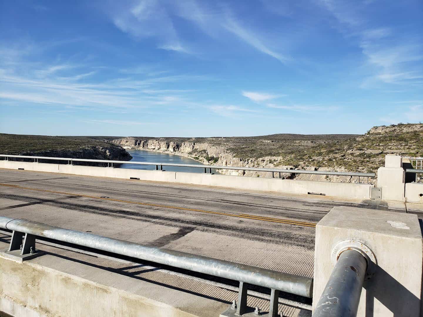
Then the shoulders fall away and you are on the bridge. To the left, the Pecos runs green and glassy between pale walls. To the right, the canyon bends toward the Rio Grande. For about a quarter of a mile, you are driving through open air.
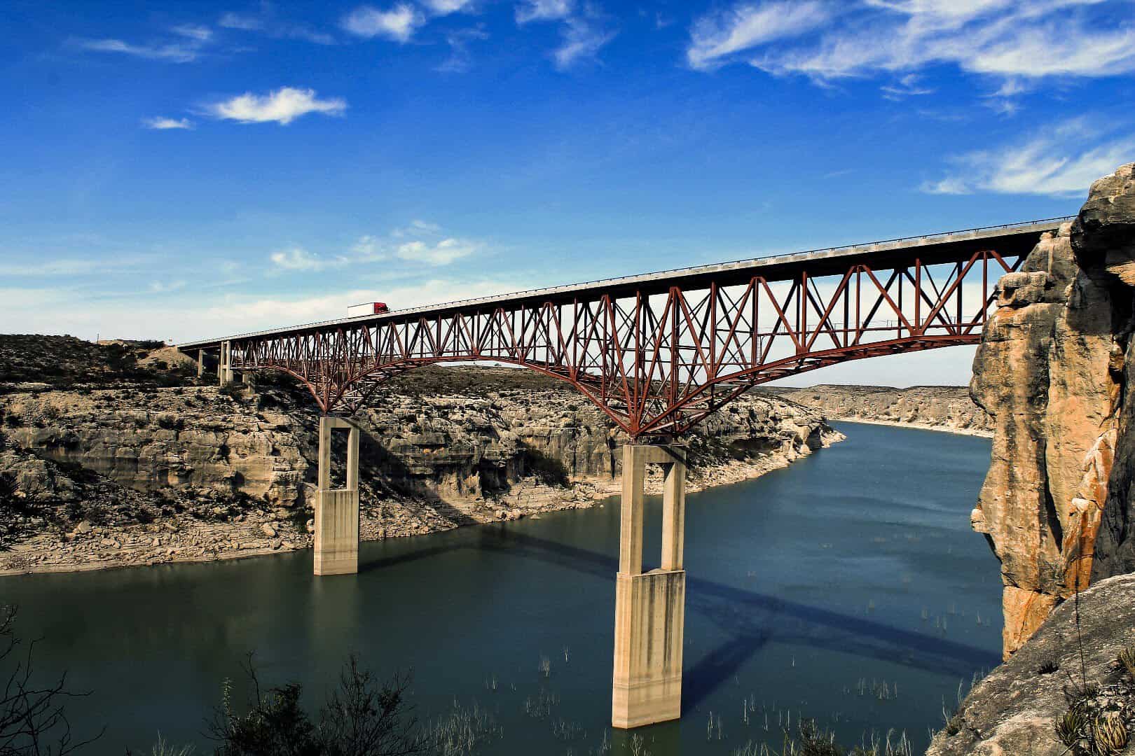
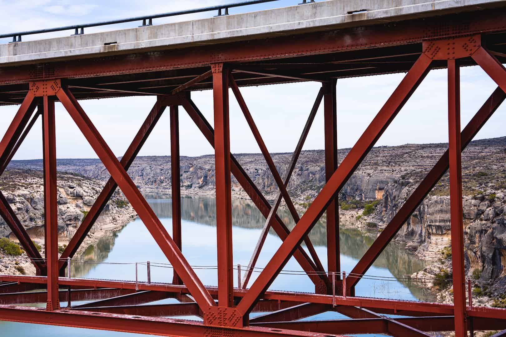
What makes this crossing special is that the bridge itself is so plain. It is a steel deck truss, not a suspension showpiece. There are no towers or cables to look at. All the drama is below you, and the low guardrail does very little to hide it.
Passengers get the best of it. Drivers get a few stolen glances and a strong urge to turn around. I would plan the drive so that someone else has the wheel, or so you can pull off at the overlook on the east side and take it in properly.
273 Feet of Air
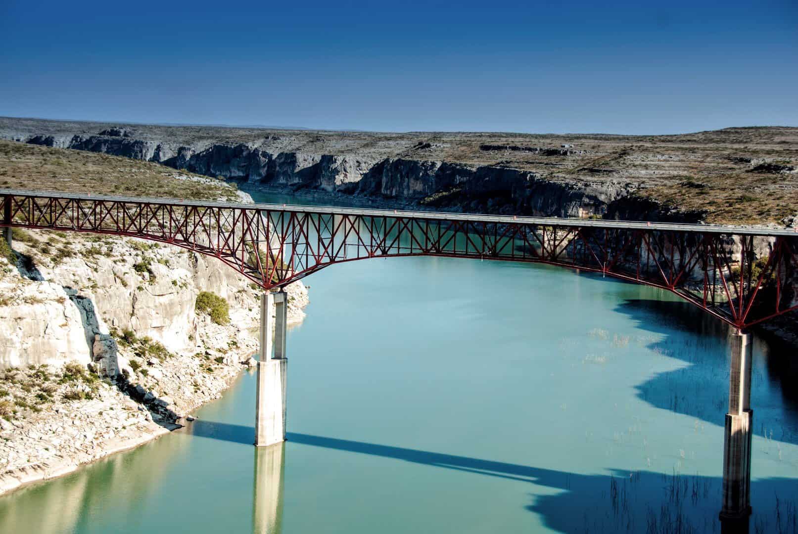
The Pecos River High Bridge opened in 1957. It runs 1,310 feet end to end and originally stood 273 feet above the river. That height moves a little now, because the water beneath it is the upper reach of Lake Amistad and rises and falls with the reservoir.
The structure rests on two central piers. Most of it is a single 1,040-foot deck truss unit, with a 240-foot continuous plate girder span and a short concrete slab span carrying the rest.
The design keeps the roadway high and the piers few, so the river can run underneath with nothing in its way.
It is not a busy bridge. Roughly a thousand vehicles a day cross it, which is a rounding error compared to any interstate in Texas. That is part of the appeal. You can stand at the overlook for half an hour and count the trucks on your fingers.
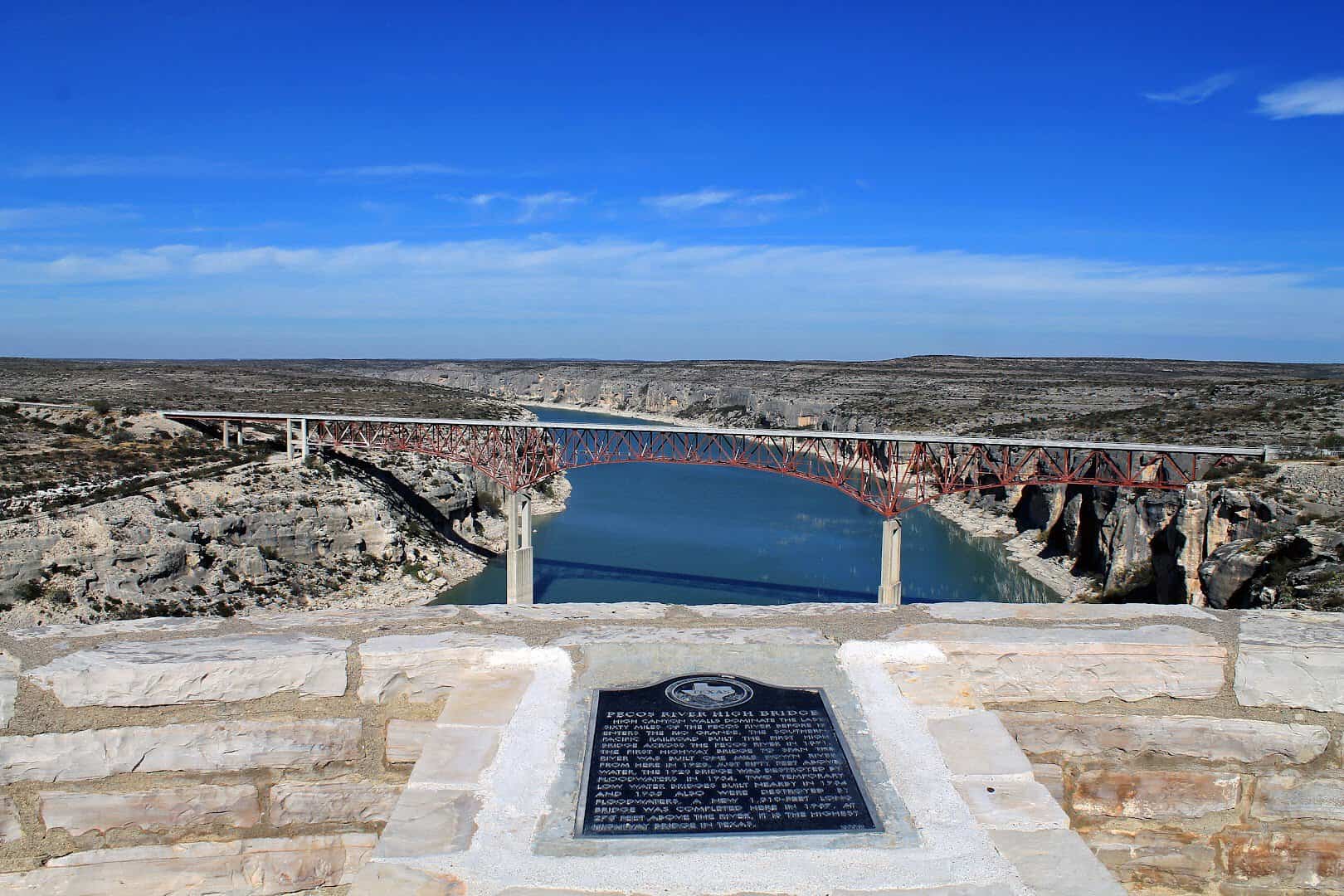
Did you know? A Texas historical marker near the bridge tells the flood story in a few paragraphs. Read it before you look down. Once you know why the road is up here, the height stops feeling like showing off.
The Overlook Most People Miss
On the east side of the bridge, a short asphalt road peels off the highway and runs about a quarter mile to a picnic area on the canyon rim. It is free, open every day, and one of the best roadside stops in the state.
The setup is simple. A few covered picnic tables, some grills, trash cans, and a parking pad level enough that vanlifers and small trailers use it as an overnight spot. No admission booth, no gift shop. Just the edge of a canyon.
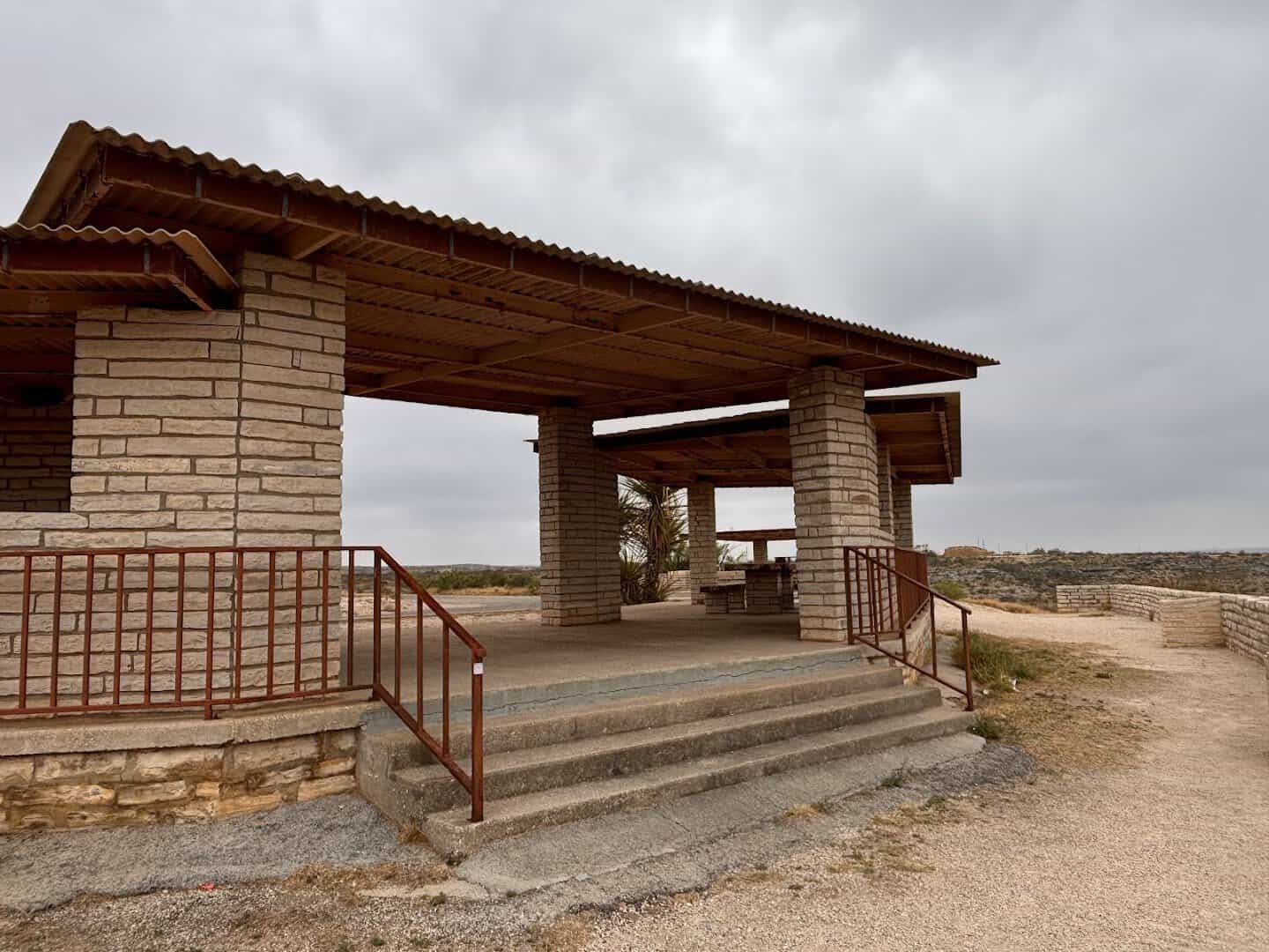
From the tables you look straight down the gorge at the bridge, the river curling below it and the far wall glowing in afternoon light. Turn your head and you can see where the Pecos meets the Rio Grande a little downstream, inside the lake.
A traveler on Campendium put it better than I could: “We explored some hiking trails around the quarry and really enjoyed the breathtaking bridge views, it’s become our family’s favorite overnight spot!”
Another camper called it the “best free spot we have found,” and that was after a full night parked on the rim in a van.
Pro tip: bring dinner. Sunset here is the show. The canyon walls turn from gray to orange to gold as the sun drops, and the bridge becomes a black line drawn across a pink sky. Then the stars come out, with nothing for miles to compete with them.
A Canyon Painted in Limestone
The Pecos cut this canyon slowly, and the walls tell the story in layers. Look closely and you will see bands of gray, tan, rust and pale white limestone stacked like pages. In some places the rock is sheer, in others it steps down to the water in ledges.
The river itself is a surprise. Most people picture the Pecos as a muddy trickle, and in places it is. Here, backed up by Lake Amistad, it is wide, calm and bottle green against the chalky rock. Boaters come up from the lake to fish beneath the bridge.
This is dry country, so the wildlife does not need much. Hawks and golden eagles work the thermals rising off the canyon walls. Deer and javelinas come down to the water at dawn and dusk. Lizards own every warm rock, and you will hear roadrunners before you see them.
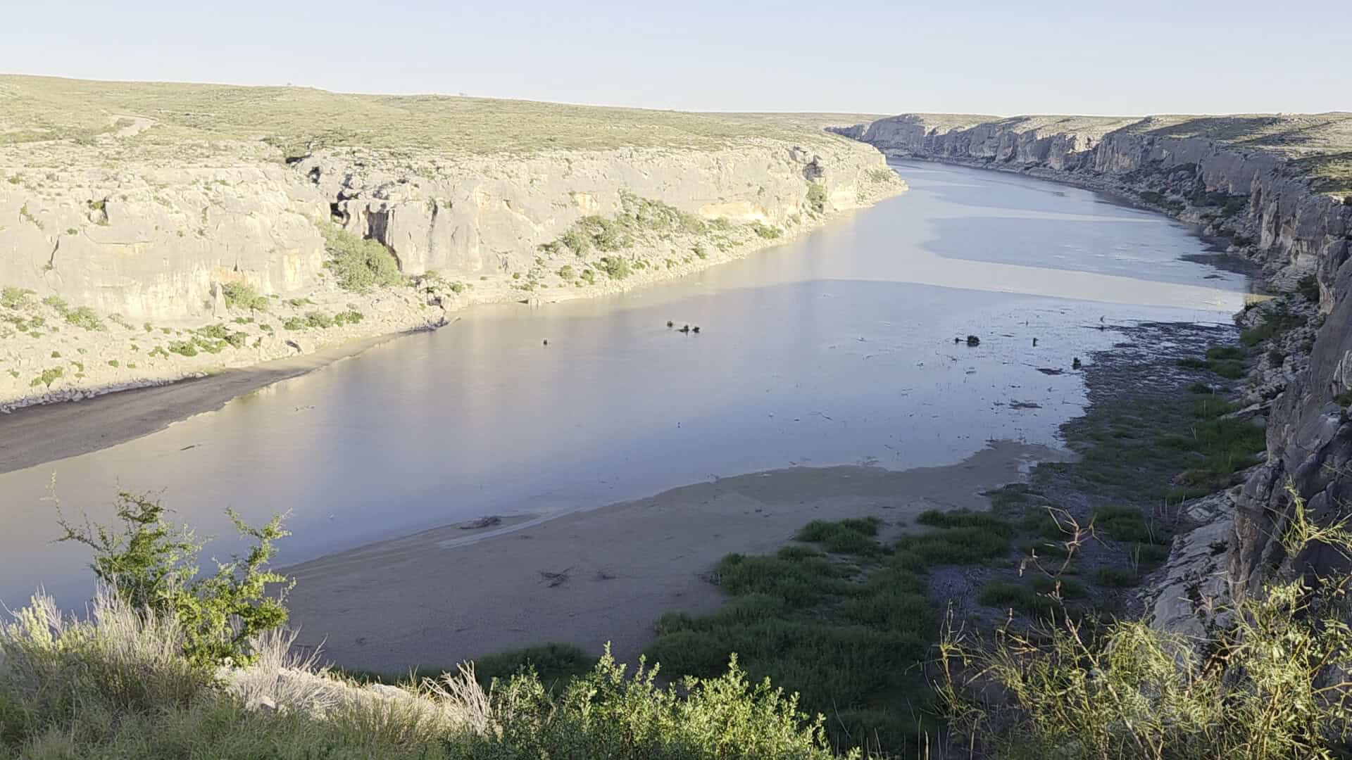
My favorite thing about the view is the scale. There is no tree line or building to compare the bridge to, so your brain keeps guessing wrong about its size. Then a pickup crawls across the deck, tiny as a toy, and the whole scene snaps into focus.
Why Texas Built a Bridge This High
The height is not vanity. It is a hard lesson.
The first highway bridge here went up in 1923, and it sat only about 50 feet above the water. For three decades that seemed like plenty. Then, in June 1954, the remains of a hurricane stalled over the border and drowned the Pecos watershed in rain.
The river rose into a wall of water that tore down the canyon and took the 1923 bridge with it. Engineers put up a temporary low-water crossing that same year. The river took that one too. They tried again in 1955, and the Pecos destroyed the replacement as well.
After three losses in two years, the Texas Highway Department stopped arguing with the river. The new bridge would sit far above any flood line the canyon had ever recorded, with its piers set high instead of in the streambed. It opened in 1957 and still carries US 90.
So when you look down from the deck and wonder why anyone would build a road so high, that is the answer. Every one of those 273 feet is insurance.
The Taller Bridge Hiding Upstream
Just around the bend, upstream and out of sight from the highway, is another Pecos River High Bridge. It carries the railroad, and it is even taller.
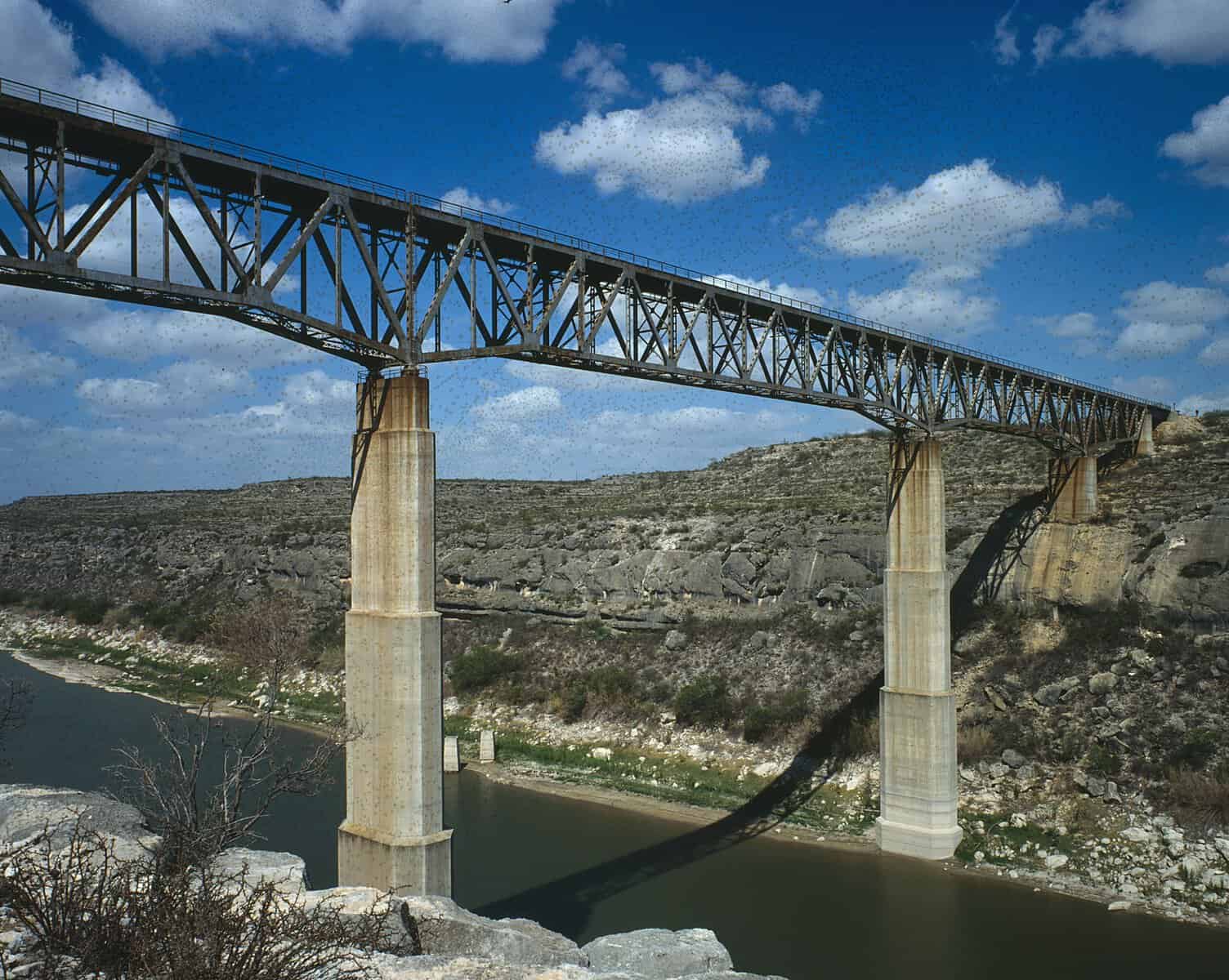
The original railroad viaduct went up in a frantic 87 working days between November 1891 and February 1892, built by the Phoenix Bridge Company of Pennsylvania. Its rails stood 321 feet above the river, the highest railroad bridge in North America and third highest in the world.
It was a spidery iron latticework of 24 towers stretching 2,180 feet across the canyon. It saved the Southern Pacific from a torturous detour called the Loop Line that dropped trains into the Rio Grande gorge, and cut 11 miles off the San Antonio to El Paso route.
The first train across, on March 30, 1892, carried railroad president C. P. Huntington himself. And the justice of the peace who handled inquests when construction went wrong was Judge Roy Bean, the self-styled Law West of the Pecos, whose saloon still stands in Langtry.
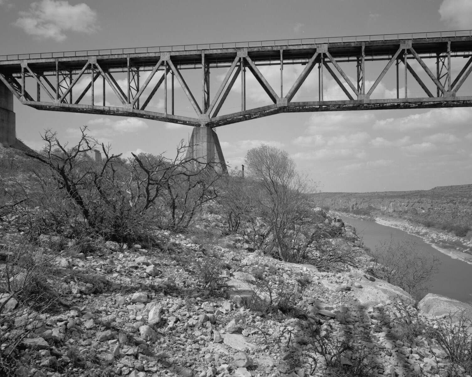
That 1892 bridge was replaced in December 1944 by a heavier steel truss designed by Modjeski and Masters, built 440 feet downstream, with rails 322 feet above the river. The old viaduct was dismantled in 1949. The 1944 bridge still carries freight and the Amtrak Sunset Limited today.
You cannot drive to the railroad bridge, and the best views of it are from the water. But knowing it is there, a few hundred feet upstream and 50 feet higher, adds a second layer to everything you see from the highway.
Make a Day of the Canyon Country
The bridge sits in a stretch of US 90 that I think of as the most underrated road trip in Texas. Nothing out here is crowded, and every stop is a few minutes apart.
East of the bridge, near Comstock, Seminole Canyon State Park and Historic Site protects some of the oldest rock art in North America. Guided hikes lead down to the Fate Bell Shelter, where painted figures have survived on the canyon walls for thousands of years.
The park also has a campground if you would rather sleep somewhere with restrooms and a hot shower.
West of the bridge, about 18 miles down the road, Langtry is home to the Judge Roy Bean Visitor Center. The original Jersey Lilly saloon and the judge’s courtroom are preserved there, along with a cactus garden and a free travel information center.
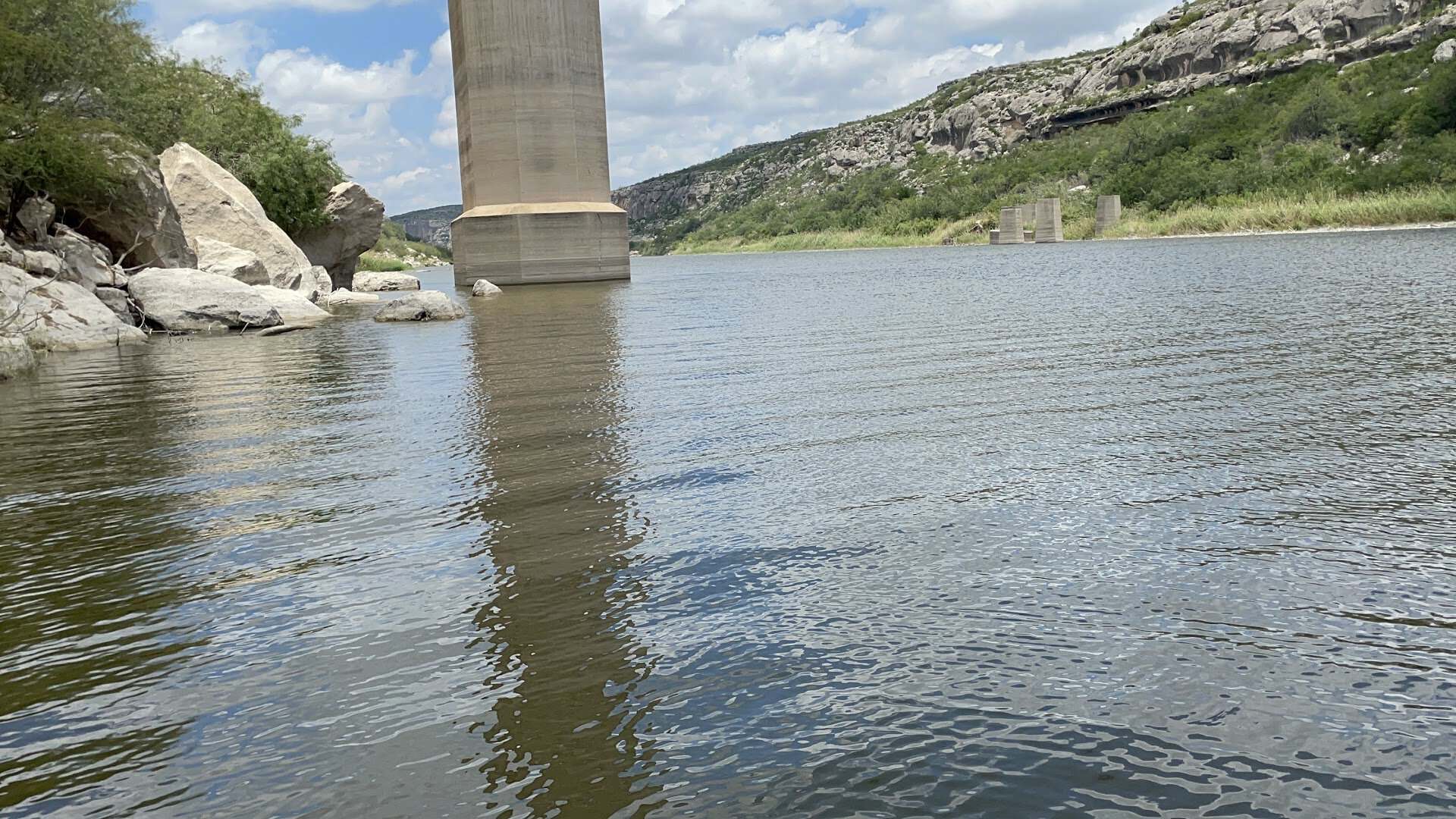
Back toward Del Rio, Amistad National Recreation Area wraps around the lake the Pecos now feeds. Boat ramps, swimming spots and lakeside campsites give you a way to see the canyons from below, including the underside of the bridge you just drove across.
If you time it right, you can hike Seminole Canyon in the morning, picnic at the overlook at midday, tour Langtry in the afternoon and be back at the overlook for sunset. That is a full day in a part of Texas most people only see through a windshield.
Know Before You Go
There are no services at the bridge. The nearest gas and food are in Comstock, a small town about a dozen miles east, and in Del Rio, roughly 45 miles east. Fill up before you head out, and carry water. Summer temperatures in this canyon regularly push past 100 degrees.
The overlook road is paved and easy for any car. Larger RVs fit, though the designated spots suit vans and smaller trailers best. Cell coverage is patchy, so download your maps ahead of time.
Pro tip: the light is flat and harsh at midday. Morning puts the sun behind you when you look west from the overlook, and late afternoon lights up the east wall of the canyon. Photographers will want to be here for one or the other, and ideally both.
Respect the edge. The rim at the picnic area is unfenced in places, the drop is real, and the wind can gust hard across the canyon. Keep pets on a leash and small children close.
How to Get There
Where: Pecos River Overlook, US Highway 90 at the Pecos River, Comstock, TX 78837
From Del Rio, take US 90 west for about 45 miles. You will pass Comstock and the turnoff for Seminole Canyon State Park, then drop toward the canyon. The overlook entrance is on the right, just before the bridge on the east side.
From Langtry, head east on US 90 for about 18 miles. The overlook is on your left just after you cross.
The overlook is free and open daily. There are no set hours, no restrooms at the picnic area, and no fee. The historical marker stands near the highway at the bridge approach.
Go Stand Over the Pecos
Texas has taller buildings and longer bridges. It does not have another spot where an ordinary two-lane highway steps off a canyon rim and hangs 273 feet over green water, with nothing but limestone and sky on every side.
Point the car west on US 90, watch for the ground to fall away, and pull off before you cross. Sit at a picnic table on the rim and wait for a pickup to crawl across the deck. You will understand the whole thing in a single glance.
Featured image: Harish Mukundan via Pecos River High Bridge

Stella Raines
Editor-in-Chief
Stella brings over a decade of storytelling experience to TX Headlines. With roots in West Texas and a love for road trips, she leads the editorial team with an eye for the hidden stories that make Texas unforgettable.
More Stories

These 10 Texas Spots Bloom Into Seas of Bluebonnets Each Spring

This Enchanting Texas Nature Trail Feels Like Hiking Through a Fairytale Forest

This Underrated Texas State Park Gives You a Full Day of Swimming and Hiking for Just $5

This Easy Texas Hike Leads to a Swinging Suspension Bridge Hidden in the Pines
Tags