This Remote 1-Mile Texas Trail Is One of the Most Unusual Hikes in the State
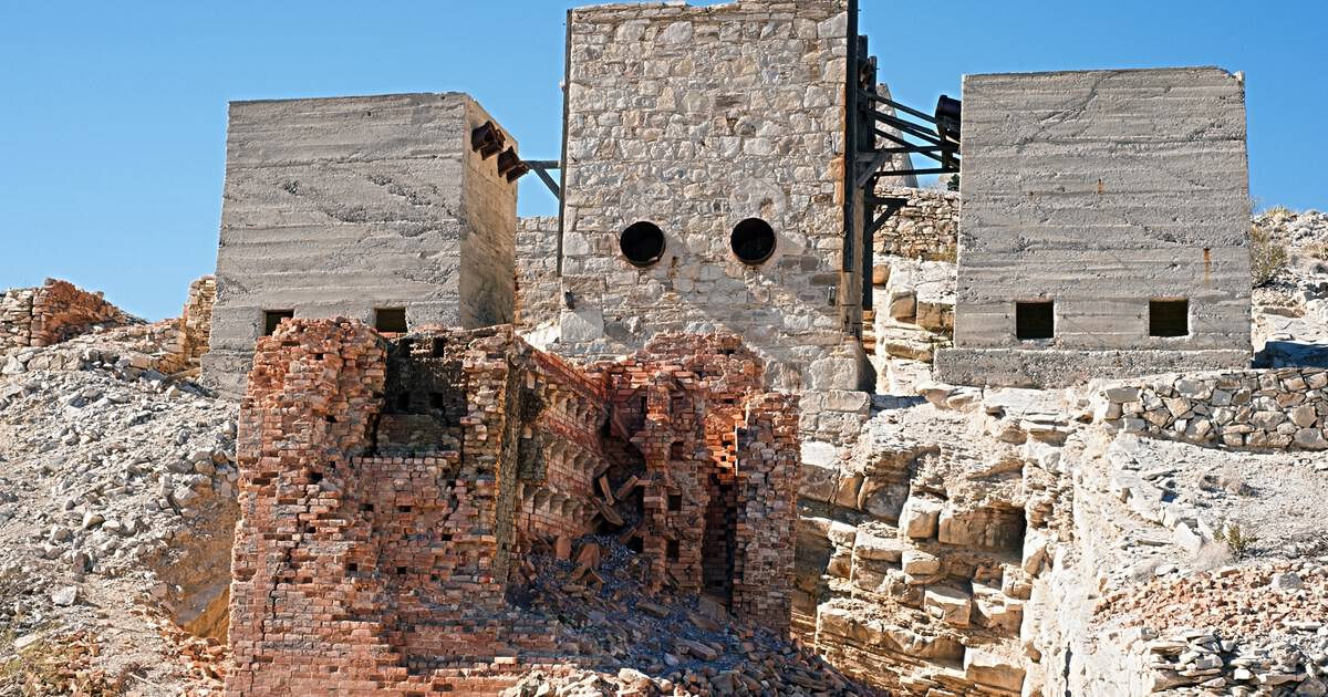
I have a rule about short hikes: the shorter the trail, the stranger the payoff had better be. A one mile loop that ends at a nice view is fine. A one mile loop that ends inside a ghost town of furnaces and mine shafts is something else entirely.
That second one exists, in the far southeast corner of Big Bend National Park. The Mariscal Mine Trail climbs through the sun-bleached, rust-red ruins of a mercury mine that once supplied nearly a quarter of the country’s quicksilver.
Below, I will walk you through what is out there, how it got there, and how to reach it without rattling your truck apart.
A Ghost Town You Walk Straight Through
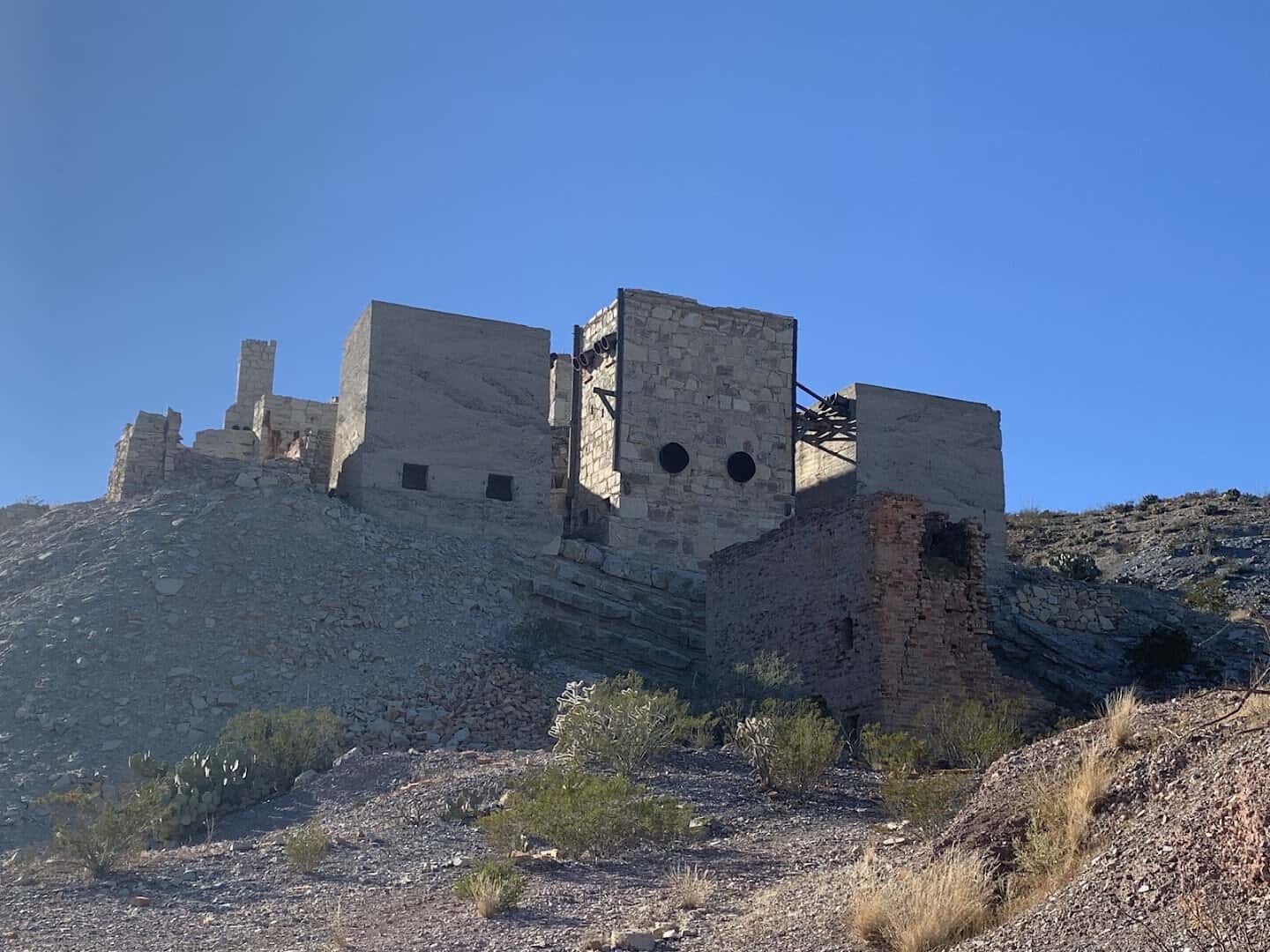
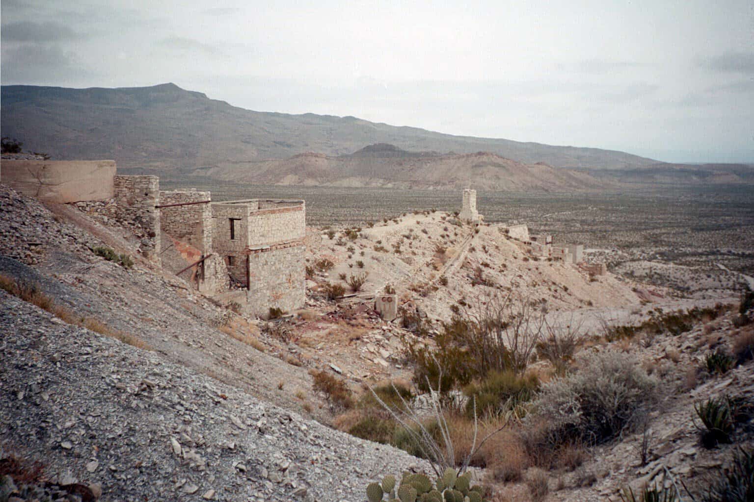
Most historic sites keep you behind a rope. This one hands you the whole hillside. The trail starts at a small dirt lot off River Road, and the old brick refinery tower is already visible from your windshield before you lace up your boots.
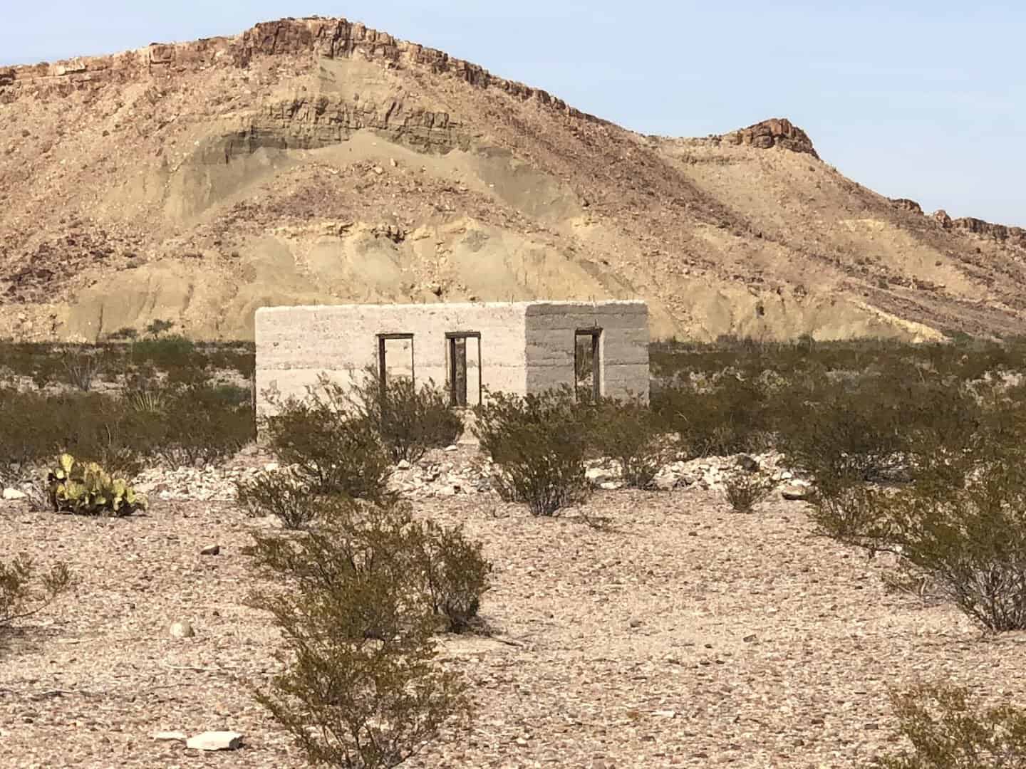
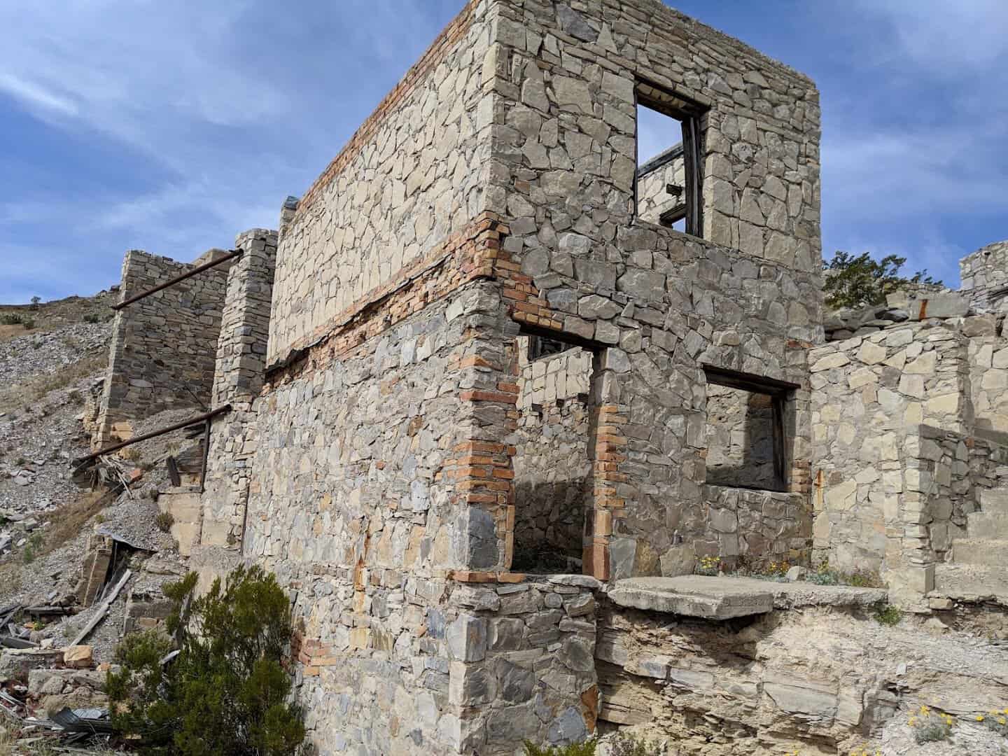
The path is sandy at first, winding uphill through mesquite. Within a few minutes you pass the first rock houses, little one to three room shelters the miners stacked by hand out of the same stone they were digging through. Roofs are long gone. Doorways still frame the desert.
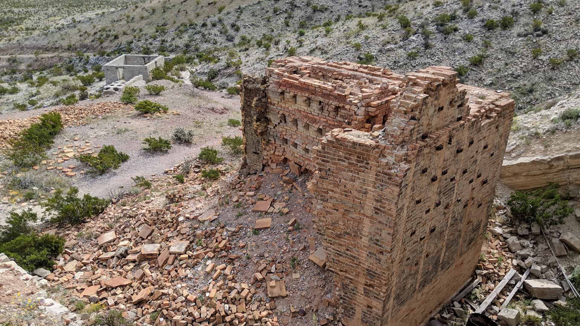
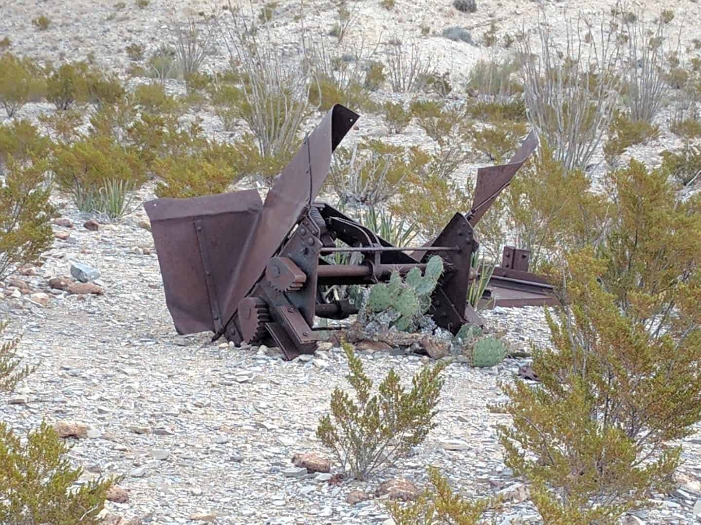
Then the industrial part rises up. The Scott furnace is the centerpiece, a tall brick and stone structure with its condensers still lined up beside it, and a 30 foot smokestack behind. Ore cars sit on stub ends of narrow gauge track. Iron pipes twist off toward nothing in particular.
The whole loop is about 1.1 miles with roughly 230 feet of climb. You could walk it in half an hour. Nobody does. There is too much to poke at and peer into.
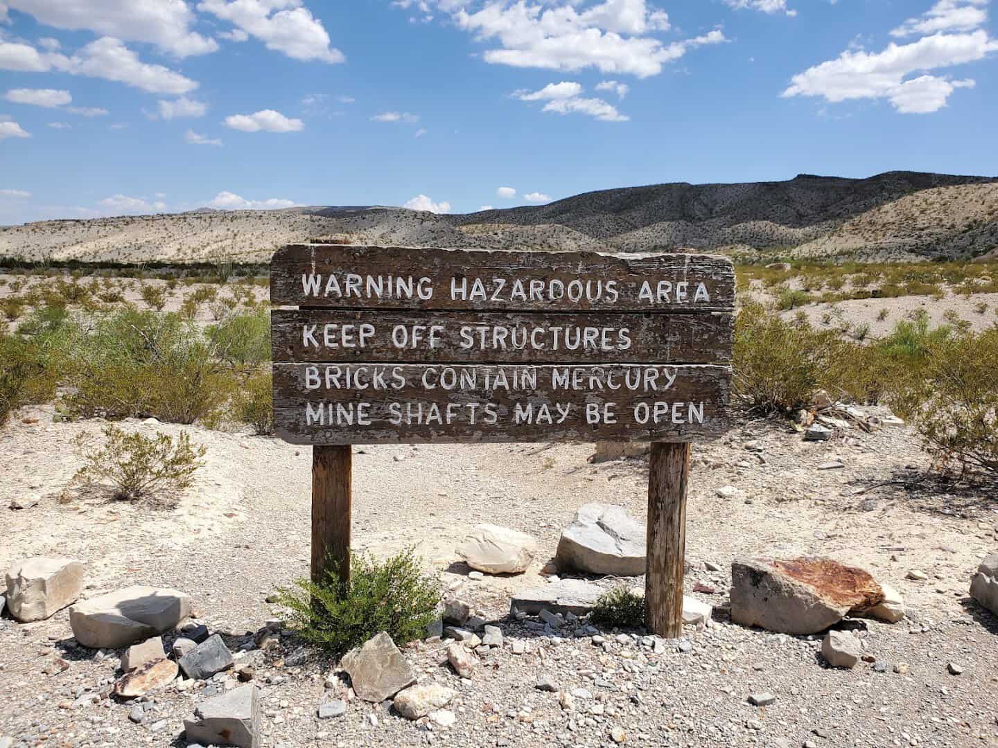
The signs ask you to keep off the structures and not to touch the furnace bricks, the condensers, or the pale mine tailings. Mercury lingers in them. Follow that, wash your hands back at the car, and you are fine. The rules are simple and the freedom is real.
What the Trail Shows You, Stop by Stop
The route works like an open air museum, and it makes sense to take it in order. First come the miners’ homes and the company commissary, where workers were paid and bought their supplies.
Next come the Ellis era condensers, older and smaller than the ones up the hill. They belong to the mine’s second act, and they look it.
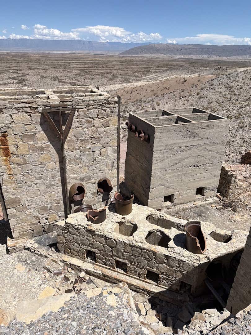
The path then follows an old mine road past the processing plant. This part of the operation ran on gravity. Ore came in at the top, got roasted, and slag went out the bottom. Pipes carried the mercury vapor through a chain of condensers until it cooled into liquid metal.
Above the furnace you find the remains of two redwood tanks and an ore delivery platform. Beyond the stack, a cement conduit covered in ceramic tile served as a final condenser. It looks like a strange half buried drainpipe until you know what it did.
Keep climbing and the mine shafts appear, some barred, some covered with metal grates. You can lean over and look down into black. My advice is to lean only as far as the grate lets you. These were working shafts, and they are deep.
Near the top sits a cluster of concrete and stucco houses that no one ever lived in. They were built for a wartime reopening in 1942 that fizzled before the crews moved in. Brand new for their day, empty ever since. That detail gets me every time.
The View From the Top of the Mine
The old mine road keeps going another half mile past the shafts to a hilltop, and I would not skip it. The views open on your right as you climb, then swing all the way around once you reach the crest.
To the south the Sierra del Carmen stands up across the Rio Grande in Mexico, a long blue wall that turns pink at sunset. To the north the Chisos Mountains float on the horizon.
In between is nothing but Chihuahuan Desert, creosote and rock, and a silence you can almost hear. No traffic, no other hikers most days, just wind moving through the old stack.
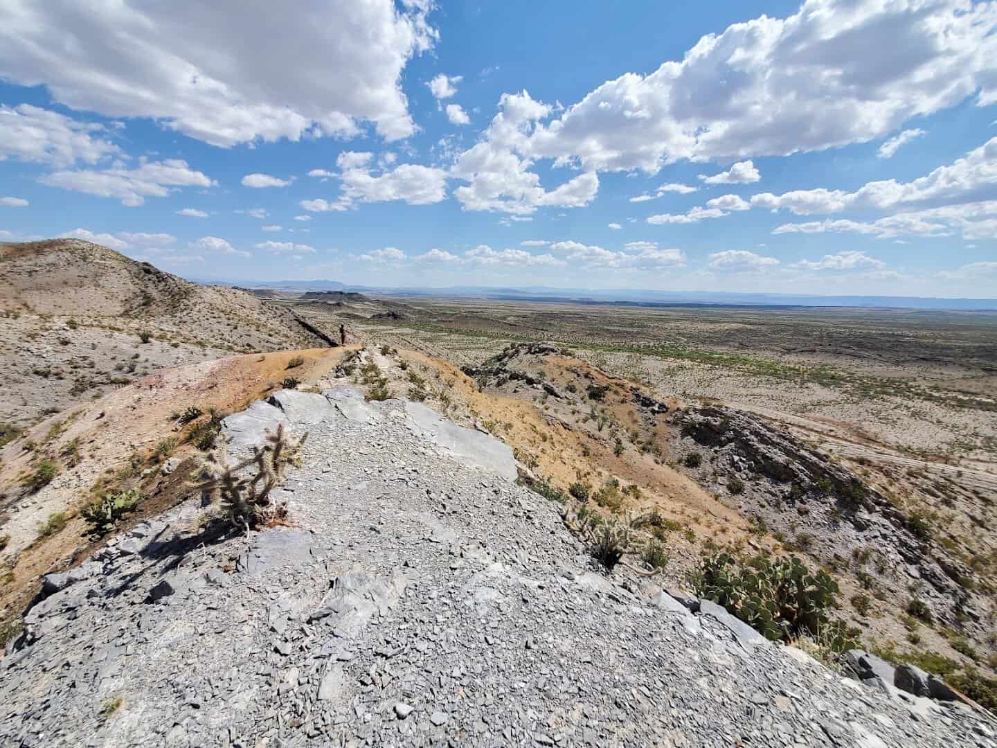
Mariscal Mountain itself rises at your back. The mine sits on its northern end, and the mountain runs south to the river where it splits into Mariscal Canyon, one of the three big canyons in the park. You are standing on the edge of all of it.
Hikers on AllTrails call it “great history in the middle of the desert” and say it is “definitely worth the trip.” I would go further. It is the only place I know of in Texas where a ten minute walk puts you inside a working landscape from 1919.
How a Mercury Mine Ended Up in the Desert
The story starts in 1900, when a rancher named Martin Solis noticed bright red rock near his farm on the north end of Mariscal Mountain. That red ore was cinnabar, and cinnabar is where mercury comes from. Word got around fast.
Ed Lindsey, a federal inspector who also ran the store in Boquillas, filed the first mining claim on the mountain. In those early years the ore went out by mule to be refined at Terlingua, which was already booming as a quicksilver town.
Lindsey sold his interest to Isaac Sanger of Dallas in 1905. Sanger’s Texas Almaden Mining Company gave it a go for a few years, then folded. The mountain went quiet.
The First World War changed everything. Mercury was needed for detonators and prices climbed. W.K. Ellis worked the mine from 1917 to 1919 and pulled out 894 flasks, each one a heavy iron bottle holding roughly 76 pounds of liquid metal.
When prices fell after the war, Ellis sold to William Burcham and a set of New York investors. Their Mariscal Mining Company built the big Scott furnace you see today, along with the processing plant, and ran the site from 1919 until 1923.
The last chapter came in 1942. The Vivianna Mining Company reopened the mine for the Second World War, added a rotary furnace, and put up those concrete houses. The hoped for boom never arrived. The mine shut for good in 1943.
Across those four decades, Mariscal produced roughly 1,400 flasks of mercury. That works out to nearly a quarter of all the mercury mined in the United States between 1900 and 1943, from one hill at the bottom of Texas.
The People Who Built It
The furnace and the rock houses were not built by engineers from back east. They were built by Mexican miners, many of whom had crossed the river to escape the upheaval of the Mexican Revolution. At one point the workforce was entirely Mexican except for three American employees.
Pay ran between a dollar and a dollar fifty for a ten hour shift, six days a week, with supplies bought from the company store. The little stone homes on the lower slope are their work. So is the furnace stack. Every brick was carried up that hill by hand.
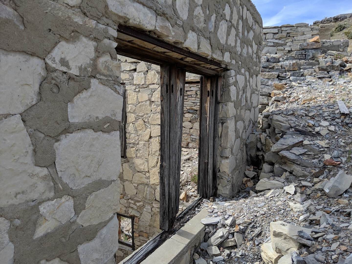
The Mariscal Mine Historic District was added to the National Register of Historic Places on September 13, 1974. The district covers 640 acres, and it is often called the best preserved mercury mining site in the country.
Most of the machinery was hauled off for scrap in the 1940s and 1950s. The bones of the place remain, and the dry desert air has kept them standing far better than any museum could.
Getting There Is Half the Adventure
Here is the part that keeps the crowds away. Mariscal Mine sits on River Road, a primitive gravel route that runs for about 50 miles along the southern edge of the park. From the east end, near Rio Grande Village, the mine is roughly 20 miles in.
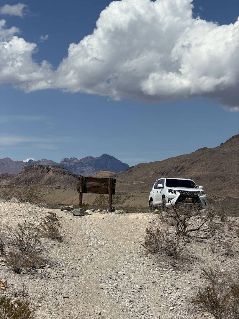
Those 20 miles take an hour and a half to two hours. The road is washboard in stretches, rutted in others, and it dips through several arroyos that fill with water when it rains. The park asks for a high clearance vehicle, and four wheel drive after any storm.
Plan on at least half a day for the drive and the hike combined. The road from the west end, off the Ross Maxwell Scenic Drive near Castolon, is longer at about 35 miles and rougher, so most visitors come in from the Rio Grande Village side.
Pro tip: stop at the Panther Junction or Rio Grande Village visitor center and ask about River Road conditions before you commit. Rangers know which arroyos are running. Download an offline map too, because there is no cell service down there at all.
Did you know? River Road also passes primitive backcountry campsites, and the Fresno site sits just before the mine. Snag a permit and you can sleep a few minutes from the ruins under some of the darkest skies in the lower 48.
What to Bring and When to Go
The trail is short, but it is steep in places and there is no shade past the mesquite. Carry more water than you think a one mile walk needs. A liter per hour is the park’s rule, and the desert does not care that the trail is short.
Sturdy shoes matter here more than on most easy trails. The surface shifts from sand to loose rock to old rail bed, and the shafts are a good reason to watch your footing. A hat and sunscreen go without saying.
Cooler months are the sweet spot. November through March gives you comfortable walking and clear air for those views into Mexico. In summer, go at first light and be back at the car before the heat builds.
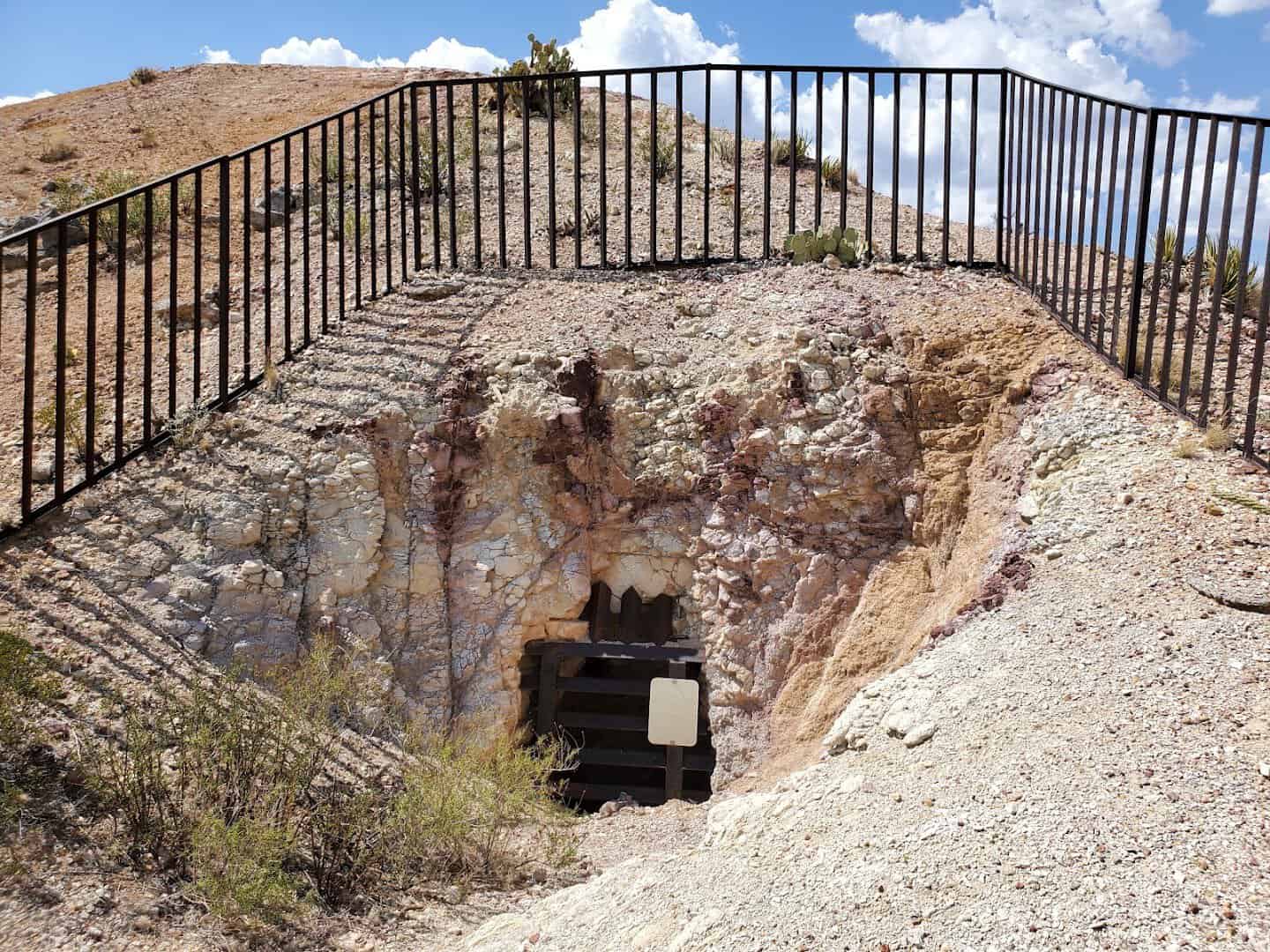
Bring a flashlight to shine down the grated shafts, and bring your camera. The red brick against the tan desert, the rusted condensers, the doorways with the Sierra del Carmen behind them, all of it photographs beautifully in low light.
Leave everything where you found it. Collecting artifacts is prohibited, and the old bricks and tailings are not something you want in your pockets anyway.
How to Get There
Where: Mariscal Mine Trail, River Road East, Big Bend National Park, TX 79834. From the Rio Grande Village end, follow River Road roughly 20 miles to the small trailhead lot on the south side.
Big Bend charges $30 per private vehicle for a seven day pass, and the park is cashless, so bring a card. The fee covers Mariscal Mine and every other trail in the park. The nearest fuel and supplies are at Rio Grande Village and Panther Junction.
Go Find the Quietest Corner of Big Bend
Plenty of Texas trails are longer, and plenty are prettier in the usual way. Very few let you climb through a furnace, peer down a mine shaft, and stand in a doorway that a miner stacked by hand a century ago, all before lunch.
So check the road, fill the water bottles, and point the truck down River Road. Walk it slow. Read the signs. Sit on the hilltop long enough to watch the Sierra del Carmen change color. Then come home and tell someone about the strangest mile in Texas.
Featured image: Ron Nichols via Mariscal Mine

Stella Raines
Editor-in-Chief
Stella brings over a decade of storytelling experience to TX Headlines. With roots in West Texas and a love for road trips, she leads the editorial team with an eye for the hidden stories that make Texas unforgettable.
More Stories
These 12 Dog-Friendly Texas Beaches Belong on Every Pet Parent’s List
This Rugged Texas Ranch Is Laced With Twisting Mountain Bike Trails That Keep Riders Coming Back
These 10 Peaceful Texas Walking Trails Are Perfect for Seniors
This Spring-Fed Texas Lake Is So Clear You Can See the Bottom, and Locals Intend to Keep It That Way
Tags