6 Bucket-List Solo Road Trips That Deliver Freedom Mile After Mile
I will take a solo road trip over a group vacation every single time. No debate about where to stop for lunch. No fight over the playlist. You pull over when a view grabs you, and you drive on the second you are ready.
I fell for the idea the first time I understood I could point a car in any direction and answer to nobody. That is the whole appeal of the open road. It belongs to you alone, mile after wide-open mile.
Below are six of the best solo road trips across America, from ocean cliffs to desert canyons to a highway that runs out across open sea. Each one is built for one driver, one soundtrack, and a windshield full of country. Pick the one that pulls at you.
One word before you go. Tell someone your route, keep the tank above half, and download your maps for the long stretches with no signal. Do that much and you can let the rest of the trip be gloriously spontaneous.
1. Blue Ridge Parkway, North Carolina
If you want a gentle first solo trip, the Blue Ridge Parkway is it. The road rolls 469 miles along the ridgeline from Virginia down into North Carolina, with no billboards, no trucks, and no reason at all to rush.
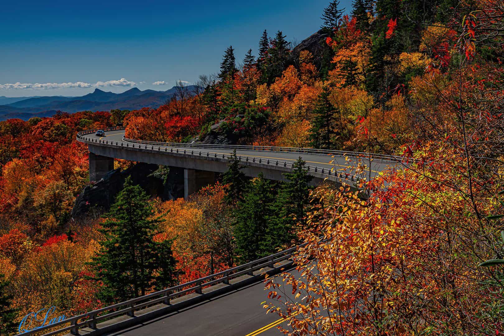
The showpiece is the Linn Cove Viaduct, a 1,243-foot bridge that curls around ancient Grandfather Mountain on 153 concrete segments. Crews built it from the top down so no heavy equipment ever scarred the fragile slope below.
It was the very last piece of the parkway finished, in 1987, after 52 years of careful building. Time your drive for autumn and the whole route turns gold, orange, and deep red.
No commercial trucks are allowed and the limit sits at a gentle 45, so you set your own pace, roll the windows down, and let the mountains do the talking.
It is also the most visited stretch of the entire National Park System. Overlooks appear every few miles, each framing another blue ridge fading into the haze that gave these mountains their name.
Nearby Grandfather Mountain adds a mile-high swinging bridge if you want to stretch your legs, and simple concrete mileposts count you along the whole route so you never quite lose your place. Half the pleasure of the parkway is stopping, not arriving.
Where: The Linn Cove Viaduct Visitor Center is at Milepost 304 on the Blue Ridge Parkway, near Linville, North Carolina.
2. Overseas Highway, Florida
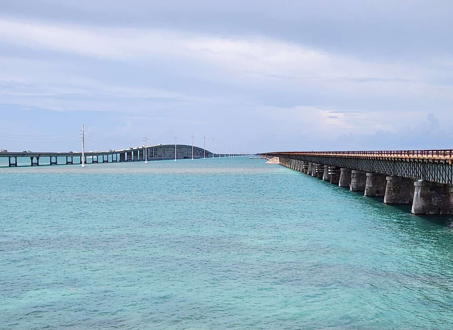
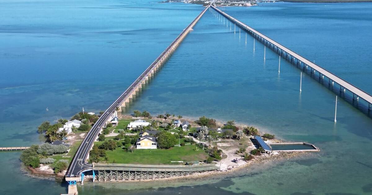
Then there is the drive that runs right out over the ocean. Florida’s Overseas Highway carries US-1 for 113 miles across 42 bridges, from the mainland all the way down to Key West.
The star is the Seven Mile Bridge, where the land vanishes and water fills every window. It reopened as a highway in 1938, built on the bones of Henry Flagler’s hurricane-wrecked overseas railroad.
Flagler’s original railroad first reached Key West in 1912, an impossible idea that took thousands of workers seven years to build. A 1935 hurricane tore it apart, and the state paved the surviving line into a road.
Pull off at Bahia Honda State Park along the way for some of the clearest water and whitest sand in all of Florida. It makes a perfect solo picnic stop before the bridges begin again.
Roll solo with the radio up and the causeway feels gloriously endless. In 2009 the highway earned an All-American Road designation, the highest honor a scenic byway can receive.
The little island tucked under the old bridge is Pigeon Key, once home to the railroad crews who built the line. Time it right and you can watch the sun rise over the Atlantic and set over the Gulf on the very same day.
Pull into any key along the way for a plate of fresh fish and a slice of key lime pie. Half the joy of this drive is how easy it is to stop, and how hard it is to leave.
Where: The Seven Mile Bridge runs between Knight’s Key and Little Duck Key near Marathon, Florida, on US-1.
3. El Camino del Rio, Texas
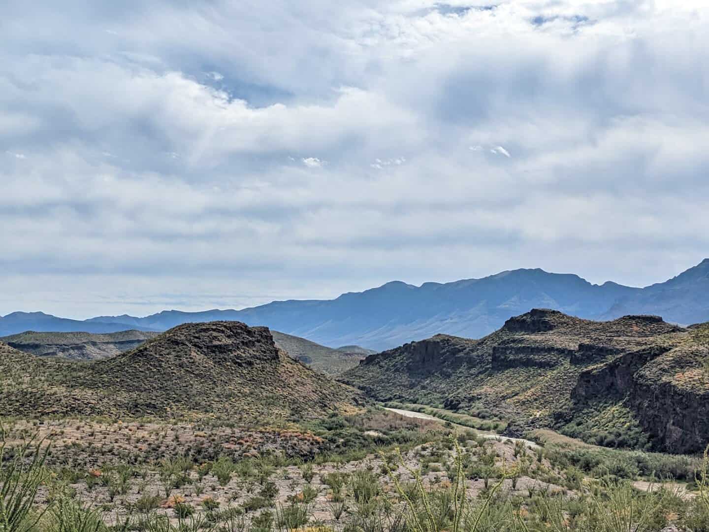
Texas keeps its prettiest drive in its emptiest corner. El Camino del Rio, marked FM 170, hugs the Rio Grande for roughly 120 miles between Lajitas and Presidio, running straight through Big Bend Ranch State Park.
National Geographic once called it possibly the prettiest drive in America. The Big Hill, one of the steepest paved grades in the state, backs up the claim with wide canyon panoramas that spill into two countries at once.
The road was finished in 1961 and named in a local school contest, though old-timers still call it Smugglers’ Trail. Out here you may not pass another car for an hour, which is exactly the point of going alone.
Big Bend Ranch, which the road runs straight through, is the largest state park in Texas at more than 300,000 acres. Desert mountains, the green ribbon of the river, and a silence so complete you can almost hear it.
Fuel up before you set out, because services are scarce and the next gas station can be a very long way down the road. That emptiness is the reward, not the risk.
Nearby sit the old quicksilver ghost town of Terlingua and the funny teepee-shaped picnic shelters that dot the roadside, perfect for a solo lunch with a canyon view. The Rio Grande here is the border itself, with Mexico rising green and rugged on the far bank.
Where: El Camino del Rio (FM 170) follows the Rio Grande between Lajitas and Presidio, Texas. Enter Big Bend Ranch State Park from the Lajitas side.
4. Scenic Byway 12, Utah
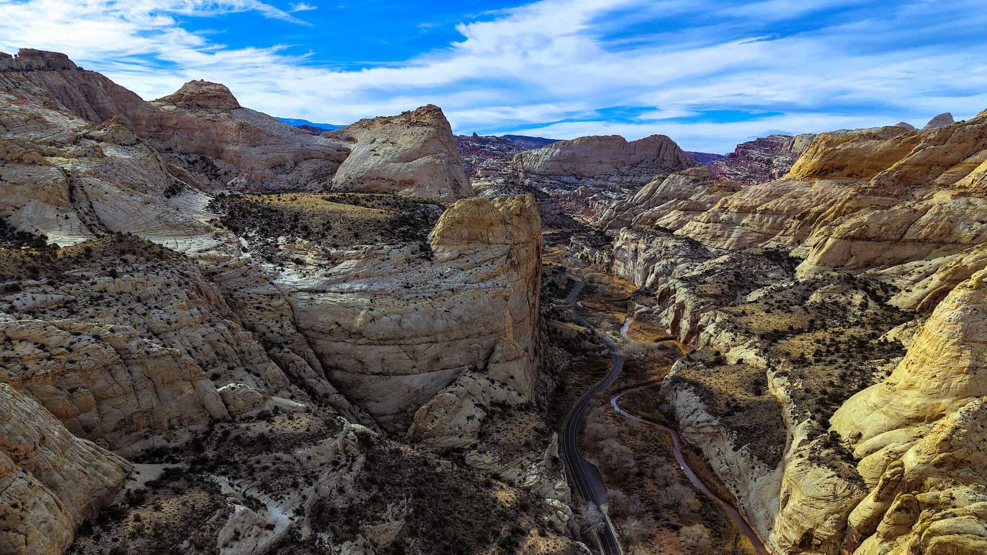
Utah’s Scenic Byway 12 is a 124-mile ribbon strung between Bryce Canyon and Capitol Reef, and it was the state’s very first All-American Road for good reason.
It threads slickrock, pine forest, and the red maze of Grand Staircase-Escalante. In one famous stretch the road runs along a narrow spine of rock with canyon falling away on both sides at once.
The section locals call the Hogback is that spine, so slim it feels like driving on the backbone of the earth. Farther on, the road climbs Boulder Mountain, where cool aspen forest replaces slickrock and the temperature drops with every switchback.
Little Boulder, one of the towns along the way, was among the last places in America to get its mail by mule, right up until 1940. Pull over at the Head of the Rocks Overlook near Escalante and the sandstone wilderness unrolls beneath you.
Detours branch off to Calf Creek Falls and the candy-colored spires of Kodachrome Basin, and Bryce Canyon’s hoodoos anchor one end of the drive while Capitol Reef’s cliffs guard the other. Two national parks bookend a single road.
Gas up in Escalante or Torrey before the long empty miles between them, and expect cell signal to come and go with the canyon walls. Out here that is a feature, not a bug.
Solo, you can sit on the rim for as long as the light holds and not owe anyone an explanation.
Where: The Head of the Rocks Overlook is near milepost 69 on Highway 12, a few miles east of Escalante, Utah.
5. North Shore Scenic Drive, Minnesota
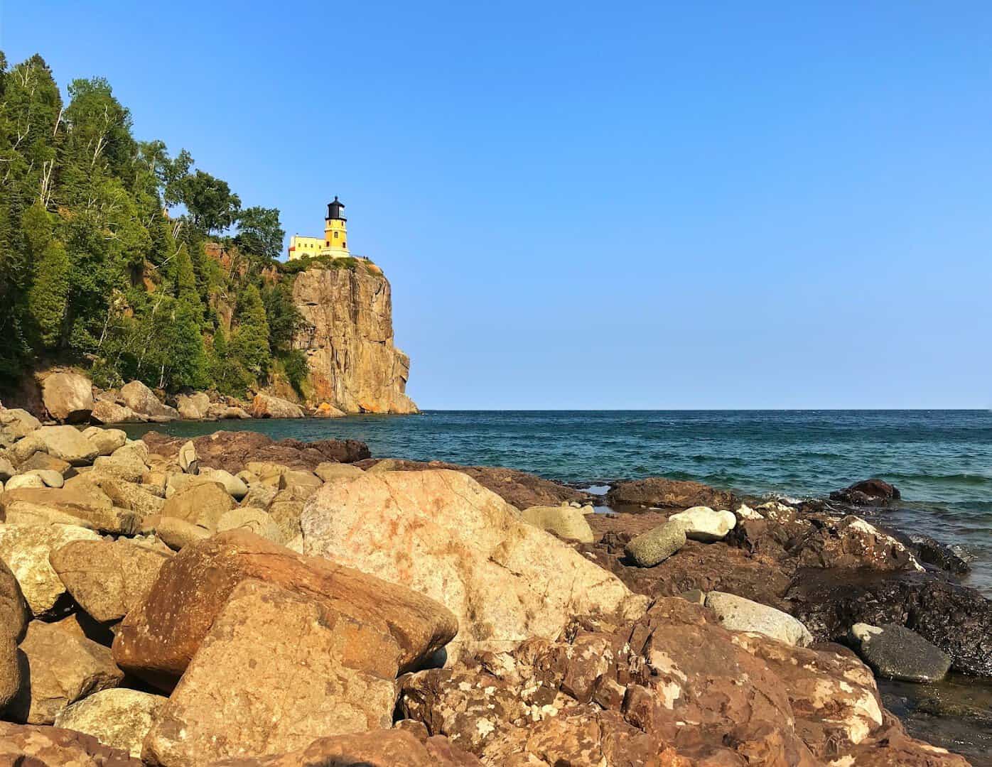
For big-water calm instead of desert heat, Minnesota’s North Shore Scenic Drive follows Highway 61 for 145 miles along Lake Superior, from Duluth all the way to the Canadian border.
It opened in 1924 as the Lake Superior International Highway. The lake is the largest freshwater lake on Earth by surface area, so vast it behaves like an ocean and makes its own weather.
The one you will stop the car for is Split Rock Lighthouse, a 54-foot tower that has stood on a 130-foot cliff since 1910. It went up after a fierce 1905 storm wrecked dozens of ships.
Its beam once reached 22 miles across the water. Every November 10th it is lit again to honor the lost crew of the Edmund Fitzgerald. Solo drivers get the quiet overlooks almost entirely to themselves.
Stop for the falls at Gooseberry or climb the cliff at Palisade Head, and the drive starts to feel wonderfully far from anywhere. In winter the shore grows ice caves and frozen waterfalls.
The lighthouse was retired in 1969 once modern navigation took over, but the state park around it keeps it perfectly preserved. Farther up the shore, the little harbor town of Grand Marais makes a cozy solo base for the night.
Where: Split Rock Lighthouse State Park sits off Highway 61 near Two Harbors, Minnesota, about 20 miles up the shore from Duluth.
6. Park Loop Road, Maine
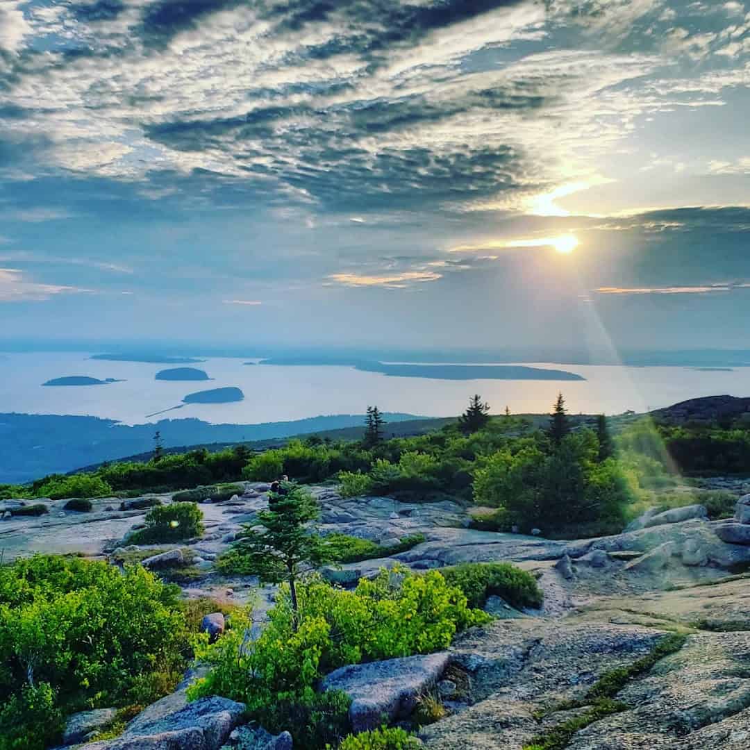
End where the country itself does. Acadia National Park’s Park Loop Road runs 27 miles around Mount Desert Island, past Sand Beach, the roar of Thunder Hole, and the pink granite of Otter Cliff.
Acadia was the first national park east of the Mississippi, and the loop runs mostly one way, so you drive it clockwise at an easy roll with the ocean almost always on your right.
The finale is the 3.5-mile spur up Cadillac Mountain, the highest point on the entire U.S. eastern seaboard at 1,530 feet. On certain fall and winter dates it is the first ground in America to catch the sunrise.
John D. Rockefeller Jr. helped fund the loop between 1921 and 1958 to keep cars off his beloved carriage roads. Drive it solo before dawn and you may have the summit almost to yourself.
Summit reservations are required from mid-May to mid-October, so book your slot ahead. Afterward the loop rolls past Jordan Pond, where the tradition is a pot of tea and warm popovers on the lawn.
Time Thunder Hole for a rising tide and the waves boom like a cannon through a slot in the rock. Rockefeller left 45 miles of crushed-stone carriage roads too, if you ever want to swap the car for a rented bike.
Where: The Park Loop Road begins near the Hulls Cove Visitor Center in Bar Harbor, Maine. The Cadillac Summit Road climbs from the loop’s north side.
Point the Car Wherever You Like
That is the real magic of a solo road trip. The whole route bends to you. No committee, no compromise, just a full tank and a windshield full of America.
Pick the one that pulls at you, whether it is ocean cliffs, red canyons, cool north woods, or a highway that runs across open sea. Load a playlist you would be a little embarrassed to admit you love.
Pack more snacks than you could possibly need, pick a start date, and go. The best trip is the one you actually take, and the road is waiting. This time it is all yours.
Featured image: Jennifer Pittroff via Seven Mile Bridge

Stella Raines
Editor-in-Chief
Stella brings over a decade of storytelling experience to TX Headlines. With roots in West Texas and a love for road trips, she leads the editorial team with an eye for the hidden stories that make Texas unforgettable.