10 Road Trips Along the Great Lakes
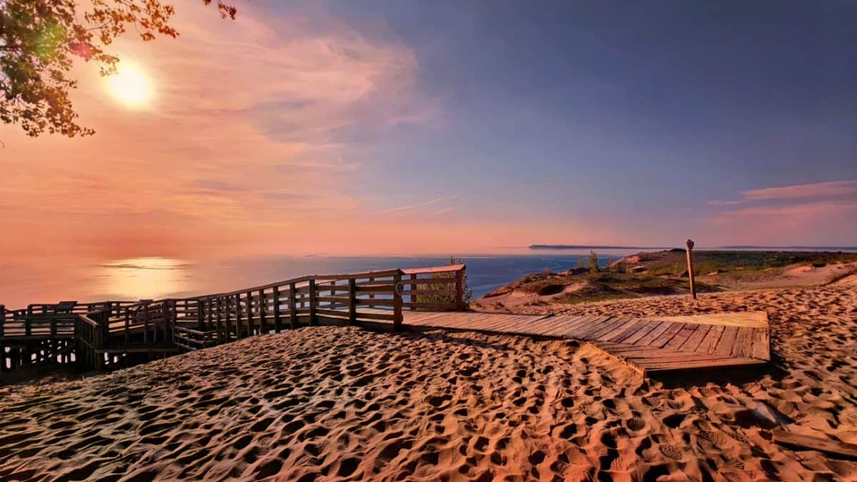
Nobody warned me how big a lake can feel until I drove beside one all afternoon and never once saw the far shore. The Great Lakes hold enough fresh water to reshape your idea of the word “lake.” They roll like oceans and throw real surf onto the sand.
String a few of their shoreline roads together and you get the kind of open-window freedom a road trip is supposed to feel like. Below, I’ve mapped ten drives that trace these inland seas across eight states, from Minnesota’s cliffs to Michigan’s dune country.
Pack a swimsuit, a jacket, and a full tank. The lake decides the weather up here, and half the fun is not knowing which of the five you’ll love most by the end.
Pro tip: go between June and October. Summer gives you warm sand and long light, while autumn turns the shoreline forests into a wall of color that reflects right off the water.
1. M-22 Along the Leelanau Peninsula, Michigan
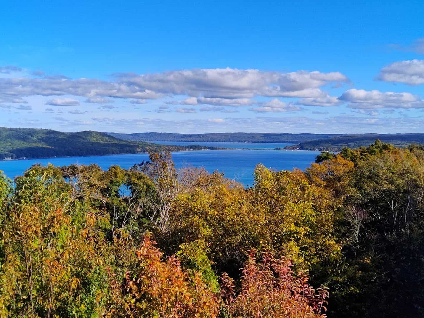
M-22 is so beloved that locals put its road-sign shield on hoodies and coffee mugs. The route curls for roughly 116 miles around the Leelanau Peninsula, tracing Lake Michigan past cherry orchards and fishing villages the whole way.
The crown jewel is Sleeping Bear Dunes National Lakeshore, where sand bluffs rise hundreds of feet straight off the water. Climb one and the whole lake opens below you like a second sky. Time your drive for late afternoon and the light does the rest.
Don’t rush past the little towns either. Glen Arbor, Leland, and Suttons Bay all serve up cherry pie, fresh whitefish, and harbor views worth a slow stop. Fall paints the orchards gold, so October is a quietly magical time to go.
Where: Sleeping Bear Dunes National Lakeshore, 9922 Front St, Empire, Michigan. M-22 runs north from Manistee through the town of Empire.
2. The Door County Coastal Loop, Wisconsin
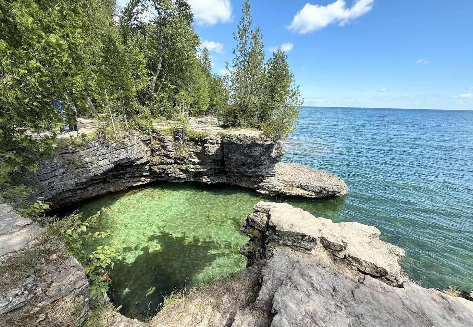
Door County is the skinny peninsula that reaches into Lake Michigan like Wisconsin’s thumb. Driving its shoreline loop feels like touring a string of seaside villages that somehow wandered inland, with roughly 300 miles of coast and cherry stands on nearly every bend.
My favorite stop is Cave Point County Park, where the lake has carved the limestone into sea caves that boom when the waves roll in. Bring a picnic. Watching the water crash against those ledges is the kind of free show you drive hours for.
The peninsula also claims a small army of historic lighthouses, more than almost anywhere on the lakes. Cap the day with a traditional fish boil, a local ritual where the pot flares up in a burst of flame right before dinner is served.
Where: Cave Point County Park, 5360 Schauer Rd, Sturgeon Bay, Wisconsin. It sits on the Lake Michigan side, just off County Road WD.
3. The North Shore Scenic Drive, Minnesota
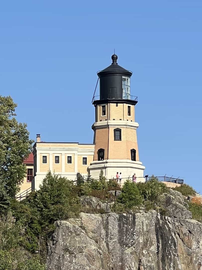
Highway 61 out of Duluth hugs Lake Superior toward the Canadian border, and it might be the most dramatic lakeshore road in the country. Think evergreen cliffs, waterfalls tumbling toward the lake, and a horizon so wide you’ll swear you’re looking at the sea.
The postcard moment is Split Rock Lighthouse, perched on a 130-foot cliff since 1910. It’s arguably the most photographed lighthouse in America, and standing there with Superior stretching to nowhere, you’ll understand why.
Break up the drive with the state parks that line the route. Gooseberry Falls, Tettegouche, and Temperance River all put waterfalls within a short walk of the car. Pack a fleece even in July, because Superior keeps this shore cool and crisp.
Where: Split Rock Lighthouse, 3713 Split Rock Lighthouse Rd, Two Harbors, Minnesota. Follow Highway 61 northeast from Duluth.
4. The Lake Erie Coastal Route, Ohio
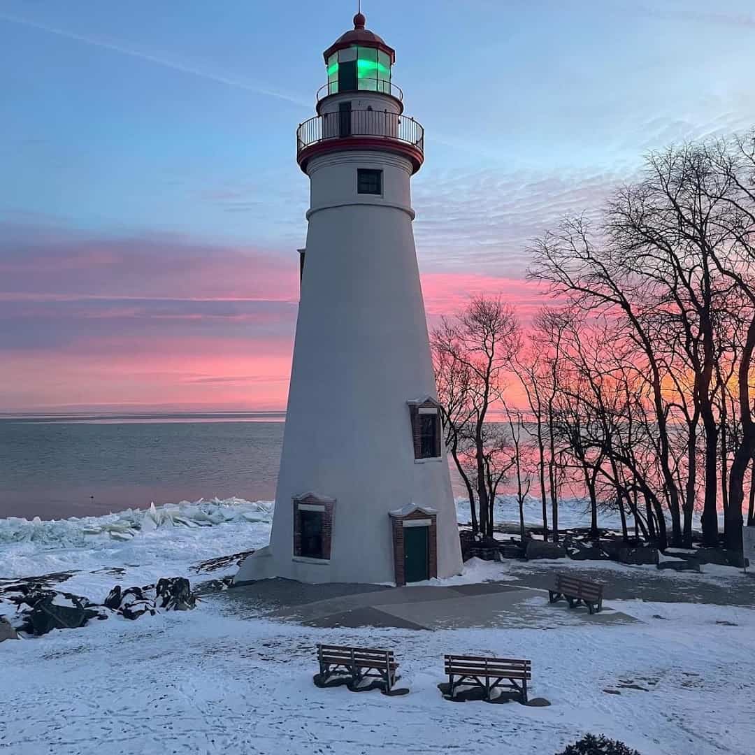
Ohio’s Lake Erie shore is a run of easygoing beach towns, wineries, and island ferries that feels like a Midwestern riviera. State Route 2 and the smaller shore roads link Sandusky, the Marblehead Peninsula, and Lakeside, with island-hopping right offshore.
Aim for Marblehead Lighthouse, the oldest continuously operating lighthouse on the U.S. side of the Great Lakes. It’s been guiding boats since 1822. Climb the tower, then watch the ferries slide toward Put-in-Bay while sailboats lean into the Erie breeze.
Give yourself time for a ferry hop to Kelleys Island or the Bass Islands, where the pace slows to a golf-cart crawl. Erie’s shallow water warms up nicely by midsummer, making this the friendliest Great Lake for an actual swim.
Where: Marblehead Lighthouse State Park, 110 Lighthouse Dr, Marblehead, Ohio. It’s on the peninsula’s tip, off State Route 163.
5. The Indiana Dunes Drive, Indiana
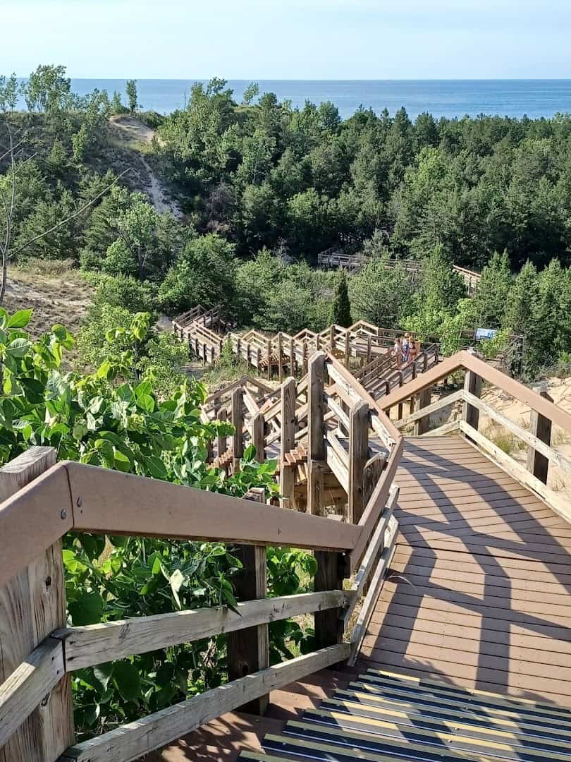
Indiana packs a surprising slice of Lake Michigan magic into its short northern coast, and Indiana Dunes National Park is the star. Named a national park in 2019, it protects about 15 miles of shoreline where towering dunes meet the water.
Cruise the park roads, then climb Mount Baldy, a living dune that actually shifts inland over time. On a clear evening the distant Chicago towers glow pink across the water while your toes are still in Indiana sand. It’s a fun bit of geography theater.
Naturalists love this pocket of coast for its wild variety, with prairie, marsh, and forest all packed between the dunes. For its size, it ranks among the most biologically rich parks in the country.
Come at sunset, when the beach crowds thin out and the lake turns the color of a peach. The city lights flickering on across the water make a fitting curtain call.
Where: Indiana Dunes National Park, 1215 Indiana 49, Porter, Indiana. The visitor center sits just off Highway 49 near Chesterton.
6. The Pictured Rocks Byway, Michigan
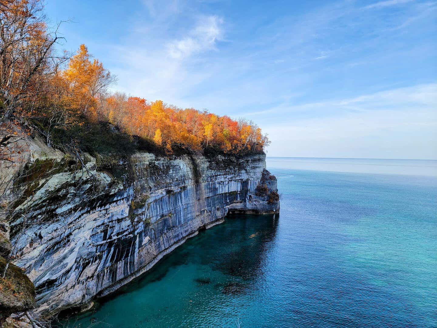
Up in Michigan’s Upper Peninsula, County Road H-58 leads you to Pictured Rocks National Lakeshore, the first national lakeshore ever designated, back in 1966. The name comes from sandstone cliffs streaked in mineral colors, rising straight out of Lake Superior.
Drive between Munising and Grand Marais, then walk out to Miners Castle for the overlook that launches a thousand desktop wallpapers. Better yet, hop a boat cruise so you can see those painted walls from the water, where they truly earn the name.
Waterfalls hide all along this stretch, and the fall color up here is legendary. Fuel up before you go, because gas stations get sparse in the U.P. and the scenery will happily eat a whole day if you let it.
Where: Pictured Rocks National Lakeshore, Munising Falls Visitor Center, Munising, Michigan. H-58 links Munising to Grand Marais.
7. The Lake Ontario Seaway Trail, New York
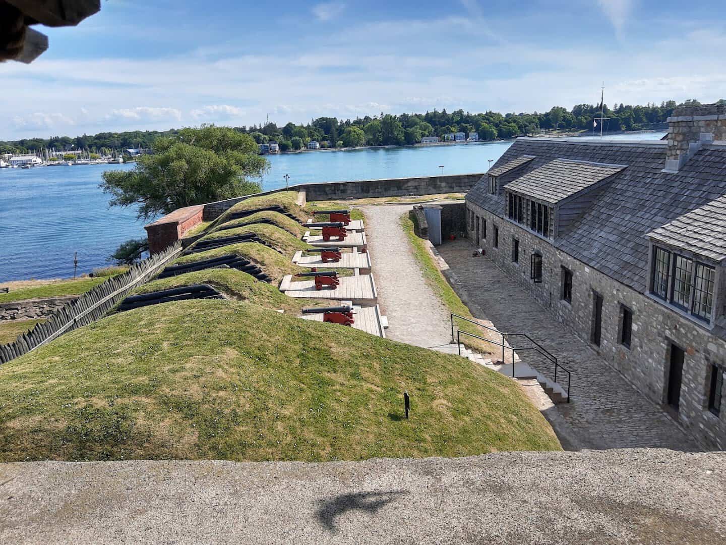
New York’s slice of the Great Lakes runs along Lake Ontario on the Great Lakes Seaway Trail, one of America’s longest scenic byways at more than 500 miles. It threads orchards, sleepy harbor villages, and lighthouses, with the roar of Niagara just to the west.
Start where the Niagara River spills into the lake at Old Fort Niagara, a stone fortress guarding this water since the 1720s. From its walls you can see three centuries of history and a lake that looks like it has no other side.
Follow the shore east through apple country and you’ll trip over lighthouses, wineries, and little state parks made for a picnic. Do yourself a favor and detour to the falls while you’re this close. It’s only a short drive south.
Where: Old Fort Niagara, 102 Morrow Plaza, Youngstown, New York. It sits at the mouth of the Niagara River on Lake Ontario.
8. The Presque Isle Loop, Pennsylvania
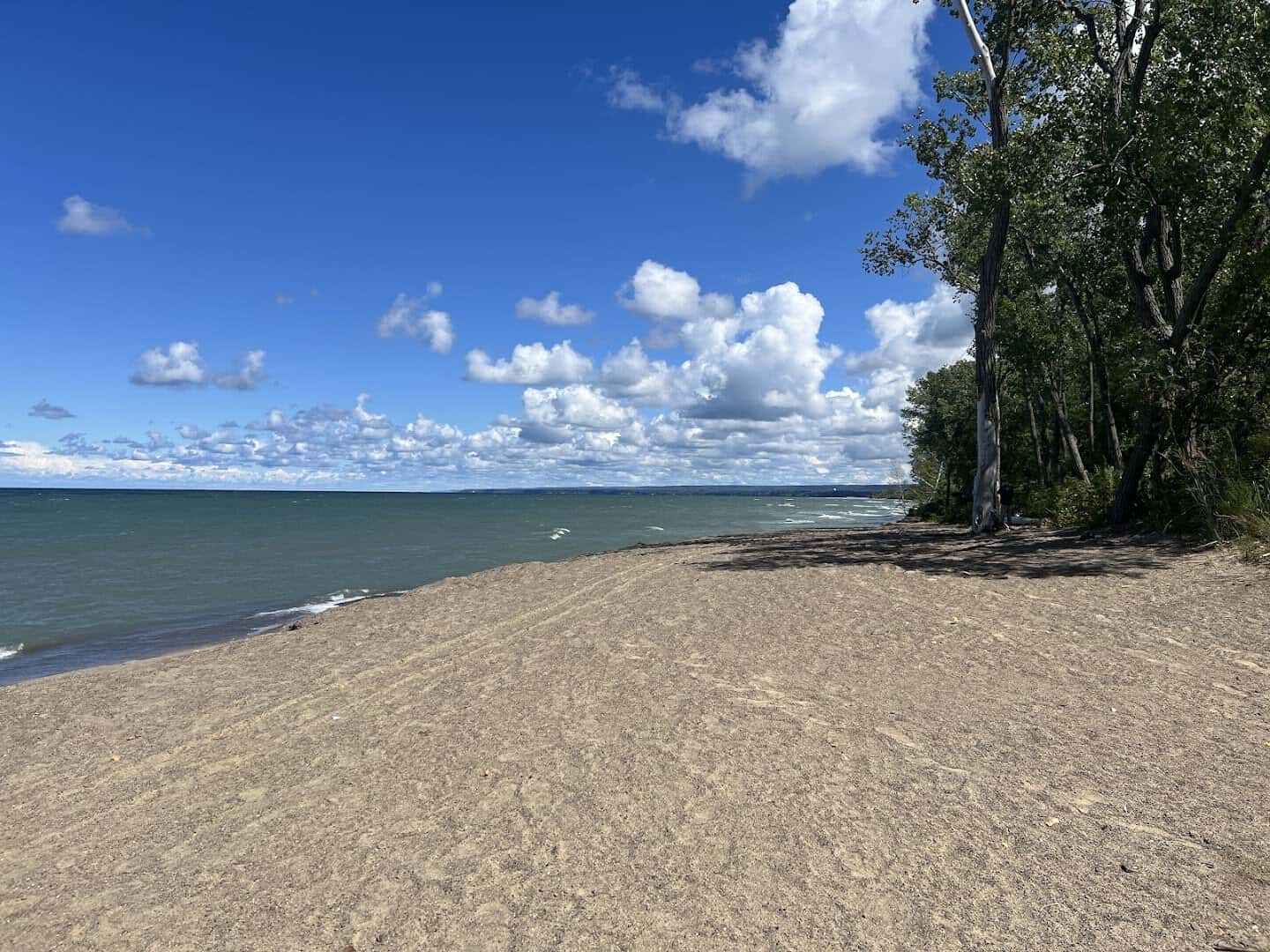
Pennsylvania only touches one Great Lake, but it makes the most of it. Presque Isle State Park is a sandy peninsula that curls seven miles into Lake Erie, and its scenic drive loops past beaches, lagoons, and a pretty lighthouse. It’s the busiest state park in the state.
Rent a bike or just roll the windows down and follow the road as it hugs the water on both sides. The sunset over the Erie skyline from the peninsula’s tip is a local ritual, and once you see it you’ll happily join in.
Birders adore this spot, since the peninsula is a famous rest stop for migrating flocks each spring and fall. Pack a swimsuit too, because these are some of the best sand beaches in the whole state.
Where: Presque Isle State Park, 301 Peninsula Dr, Erie, Pennsylvania. The park entrance is just west of downtown Erie.
9. DuSable Lake Shore Drive, Illinois
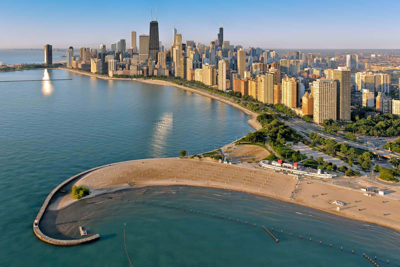
You don’t expect a big-city expressway to make a road-trip list, but DuSable Lake Shore Drive earns it. For roughly 15 miles it runs between Chicago’s skyline and the open blue of Lake Michigan, with harbors, beaches, and parks stacked along the water.
Pull off at North Avenue Beach, where a boat-shaped beach house looks back at one of the great American skylines. Kite surfers, joggers, and cyclists share the sand while freighters drift on the horizon.
It’s proof a lake can feel like a coastline right in the heart of a city. Time it for the golden hour, when the towers light up and the water throws the whole skyline back at you in ripples. Then go find deep-dish for dinner.
Where: North Avenue Beach, 1600 N Lake Shore Dr, Chicago, Illinois. Exit the Drive at North Avenue on the near north side.
10. The Tunnel of Trees to Mackinac, Michigan
Save one of the sweetest drives for the top of the mitten. M-119, nicknamed the Tunnel of Trees, is a narrow ribbon that snakes about 20 miles from Harbor Springs to Cross Village, with hardwoods arching overhead and Lake Michigan flashing blue through the trunks.
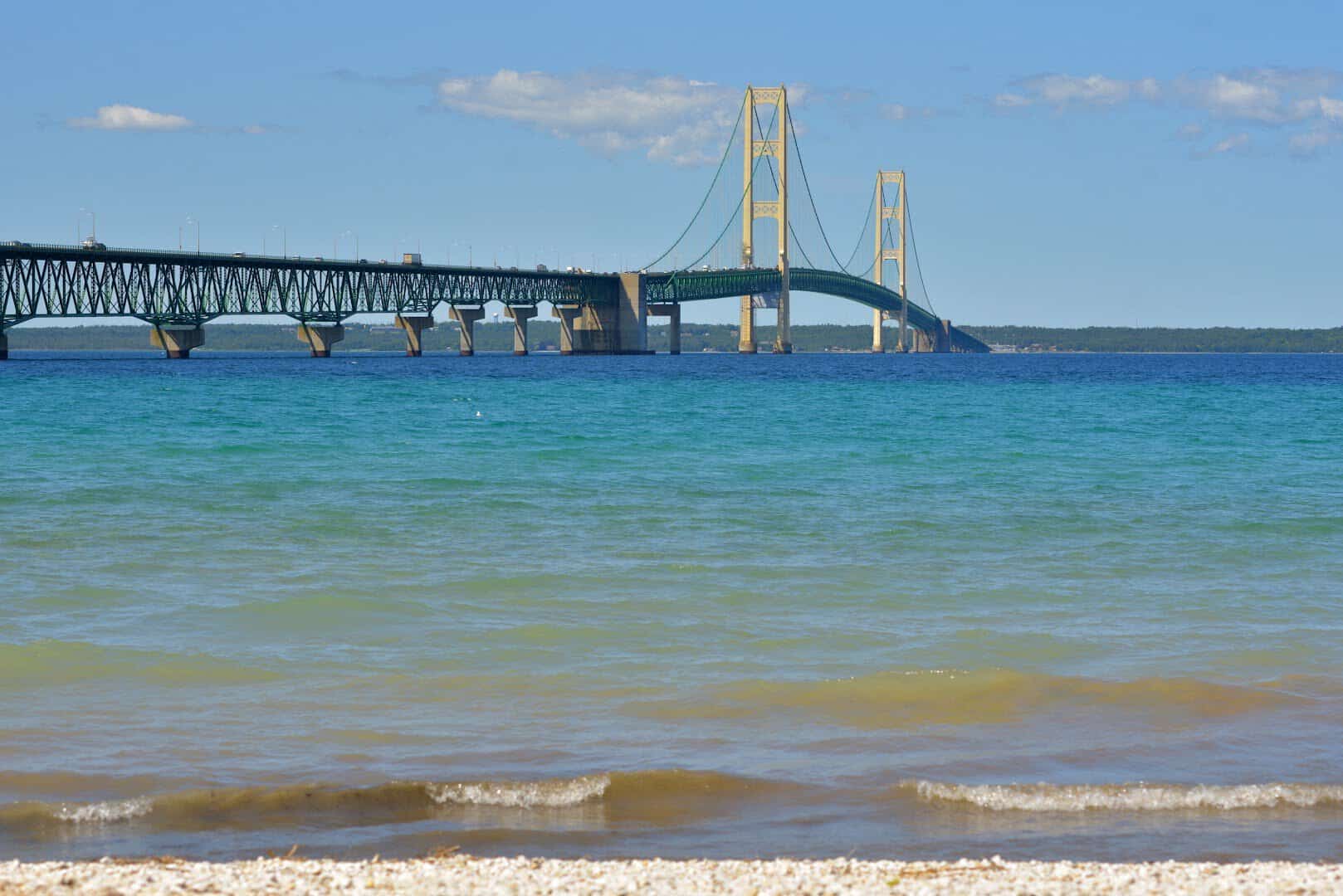
Stop at the storybook Legs Inn for lunch, then point north to the Mackinac Bridge, the five-mile suspension span that has linked Michigan’s two peninsulas since 1957. Crossing it, with two Great Lakes on either side, is a genuine bucket-list moment.
Catch a ferry to Mackinac Island while you’re up here, where cars are banned and horse-drawn carriages still rule the streets. Fudge shops line the main drag, so come hungry and leave a little heavier.
Where: Mackinac Bridge, Mackinaw City, Michigan. Take M-119 north from Harbor Springs, then US-31 to the bridge at the Straits of Mackinac.
Start Planning Your Great Lakes Getaway
The beauty of these inland seas is that you can chase them for a weekend or a whole summer and never run out of shoreline. Pick a lake, pick a road, and let the water pull you north.
Whether you’re drawn to Superior’s cliffs, Michigan’s dunes, or Erie’s easy beach towns, each of these drives hands you the same gift: a fresh-water horizon that goes on forever.
You could link two of them into one long loop, or stretch all ten across a summer of weekends. However you slice it, the water is always the reason to keep driving. Gas up, cue a good playlist, and go find your favorite coast.
Featured image: Marcus Bost Jr via Sleeping Bear Dunes National Lakeshore

Stella Raines
Editor-in-Chief
Stella brings over a decade of storytelling experience to TX Headlines. With roots in West Texas and a love for road trips, she leads the editorial team with an eye for the hidden stories that make Texas unforgettable.