10 Breathtaking Places That Beg to Be Photographed
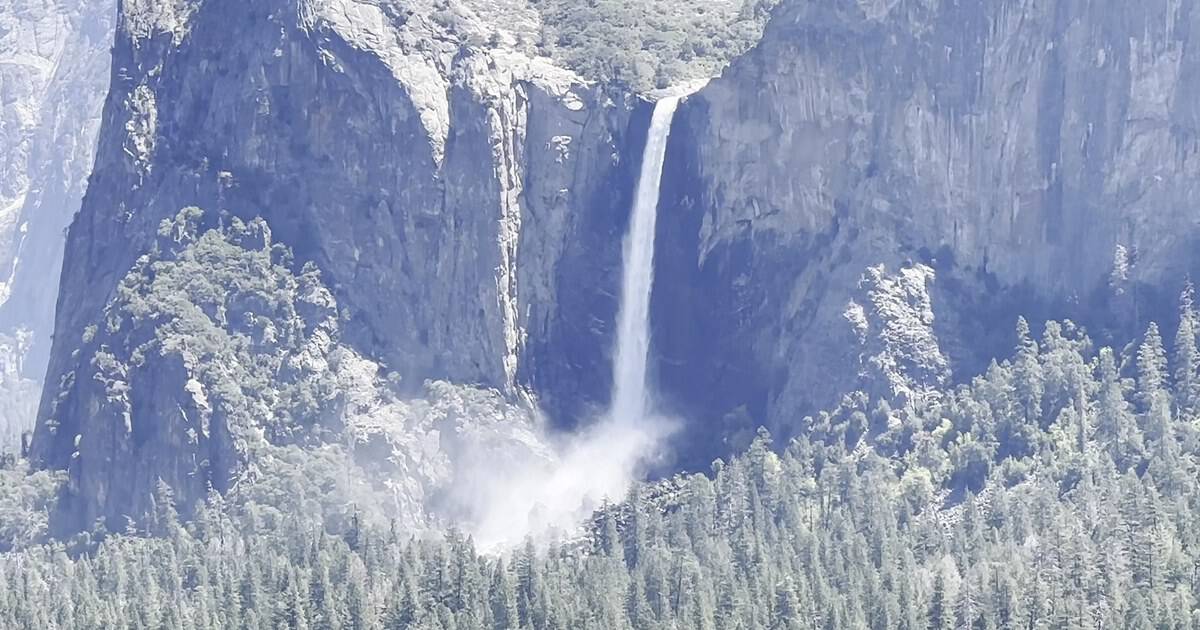
I keep a running list of the places that ruin you for postcards. Ask ten photographers to name the one shot still on their bucket list and you will get ten different answers.
But they all share a look: that slack-jawed stare when a view is simply too big for the frame.
These are the spots I mean. Not the merely pretty ones, but the ones that stop you mid-sentence and make you fumble for a camera you already know will fall short.
America is stacked with them, from canyon-rim vertigo to mirror-still mountain lakes. Below are ten of the most photogenic spots in the country, each a wide, recognizable vista worth the drive, the early alarm, and the memory card. Here is where to point the lens.
1. Mather Point, Arizona
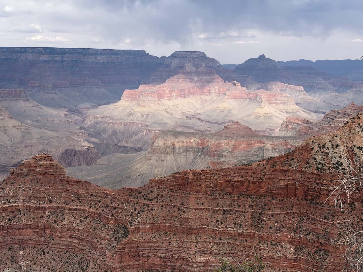
Some views you build up in your head, then arrive to find the real thing dwarfs the postcard. The Grand Canyon does that to almost everyone, and Mather Point is where most people meet it for the first time.
It sits just behind the South Rim Visitor Center, a limestone promontory perched 7,120 feet up. The canyon drops roughly 4,500 feet to the Colorado River below, and that scale is the whole shot.
Layers of red and ochre rock stack toward the horizon until they fade into haze. It is named for Stephen Mather, the first director of the National Park Service.
The railed overlooks look north across Granite Gorge toward buttes with names like Zoroaster Temple. Come at sunrise or sunset, when the light rakes sideways and every ridge throws a shadow.
Pro tip: walk a few minutes west on the Rim Trail, away from the busy main rail, for a cleaner foreground.
Where: Mather Point, Grand Canyon Village, AZ 86023, directly behind the Grand Canyon Visitor Center on the South Rim.
2. Oxbow Bend, Wyoming
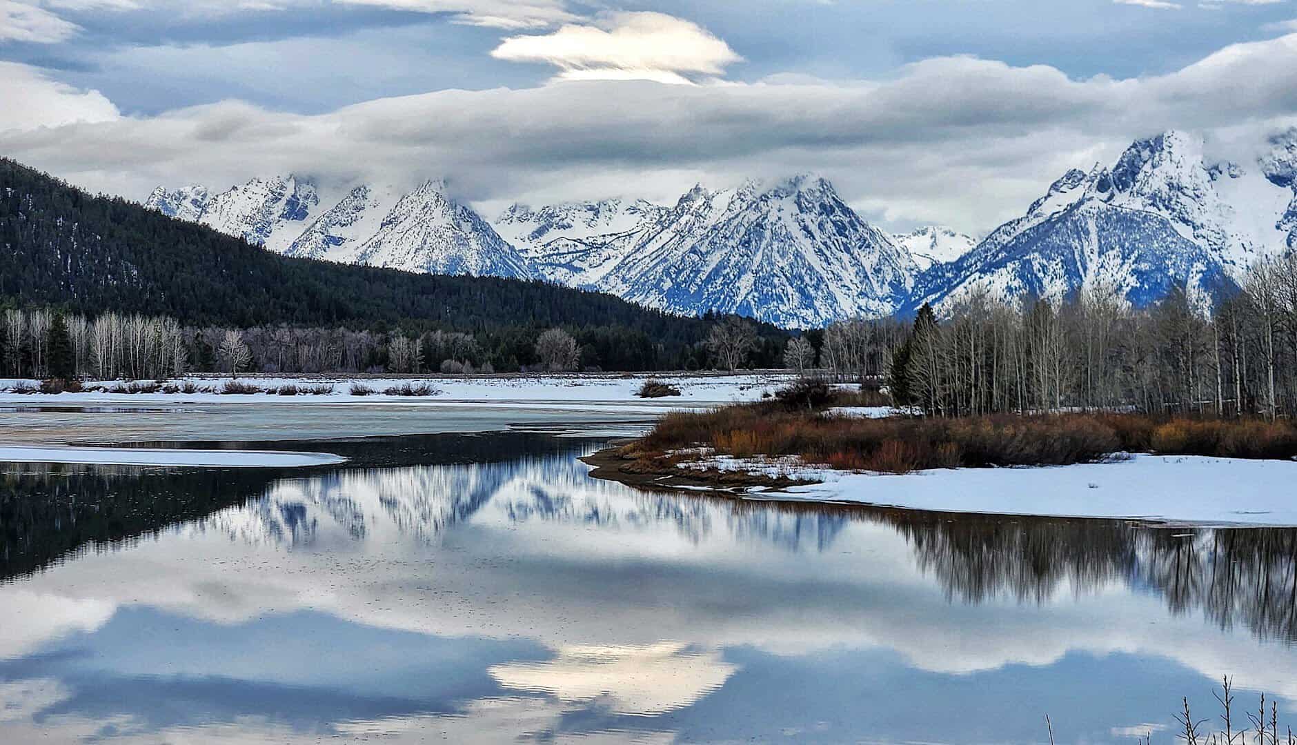
If you have ever seen a photo of the Tetons doubled perfectly in still water, there is a good chance it was taken right here. Oxbow Bend is a lazy curve in the Snake River, and on a windless morning it turns into a mirror.
The star is Mount Moran, a flat-topped peak just over 12,600 feet that stands almost dead center in the reflection. Add slow water, a fringe of cottonwoods and willows, and you have one of the most photographed scenes in the Rockies.
The best part is how easy it is. There is no hike at all. A paved pullout sits right off the highway, so you can roll up before dawn, set the tripod, and wait for the light.
Autumn is prime, when the cottonwoods go gold and moose sometimes wade through the frame. Get there early, because the reflection dies the moment the wind picks up.
Where: Oxbow Bend Turnout, US Highway 89/191/287, Moran, WY 83013, about three miles from the park’s Moran entrance.
3. Tunnel View, California
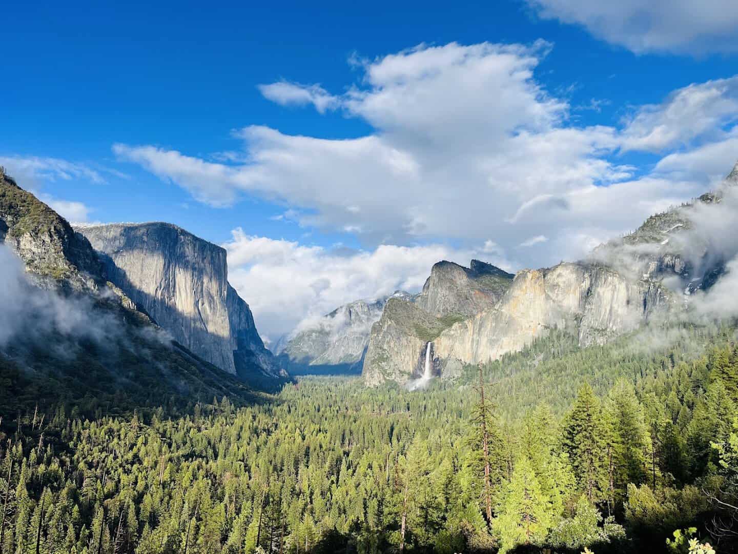
There is a reason a parking lot at the mouth of a highway tunnel is one of the most famous spots in California. You come out of the Wawona Tunnel, the trees part, and the whole of Yosemite Valley opens in a single frame.
Everything you want is arranged as if the park did it on purpose. El Capitan rises on the left, Bridalveil Fall drops on the right, and Half Dome sits dead center at the back.
Ansel Adams shot near here, and the composition still holds. It is the easiest iconic view in the park, a few steps from two small lots off Wawona Road, which does mean crowds.
Chase the weather. A clearing storm, with mist tearing off the granite walls, turns an already great view into the shot of the trip.
Where: Tunnel View, Wawona Road (Highway 41), Yosemite Valley, CA 95389, at the east end of the Wawona Tunnel.
4. Delicate Arch, Utah
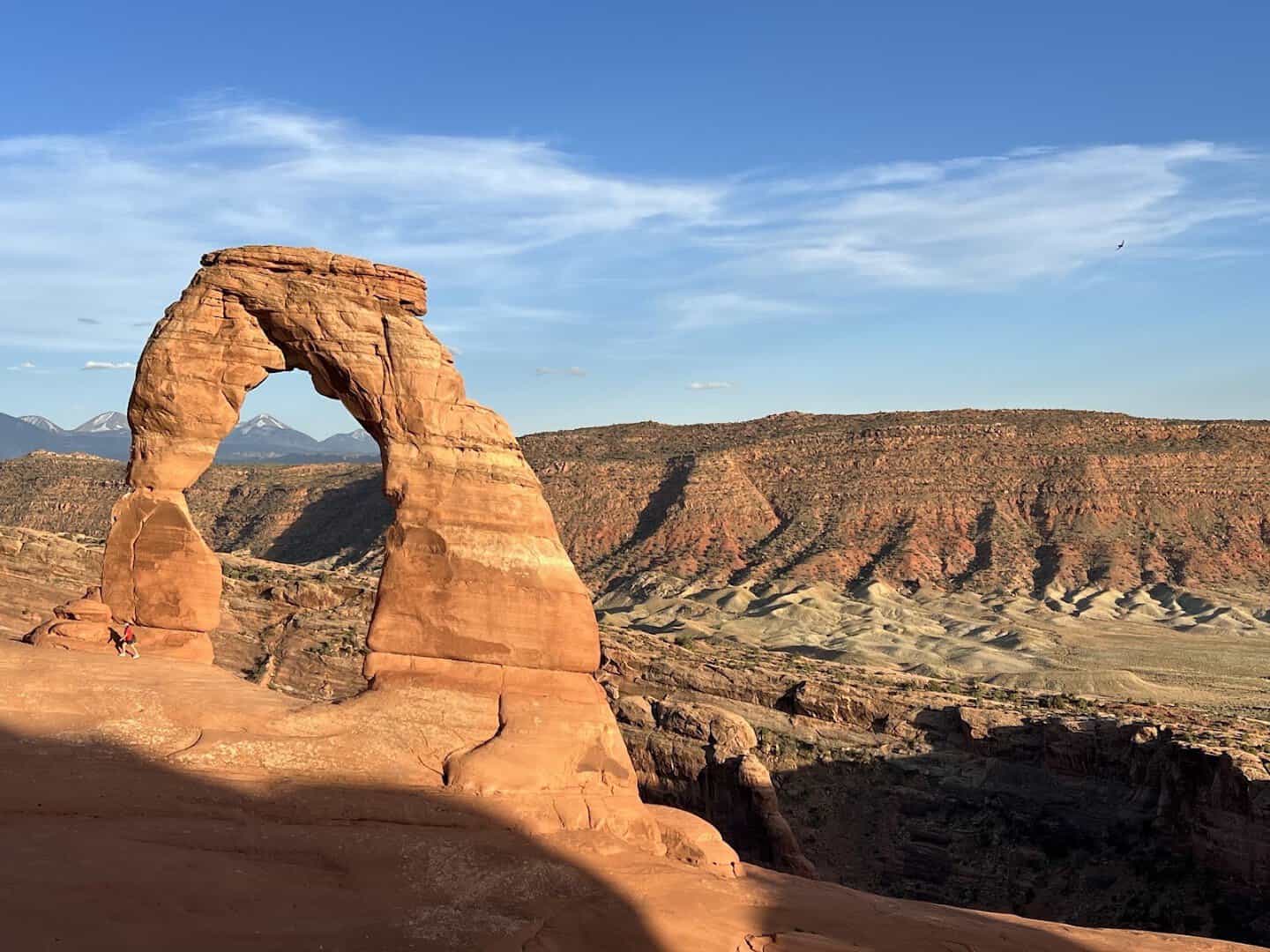
You know this one even if you do not know its name. It is on Utah’s license plates: a 52-foot ribbon of sandstone standing free against open sky, with the La Sal Mountains stacked behind it.
Getting the shot takes effort, and that is part of the reward. The trail runs 3.2 miles round trip, climbing open slickrock with no shade, so bring more water than you think you need.
The arch hides until the last moment, then appears all at once. Photographers line up for sunset, when the low sun sets the whole formation glowing orange and the bowl beneath it fills with warm light.
It becomes a genuine event, strangers going quiet together. Did you know? Wind, water, and millions of years of erosion carved it, and it grows a little thinner every year.
Where: Delicate Arch, Arches National Park, off US-191 about five miles north of Moab, UT 84532, at the end of the Delicate Arch Trail.
5. Maroon Bells, Colorado
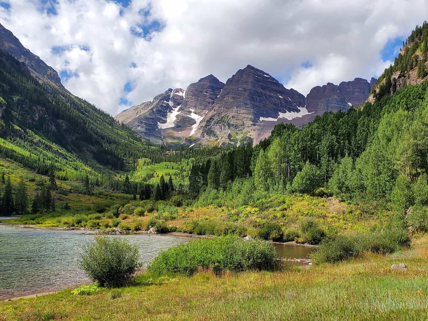
Colorado has plenty of mountains, but only one view gets called the most photographed in North America without much argument. The Maroon Bells are two bell-shaped, wine-colored peaks that rise straight out of a glassy alpine lake.
Both summits clear 14,000 feet, and Maroon Lake sits at 9,580 feet right at their feet. On a calm morning the water holds a perfect double image, and in late September the aspens along the shore burn gold.
This is another easy one. Maroon Creek Road ends at the lake, and a short, level loop trail hugs the water. Reservations and a shuttle are required in season, so plan ahead.
My vote is sunrise. The first light hits the peaks while the lake is still dead calm, and the crowds have not arrived yet.
Where: Maroon Bells Scenic Area, end of Maroon Creek Road, about 10 miles west of Aspen, CO 81611. Shuttle or reservation required in season.
6. Multnomah Falls, Oregon
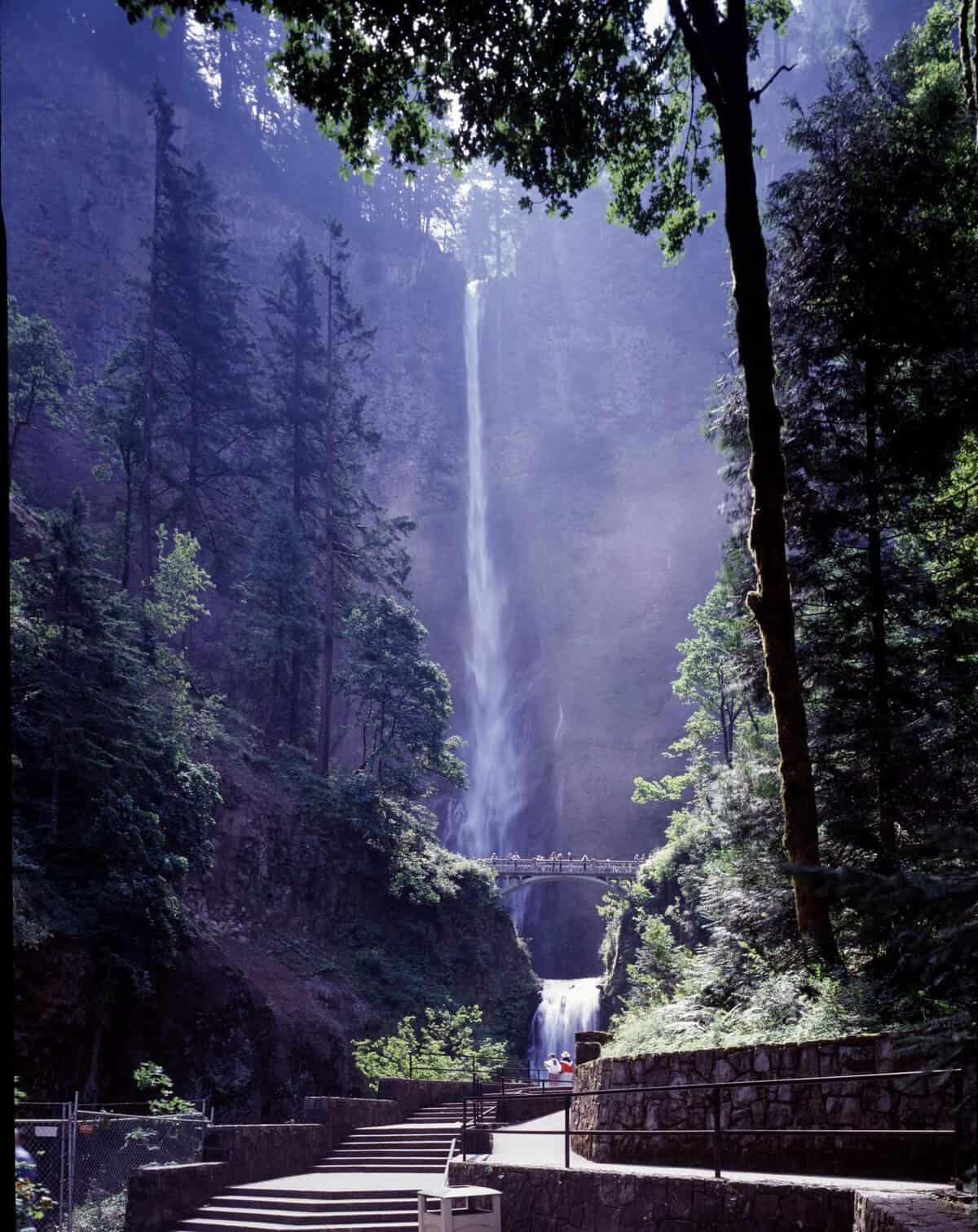
The Pacific Northwest does waterfalls better than almost anywhere, and this is its showpiece. Multnomah Falls drops 620 feet in two tiers, and the classic frame is unmistakable thanks to a slim stone footbridge crossing between them.
That is the Benson Bridge, built in 1925, sitting 105 feet above the lower pool. It gives the whole scene scale and a place for the eye to land. Green ferns and mossy basalt frame the water year round.
It is a short walk from the parking area off the Historic Columbia River Highway, which makes it one of the most accessible great shots in the state.
Go on an overcast day, when soft light lets you slow the shutter and turn the falls silky. Pro tip: spring runoff makes it thunder, but autumn brings color to the gorge around it.
Where: Multnomah Falls, 53000 E Historic Columbia River Highway, Bridal Veil, OR 97010, about 30 minutes east of Portland.
7. Palo Duro Canyon, Texas
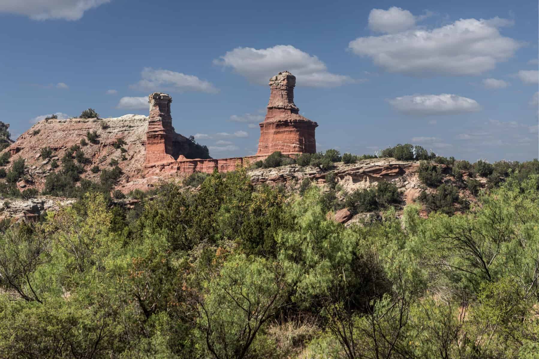
Yes, Texas belongs on a list like this, and the folks who call Palo Duro the Grand Canyon of Texas are not overselling it. It is the second-largest canyon in the country, and the Panhandle floor drops away into 800 feet of banded red rock.
The signature shot is the Lighthouse, a 310-foot hoodoo of hard sandstone balanced on softer shale, glowing rust-orange in the late sun. It is the most recognizable formation in the park and the payoff of a mostly flat three-mile trail.
Photographers love the color here. The rock runs through reds, oranges, yellows, and whites in visible layers, and it lights up like a furnace at golden hour.
Come in spring for wildflowers on the canyon floor, or after a rain when the walls turn deep and saturated.
Where: Palo Duro Canyon State Park, 11450 Park Road 5, Canyon, TX 79015, about 30 minutes southeast of Amarillo.
8. Na Pali Coast, Hawaii
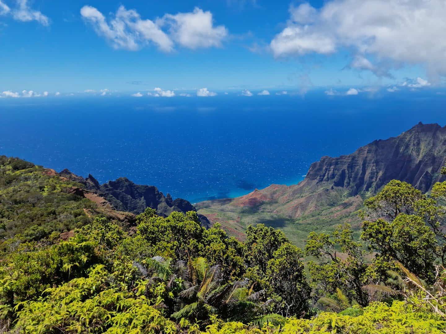
Some places look invented. The Na Pali Coast, all emerald cliffs pleated like green velvet and plunging into the Pacific, is one of them. The easiest way to photograph it is from above.
Kalalau Lookout in Kokee State Park perches around 4,000 feet up, staring straight down into the Kalalau Valley. The fluted walls, the deep folds of jungle, the ocean far below: it is a view that makes people gasp out loud.
The catch is timing. Clouds pour into the valley by late morning, so photographers aim for a window before 11 a.m., when the sun lights the walls but the mist has not rolled in.
There is a paved path right to the railing, so no hike is needed. Just get there early and be patient with the weather.
Where: Kalalau Lookout, Kokee Road (Highway 550), mile marker 18, Kekaha, HI 96752, past Waimea Canyon in Kokee State Park.
9. Cadillac Mountain, Maine
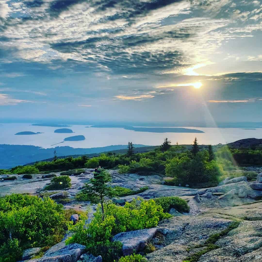
For part of the year, this is the first place in the entire country to catch the sunrise, and photographers climb out of warm beds in the dark to prove it. Cadillac Mountain is the highest point on the North Atlantic seaboard.
The summit is bald granite, open in every direction. From up there you look down on Bar Harbor, Frenchman Bay, and a scatter of pine-dark islands, all of it going pink and gold as the sun breaks the horizon.
From October 7 through March 6, the sun touches here before anywhere else in the country. You can drive the 3.5-mile summit road right to the top, though a vehicle reservation is required in the busy season.
Bring a jacket, because the wind up there has an edge even in summer.
Where: Cadillac Summit Road, Acadia National Park, Bar Harbor, ME 04609, off the Park Loop Road.
10. Kuwohi (Clingmans Dome), Tennessee
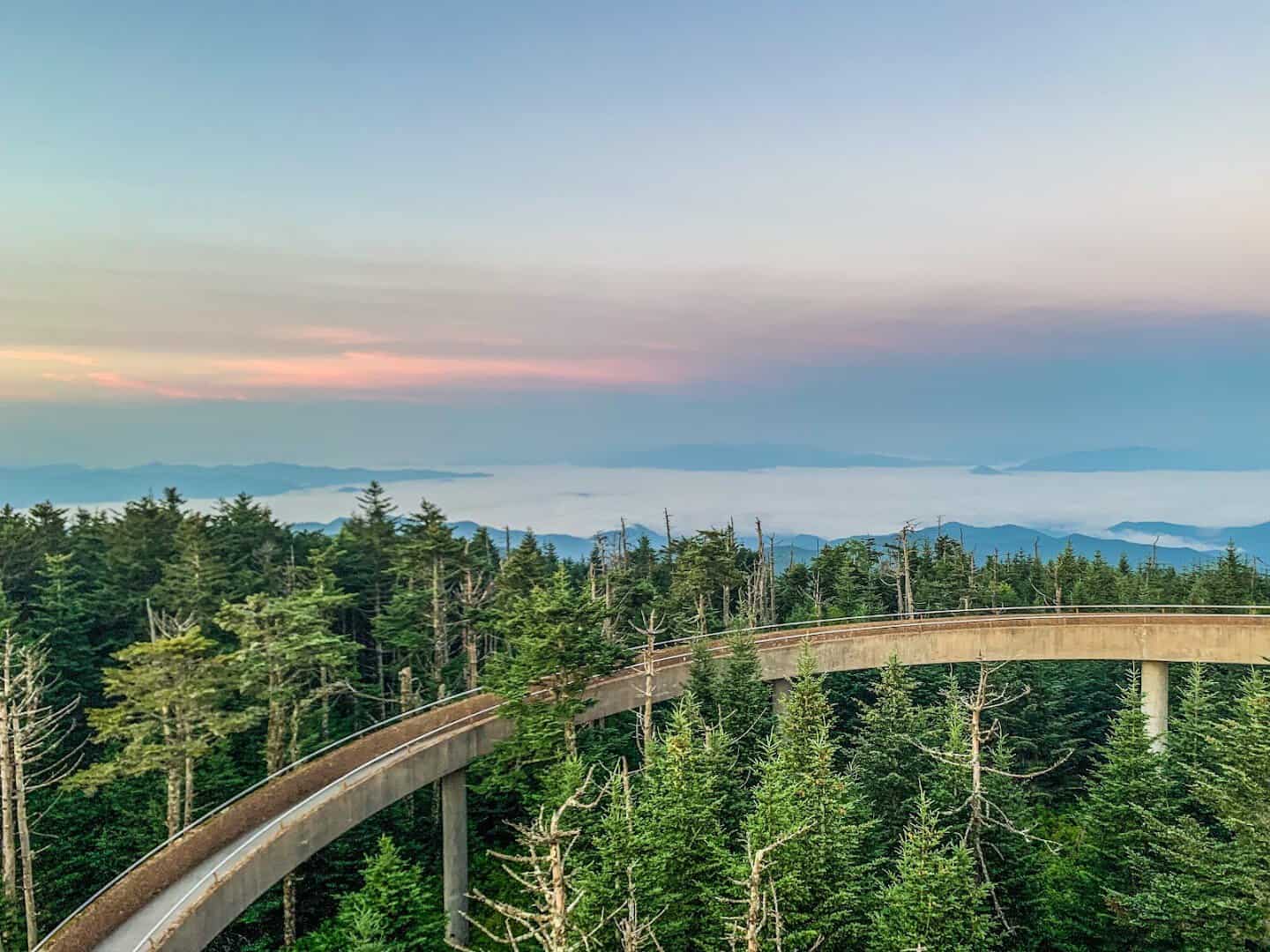
Save a high, hazy blue view for last. Kuwohi, long known as Clingmans Dome, is the tallest peak in the Great Smoky Mountains at 6,643 feet, and a spiral observation tower lifts you above the treetops for a full 360.
On a clear day you can see 100 miles, ridgeline after ridgeline fading from green to gray to that famous smoky blue. At sunrise or sunset the layered mountains stack into exactly the shot the Smokies are known for.
The walk from the parking lot is only half a mile, but it is steep and paved the whole way. The futuristic ramp curling up to the platform is a fun frame in its own right.
Did you know? The peak’s Cherokee name, restored in 2024, means mulberry place.
Where: Kuwohi (Clingmans Dome), off Newfound Gap Road (US-441), Great Smoky Mountains National Park; nearest town Gatlinburg, TN 37738. Access road closed December through March.
Start Your American Bucket List
None of these ten ever quite fits inside a photo. The scale, the light, and the plain surprise of standing there always spill over the edges of the frame. That is exactly why they are worth chasing.
So pick one, set an early alarm, and go see it with your own eyes first. Charge the batteries, clear the memory card, and let the picture be the souvenir. The best shot of your life might be one sunrise away.
Featured image: Trevor Guwalgiya (Trevor) via Tunnel View

Stella Raines
Editor-in-Chief
Stella brings over a decade of storytelling experience to TX Headlines. With roots in West Texas and a love for road trips, she leads the editorial team with an eye for the hidden stories that make Texas unforgettable.